
| Memorials | : | 0 |
| Location | : | Cowra, Cowra Shire, Australia |
| Website | : | cowracouncil.com.au |
| Coordinate | : | -33.8487830, 148.7087030 |
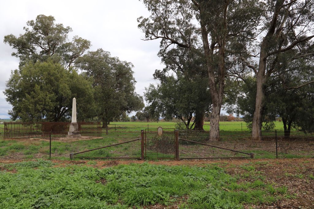
| Description | : | Jerula Homestead has a small cemetery located on its property. Permission to enter the cemetery should be sought from the Jerula Homestead owners. This homestead was previously known as Mufflon Park and Mufton Park. This cemetery may be the oldest cemetery in Cowra. The Cowra Guardian newspaper reported the oldest headstone in the cemetery dated back to 1855. |
frequently asked questions (FAQ):
-
Where is Jerula Homestead Cemetery?
Jerula Homestead Cemetery is located at Off 226 Darbys Falls Road Cowra, Cowra Shire ,New South Wales , 2794Australia.
-
Jerula Homestead Cemetery cemetery's updated grave count on graveviews.com?
0 memorials
-
Where are the coordinates of the Jerula Homestead Cemetery?
Latitude: -33.8487830
Longitude: 148.7087030
Nearby Cemetories:
1. Lone Graves
Cowra, Cowra Shire, Australia
Coordinate: -33.8346330, 148.6904240
2. Cowra War Cemetery
Cowra, Cowra Shire, Australia
Coordinate: -33.8016220, 148.6917260
3. Cowra Japanese War Cemetery
Cowra, Cowra Shire, Australia
Coordinate: -33.8012429, 148.6918062
4. Cowra General Cemetery
Cowra, Cowra Shire, Australia
Coordinate: -33.8004890, 148.6901560
5. Morongla Creek Cemetery
Morongla Creek, Cowra Shire, Australia
Coordinate: -33.9503370, 148.6666920
6. Woodstock Cemetery
Woodstock, Cowra Shire, Australia
Coordinate: -33.7575190, 148.8569250
7. Soldiers Flat Memorial Cemetery
Billimari, Cowra Shire, Australia
Coordinate: -33.6833180, 148.6183260
8. Bennett Springs Cemetery
Hovells Creek, Hilltops Council, Australia
Coordinate: -34.0201150, 148.8396480
9. Koorawatha Cemetery
Koorawatha, Hilltops Council, Australia
Coordinate: -34.0516780, 148.5550840
10. Canowindra Cemetery
Canowindra, Cabonne Shire, Australia
Coordinate: -33.5487100, 148.6718000
11. St Joseph's Cemetery
Hovells Creek, Hilltops Council, Australia
Coordinate: -34.1247560, 148.8734790
12. Lyndhurst Cemetery
Lyndhurst, Blayney Shire, Australia
Coordinate: -33.6694310, 149.0298390
13. Nyrang Creek Cemetery
Nyrang Creek, Cabonne Shire, Australia
Coordinate: -33.5460980, 148.5733620
14. Gooloogong Cemetery
Gooloogong, Cowra Shire, Australia
Coordinate: -33.6159416, 148.4138346
15. Carcoar Anglican Church Cemetery
Carcoar, Blayney Shire, Australia
Coordinate: -33.6097560, 149.1407530
16. Frogmore Catholic Cemetery
Frogmore, Hilltops Council, Australia
Coordinate: -34.2712106, 148.8396097
17. Neville Cemetery
Neville, Blayney Shire, Australia
Coordinate: -33.7207917, 149.2114111
18. Frogmore General Cemetery
Frogmore, Hilltops Council, Australia
Coordinate: -34.2715960, 148.8485260
19. Cargo General Cemetery
Cargo, Cabonne Shire, Australia
Coordinate: -33.4117100, 148.8034600
20. Carcoar Cemetery
Carcoar, Blayney Shire, Australia
Coordinate: -33.5931600, 149.1522750
21. Cadia Cemetery
Orange, Orange City, Australia
Coordinate: -33.4582190, 148.9918270
22. Monteagle Cemetery
Monteagle, Hilltops Council, Australia
Coordinate: -34.2025380, 148.3429110
23. Toogong Cemetery
Toogong, Cabonne Shire, Australia
Coordinate: -33.3530430, 148.6331530
24. Murringo General Cemetery
Murringo, Hilltops Council, Australia
Coordinate: -34.3195415, 148.4902374