
| Memorials | : | 1 |
| Location | : | Woodstock, Cowra Shire, Australia |
| Coordinate | : | -33.7575190, 148.8569250 |
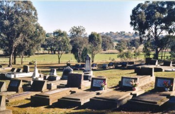
| Description | : | The bushranger John Vane is buried here in an unmarked grave. COORDINATES: Latitude: -33.748500823 Longitude: 148.851196289 Cemetery location is pinpointed on the map below. |
frequently asked questions (FAQ):
-
Where is Woodstock Cemetery?
Woodstock Cemetery is located at Woodstock, Cowra Shire ,New South Wales ,Australia.
-
Woodstock Cemetery cemetery's updated grave count on graveviews.com?
1 memorials
-
Where are the coordinates of the Woodstock Cemetery?
Latitude: -33.7575190
Longitude: 148.8569250
Nearby Cemetories:
1. Cowra Japanese War Cemetery
Cowra, Cowra Shire, Australia
Coordinate: -33.8012429, 148.6918062
2. Cowra War Cemetery
Cowra, Cowra Shire, Australia
Coordinate: -33.8016220, 148.6917260
3. Cowra General Cemetery
Cowra, Cowra Shire, Australia
Coordinate: -33.8004890, 148.6901560
4. Jerula Homestead Cemetery
Cowra, Cowra Shire, Australia
Coordinate: -33.8487830, 148.7087030
5. Lone Graves
Cowra, Cowra Shire, Australia
Coordinate: -33.8346330, 148.6904240
6. Lyndhurst Cemetery
Lyndhurst, Blayney Shire, Australia
Coordinate: -33.6694310, 149.0298390
7. Soldiers Flat Memorial Cemetery
Billimari, Cowra Shire, Australia
Coordinate: -33.6833180, 148.6183260
8. Morongla Creek Cemetery
Morongla Creek, Cowra Shire, Australia
Coordinate: -33.9503370, 148.6666920
9. Canowindra Cemetery
Canowindra, Cabonne Shire, Australia
Coordinate: -33.5487100, 148.6718000
10. Bennett Springs Cemetery
Hovells Creek, Hilltops Council, Australia
Coordinate: -34.0201150, 148.8396480
11. Carcoar Anglican Church Cemetery
Carcoar, Blayney Shire, Australia
Coordinate: -33.6097560, 149.1407530
12. Carcoar Cemetery
Carcoar, Blayney Shire, Australia
Coordinate: -33.5931600, 149.1522750
13. Neville Cemetery
Neville, Blayney Shire, Australia
Coordinate: -33.7207917, 149.2114111
14. Nyrang Creek Cemetery
Nyrang Creek, Cabonne Shire, Australia
Coordinate: -33.5460980, 148.5733620
15. Cadia Cemetery
Orange, Orange City, Australia
Coordinate: -33.4582190, 148.9918270
16. Cargo General Cemetery
Cargo, Cabonne Shire, Australia
Coordinate: -33.4117100, 148.8034600
17. St Joseph's Cemetery
Hovells Creek, Hilltops Council, Australia
Coordinate: -34.1247560, 148.8734790
18. Koorawatha Cemetery
Koorawatha, Hilltops Council, Australia
Coordinate: -34.0516780, 148.5550840
19. Blayney Cemetery
Blayney, Blayney Shire, Australia
Coordinate: -33.5244200, 149.2338720
20. Gooloogong Cemetery
Gooloogong, Cowra Shire, Australia
Coordinate: -33.6159416, 148.4138346
21. St. Peter's Uniting Church Cemetery
Hobbys Yards, Blayney Shire, Australia
Coordinate: -33.6939850, 149.3271790
22. Hobbys Yards Cemetery
Hobbys Yards, Blayney Shire, Australia
Coordinate: -33.6763540, 149.3270730
23. Millthorpe Cemetery
Millthorpe, Blayney Shire, Australia
Coordinate: -33.4545400, 149.1857520
24. St Andrews Anglican Church (closed) Cemetery
Moorilda, Blayney Shire, Australia
Coordinate: -33.6087430, 149.3386340