
| Memorials | : | 2 |
| Location | : | Jane Lew, Lewis County, USA |
| Coordinate | : | 39.0913070, -80.3372790 |
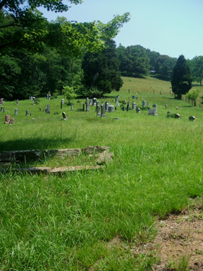
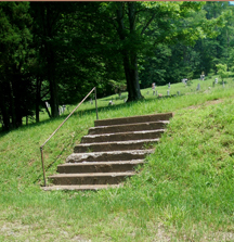
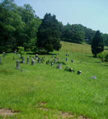
| Description | : | Cemetery is located on Jesses Run Jane Lew,WV a branch of Hacker's Creek in Lewis County. The church was named Mt. Point Pleasant Church. and was organized in 1834. The Cemetery is 3.7 miles upstream from the roads intersection of Jesses Run, and I-79, near the town of Jane Lew. The Cemetery is on the left (North) side of the highway, on a hill. You must look hard ,there is no sign for the Cemetery and cannot see the Cemetery from the road. The Church is no longer there. |
frequently asked questions (FAQ):
-
Where is Jesse Run Church Cemetery?
Jesse Run Church Cemetery is located at Jane Lew, Lewis County ,West Virginia ,USA.
-
Jesse Run Church Cemetery cemetery's updated grave count on graveviews.com?
2 memorials
-
Where are the coordinates of the Jesse Run Church Cemetery?
Latitude: 39.0913070
Longitude: -80.3372790
Nearby Cemetories:
1. Aberdeen Cemetery
Berlin, Lewis County, USA
Coordinate: 39.0608420, -80.3225540
2. Morrison Cemetery
Berlin, Lewis County, USA
Coordinate: 39.0633100, -80.3648120
3. Friendship Cemetery
Berlin, Lewis County, USA
Coordinate: 39.0760994, -80.3794022
4. Jonas Smith Graveyard
Upshur County, USA
Coordinate: 39.0611350, -80.3088030
5. Harmony Cemetery
Jane Lew, Lewis County, USA
Coordinate: 39.0999985, -80.3899994
6. Jesse Run Cemetery
Jane Lew, Lewis County, USA
Coordinate: 39.1038235, -80.3900664
7. Rockford Cemetery
Lost Creek, Harrison County, USA
Coordinate: 39.1338997, -80.3274994
8. Straley Cemetery
Jane Lew, Lewis County, USA
Coordinate: 39.0990820, -80.3941210
9. McWhorter Church Cemetery
McWhorter, Harrison County, USA
Coordinate: 39.1281000, -80.3815670
10. New Johnstown Cemetery
Harrison County, USA
Coordinate: 39.1175003, -80.2769012
11. Johnstown Cemetery
Johnstown, Harrison County, USA
Coordinate: 39.1189003, -80.2771988
12. Buckhannon Run Cemetery
Berlin, Lewis County, USA
Coordinate: 39.0365720, -80.3361230
13. Laurel Lick Cemetery
Lewis County, USA
Coordinate: 39.0386009, -80.3617020
14. Hicks Cemetery
Lewis County, USA
Coordinate: 39.0717010, -80.4077988
15. Pioneer Cemetery
Jane Lew, Lewis County, USA
Coordinate: 39.1071830, -80.4098780
16. Mount Hebron Cemetery
Jane Lew, Lewis County, USA
Coordinate: 39.1060982, -80.4255981
17. McVaney Cemetery
Hodgesville, Upshur County, USA
Coordinate: 39.0719430, -80.2488570
18. Old Lorentz Family Cemetery
Lorentz, Upshur County, USA
Coordinate: 39.0251640, -80.2987770
19. Old Frame Meeting House Graveyard
Lost Creek, Harrison County, USA
Coordinate: 39.1630550, -80.3548340
20. Frame Seventh Day Baptist Church Cemetery
Clarksburg, Harrison County, USA
Coordinate: 39.1630690, -80.3547570
21. Thomas Law Cemetery
Jane Lew, Lewis County, USA
Coordinate: 39.0893270, -80.4326240
22. Radabaugh Cemetery
Upshur County, USA
Coordinate: 39.0220000, -80.3016900
23. Smiths Run Cemetery
Weston, Lewis County, USA
Coordinate: 39.0463070, -80.4173810
24. Morrissette and Tomblin Cemetery
Lorentz, Upshur County, USA
Coordinate: 39.0214996, -80.2916260