| Memorials | : | 0 |
| Location | : | Omaha, Boone County, USA |
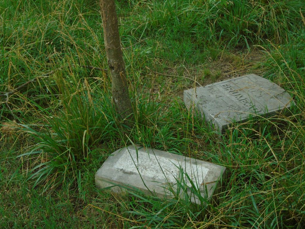
| Description | : | There are only two stones in this cemetery, both of which are on the ground. One is John J. Brumead's, and is still readable, the other is a fieldstone. They are close to the road, but not easily visible. Location is just off of Hodges road about 1/4 mile from the split with Flint Hill School Road in a pasture. |
frequently asked questions (FAQ):
-
Where is John J. Brumead Gravesite?
John J. Brumead Gravesite is located at Omaha, Boone County, USA.
-
John J. Brumead Gravesite cemetery's updated grave count on graveviews.com?
0 memorials
Nearby Cemetories:
1. Knight Cemetery
Batavia, Boone County, USA
Coordinate: 36.3959670, -92.9647000
2. Sanders Cemetery
Batavia, Boone County, USA
3. Walter Smith Family Cemetery
Batavia, Boone County, USA
4. Fairview Cemetery
Diamond City, Boone County, USA
Coordinate: 36.2839012, -92.8893967
5. McElhose Cemetery
Boone County, USA
Coordinate: 36.2792390, -92.9062040
6. Brittain Cemetery
Olvey, Boone County, USA
7. Davidson Cemetery
Olvey, Boone County, USA
Coordinate: 36.3950300, -93.2871500
8. Foresee Cemetery
Olvey, Boone County, USA
Coordinate: 36.2376760, -93.1867710
9. Warner Cemetery
Olvey, Boone County, USA
Coordinate: 36.2724991, -93.1857986
10. Burlington Baptist Church Cemetery
Burlington, Boone County, USA
Coordinate: 36.2348440, -93.1883510
11. Etchison Cemetery
Burlington, Boone County, USA
Coordinate: 36.2470431, -93.1812910
12. Lee Cemetery
Burlington, Boone County, USA
Coordinate: 36.3492012, -92.9131012
13. McCord Cemetery
Boone County, USA
Coordinate: 36.3959670, -92.9647000
14. Lair Cemetery
Myrtle, Boone County, USA
15. Baker Family Cemetery
Zinc, Boone County, USA
16. Richardson Cemetery
Zinc, Boone County, USA
Coordinate: 36.2839012, -92.8893967
17. Zinc Cemetery
Zinc, Boone County, USA
Coordinate: 36.2792390, -92.9062040
18. Bluff Springs Cemetery
Boone County, USA
19. Brumead Cemetery
Boone County, USA
Coordinate: 36.3950300, -93.2871500
20. Capps Cemetery
Capps, Boone County, USA
Coordinate: 36.2376760, -93.1867710
21. Denning Cemetery
Capps, Boone County, USA
Coordinate: 36.2724991, -93.1857986
22. Lamb Cemetery
Capps, Boone County, USA
Coordinate: 36.2348440, -93.1883510
23. Speer Cemetery
Capps, Boone County, USA
Coordinate: 36.2470431, -93.1812910
24. Deshield Cemetery
Boone County, USA
Coordinate: 36.3492012, -92.9131012

