
| Memorials | : | 0 |
| Location | : | Mount Hope, Holmes County, USA |
| Coordinate | : | 40.6412964, -81.7459183 |
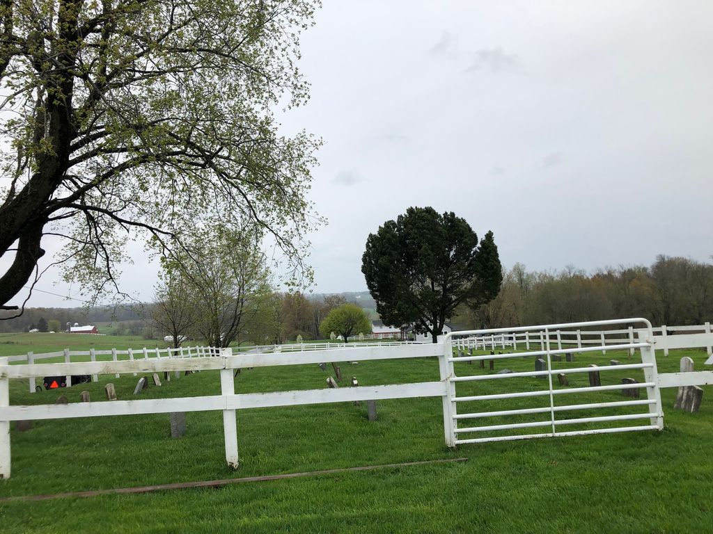
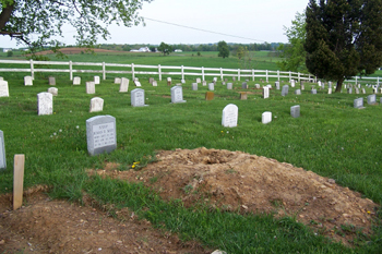
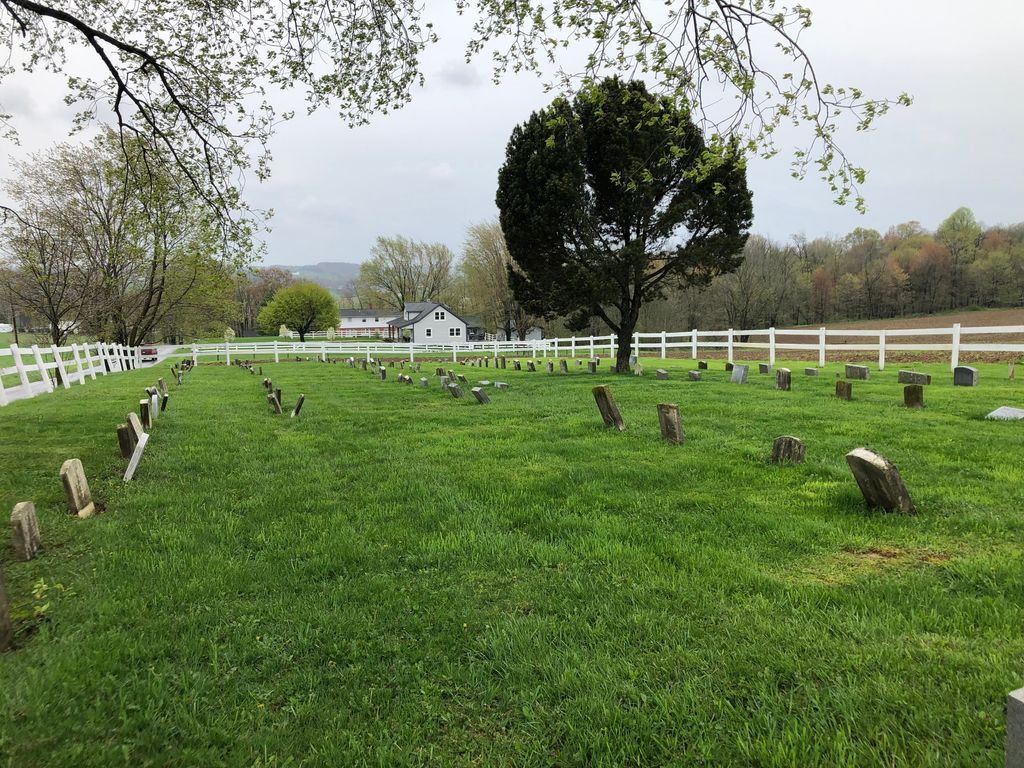
| Description | : | This is an Amish cemetery. It was established in the 1860s. There is no church building connected with it. It is a fenced-off area amidst farm fields. This Amish cemetery is located on the west side of Township Road 656 about 0.1 miles south of its intersection with Township Road 606. The cemetery is located in Paint Township, Holmes County, Ohio, and is # 5635 (John Schlabach Farm Cemetery / Weaver Cemetery) in “Ohio Cemeteries 1803-2003”, compiled by the Ohio Genealogical Society. The U.S. Geological Survey (USGS) Geographic Names Information System (GNIS) feature ID... Read More |
frequently asked questions (FAQ):
-
Where is John Schlabach Farm Cemetery?
John Schlabach Farm Cemetery is located at Township Road 656 Mount Hope, Holmes County ,Ohio , 44627USA.
-
John Schlabach Farm Cemetery cemetery's updated grave count on graveviews.com?
0 memorials
-
Where are the coordinates of the John Schlabach Farm Cemetery?
Latitude: 40.6412964
Longitude: -81.7459183
Nearby Cemetories:
1. Parker Cemetery
Holmes County, USA
Coordinate: 40.6444016, -81.7455978
2. Ben M Miller Farm Cemetery
Mount Hope, Holmes County, USA
Coordinate: 40.6335310, -81.7596100
3. Daniel S Hershberger Farm Cemetery
Mount Hope, Holmes County, USA
Coordinate: 40.6300310, -81.7632580
4. Yoder Cemetery
Mount Hope, Holmes County, USA
Coordinate: 40.6535988, -81.7296982
5. Raymond Hershberger Farm Cemetery
Mount Hope, Holmes County, USA
Coordinate: 40.6460900, -81.7685910
6. Ben J P Weaver Farm Cemetery
Mount Hope, Holmes County, USA
Coordinate: 40.6616180, -81.7652340
7. Levi Stutzman Farm Cemetery
Mount Hope, Holmes County, USA
Coordinate: 40.6219870, -81.7712110
8. Milo Yoder Farm Cemetery
Winesburg, Holmes County, USA
Coordinate: 40.6130900, -81.7377900
9. Miller Cemetery
Winesburg, Holmes County, USA
Coordinate: 40.6116982, -81.7414017
10. Yutzy Cemetery
Winesburg, Holmes County, USA
Coordinate: 40.6108017, -81.7371979
11. Schenkelberg Cemetery
Winesburg, Holmes County, USA
Coordinate: 40.6295430, -81.7068100
12. Abe Yoder Farm Cemetery
Winesburg, Holmes County, USA
Coordinate: 40.6110140, -81.7253840
13. Hershberger Cemetery
Mount Eaton, Wayne County, USA
Coordinate: 40.6758003, -81.7461014
14. Saint Genevieve Catholic Cemetery
Calmoutier, Holmes County, USA
Coordinate: 40.6659910, -81.7791100
15. Yoder Cemetery
Mount Eaton, Wayne County, USA
Coordinate: 40.6753006, -81.7268982
16. Noah Troyer Farm Cemetery
Mount Hope, Holmes County, USA
Coordinate: 40.6348950, -81.7954220
17. Pleasant View Mennonite Church Cemetery
Berlin, Holmes County, USA
Coordinate: 40.6026470, -81.7419720
18. Longenecker Mennonite Cemetery
Winesburg, Holmes County, USA
Coordinate: 40.6383930, -81.6948510
19. Hochstetler Cemetery
Mount Hope, Holmes County, USA
Coordinate: 40.6145000, -81.7832000
20. Slutz Cemetery
Mount Hope, Holmes County, USA
Coordinate: 40.6468850, -81.7971260
21. Daniel J Miller Farm Cemetery
Mount Hope, Holmes County, USA
Coordinate: 40.6042620, -81.7658340
22. Jacob Mast Farm Cemetery
Mount Hope, Holmes County, USA
Coordinate: 40.6097900, -81.7786620
23. Noah Petersheim Farm Cemetery
Fredericksburg, Wayne County, USA
Coordinate: 40.6786693, -81.7673547
24. Abe J Miller Farm Cemetery
Mount Hope, Holmes County, USA
Coordinate: 40.6179920, -81.7930730