| Memorials | : | 1 |
| Location | : | Range, Conecuh County, USA |
| Coordinate | : | 31.3050280, -87.2779330 |
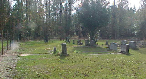
| Description | : | Old cemetery located 0.3 miles east of Bland Road intersection with Range Road. Range Road is of hard red clay. Cemetery is grown up with large oak and cedar trees. North across I-65 on Escambia County 17 (sometimes referred to as 113) to Conecuh County Line. Road becomes hard red clay. Continue 5+ miles to Range Road. Right on Range Road 0.3 miles. From I-65 on Hwy-41 go 3.0 miles to community of Range. At Range turn left onto Range Road and go approximately 6 miles. This cemetery is off the road and is virtually unseen by the... Read More |
frequently asked questions (FAQ):
-
Where is Johnson Cemetery?
Johnson Cemetery is located at Range, Conecuh County ,Alabama , 36473USA.
-
Johnson Cemetery cemetery's updated grave count on graveviews.com?
1 memorials
-
Where are the coordinates of the Johnson Cemetery?
Latitude: 31.3050280
Longitude: -87.2779330
Nearby Cemetories:
1. Range Cemetery
Range, Conecuh County, USA
Coordinate: 31.3153000, -87.2316971
2. Hartwood Methodist Church Cemetery
Conecuh County, USA
Coordinate: 31.3346996, -87.2316971
3. Lee Family Cemetery
Range, Conecuh County, USA
Coordinate: 31.2823520, -87.2086800
4. Hall-King Family Cemetery
Monroe County, USA
Coordinate: 31.3225970, -87.3584540
5. Crawford Family Cemetery
Monroe County, USA
Coordinate: 31.3319940, -87.3551500
6. Canaan Freewill Baptist Church Cemetery
Barnett Crossroads, Escambia County, USA
Coordinate: 31.2414000, -87.3233000
7. Sampey Community Cemetery
Repton, Conecuh County, USA
Coordinate: 31.3727290, -87.3206880
8. New Bethlehem Baptist Church Cemetery
Barnett Crossroads, Escambia County, USA
Coordinate: 31.2268500, -87.3001300
9. Hawkins Cemetery
Escambia County, USA
Coordinate: 31.2266998, -87.3000031
10. Smith Plantation Cemetery
Wallace, Escambia County, USA
Coordinate: 31.2418900, -87.2115820
11. Morris Cemetery
Repton, Conecuh County, USA
Coordinate: 31.3824997, -87.2356033
12. Brushy Creek Methodist Church Cemetery
Conecuh County, USA
Coordinate: 31.3067520, -87.1758750
13. Ramah Primitive Baptist Church Cemetery
Lenox, Conecuh County, USA
Coordinate: 31.3302994, -87.1791992
14. Blue Springs Cemetery
Escambia County, USA
Coordinate: 31.2173760, -87.2596790
15. Gravel Hill Baptist Church Cemetery
Barnett Crossroads, Escambia County, USA
Coordinate: 31.2132000, -87.2820200
16. Livingway Pentecostal Church Cemetery
Repton, Conecuh County, USA
Coordinate: 31.3922020, -87.2364860
17. Unity and Charity of God Church Cemetery
Excel, Monroe County, USA
Coordinate: 31.4012770, -87.3053370
18. Enon Baptist Church Cemetery
Goodway, Monroe County, USA
Coordinate: 31.3008390, -87.3949010
19. Repton Cemetery
Repton, Conecuh County, USA
Coordinate: 31.3986700, -87.2351800
20. New Hopewell Baptist Church Cemetery
Castleberry, Conecuh County, USA
Coordinate: 31.2752991, -87.1622009
21. Ryals Family Cemetery
Repton, Conecuh County, USA
Coordinate: 31.3854970, -87.2004500
22. Wallace Church Cemetery
Escambia County, USA
Coordinate: 31.2096996, -87.2213974
23. Oak Grove Assembly Of God Cemetery
Monroe County, USA
Coordinate: 31.3590590, -87.3863160
24. Battle Branch Creek Cemetery
Conecuh County, USA
Coordinate: 31.3082716, -87.1516490


