| Memorials | : | 0 |
| Location | : | Wallace, Escambia County, USA |
| Coordinate | : | 31.2418900, -87.2115820 |
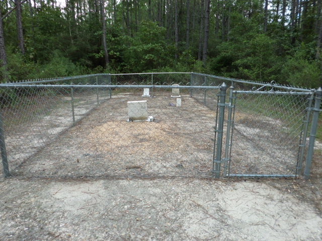
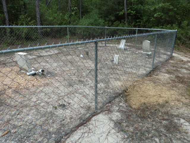
| Description | : | The old cemetery is well maintained by family member, Michael Hall. In olden times it was known as the Smith Plantation Cemetery and today is known either as Smith Cemetery or Hall Cemetery. To reach the area from I-65, exit the Interstate at #77 and turn onto Hwy-41 south (toward Brewton). At approximately 2 miles, turn right onto Hall Road and continue for another 3,500 feet, at which point Hall Road veers to the right and Timberline Road cuts in - continue straight ahead. Stay on Timberline to the first farmhouse on the left. Turn onto a graveled roadway to... Read More |
frequently asked questions (FAQ):
-
Where is Smith Plantation Cemetery?
Smith Plantation Cemetery is located at 385 Timbeline Road Wallace, Escambia County ,Alabama , 36426USA.
-
Smith Plantation Cemetery cemetery's updated grave count on graveviews.com?
0 memorials
-
Where are the coordinates of the Smith Plantation Cemetery?
Latitude: 31.2418900
Longitude: -87.2115820
Nearby Cemetories:
1. Wallace Church Cemetery
Escambia County, USA
Coordinate: 31.2096996, -87.2213974
2. Hanberry Cemetery
Wallace, Escambia County, USA
Coordinate: 31.2164001, -87.1808014
3. Smith Family Cemetery
Appleton, Escambia County, USA
Coordinate: 31.2453420, -87.1682360
4. Lee Family Cemetery
Range, Conecuh County, USA
Coordinate: 31.2823520, -87.2086800
5. Blue Springs Cemetery
Escambia County, USA
Coordinate: 31.2173760, -87.2596790
6. New Hopewell Baptist Church Cemetery
Castleberry, Conecuh County, USA
Coordinate: 31.2752991, -87.1622009
7. Cooper Cemetery
Appleton, Escambia County, USA
Coordinate: 31.2416992, -87.1466980
8. Gravel Hill Baptist Church Cemetery
Barnett Crossroads, Escambia County, USA
Coordinate: 31.2132000, -87.2820200
9. Emmons Cemetery East
Escambia County, USA
Coordinate: 31.1849995, -87.2549973
10. Brushy Creek Methodist Church Cemetery
Conecuh County, USA
Coordinate: 31.3067520, -87.1758750
11. Glory Hill Holiness Church Cemetery
Brewton, Escambia County, USA
Coordinate: 31.2656030, -87.1279120
12. Range Cemetery
Range, Conecuh County, USA
Coordinate: 31.3153000, -87.2316971
13. Pleasant Hill Cemetery
Brewton, Escambia County, USA
Coordinate: 31.1655998, -87.2031021
14. Hawkins Cemetery
Escambia County, USA
Coordinate: 31.2266998, -87.3000031
15. New Bethlehem Baptist Church Cemetery
Barnett Crossroads, Escambia County, USA
Coordinate: 31.2268500, -87.3001300
16. Hammac Cemetery
Brewton, Escambia County, USA
Coordinate: 31.1893997, -87.1438980
17. Battle Branch Creek Cemetery
Conecuh County, USA
Coordinate: 31.3082716, -87.1516490
18. Johnson Cemetery
Range, Conecuh County, USA
Coordinate: 31.3050280, -87.2779330
19. Oak Grove Holiness Church Cemetery
Sand Cut, Conecuh County, USA
Coordinate: 31.2946790, -87.1328170
20. Ramah Primitive Baptist Church Cemetery
Lenox, Conecuh County, USA
Coordinate: 31.3302994, -87.1791992
21. Hartwood Methodist Church Cemetery
Conecuh County, USA
Coordinate: 31.3346996, -87.2316971
22. Canaan Freewill Baptist Church Cemetery
Barnett Crossroads, Escambia County, USA
Coordinate: 31.2414000, -87.3233000
23. Calvary Mennonite Church Cemetery
Escambia County, USA
Coordinate: 31.2284270, -87.0948820
24. Martin Cemetery
Brewton, Escambia County, USA
Coordinate: 31.1837190, -87.1056930


