
| Memorials | : | 0 |
| Location | : | Lightwood, Elmore County, USA |
| Coordinate | : | 32.7300100, -86.3842130 |
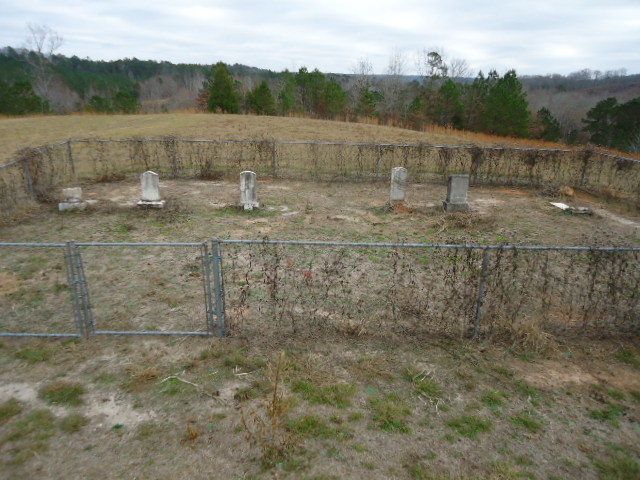
| Description | : | Cemetery is located approximately 1.5 mile north of county road 23 on county road 448 (New Harmony Rd). The cemetery is bihind the home of Mr & Mrs Pittman in their field near the woods, and can be seen from road. |
frequently asked questions (FAQ):
-
Where is Johnson Family Cemetery?
Johnson Family Cemetery is located at Lightwood, Elmore County ,Alabama ,USA.
-
Johnson Family Cemetery cemetery's updated grave count on graveviews.com?
0 memorials
-
Where are the coordinates of the Johnson Family Cemetery?
Latitude: 32.7300100
Longitude: -86.3842130
Nearby Cemetories:
1. Union Congregational Christian Cemetery
Lightwood, Elmore County, USA
Coordinate: 32.7219400, -86.3997900
2. New Harmony Baptist Church Cemetery
Elmore County, USA
Coordinate: 32.7360001, -86.4049988
3. Lightwood Church of Christ Memorial Garden
Lightwood, Elmore County, USA
Coordinate: 32.7131100, -86.3946640
4. New Hope Church Cemetery
Lightwood, Elmore County, USA
Coordinate: 32.6967010, -86.3783035
5. Harmony United Methodist Church Cemetery
Titus, Elmore County, USA
Coordinate: 32.7338330, -86.3286330
6. Jo Anna Cemetery
Chilton County, USA
Coordinate: 32.7224998, -86.4452972
7. Bethlehem West Baptist Cemetery
Elmore County, USA
Coordinate: 32.6777992, -86.4124985
8. First Baptist Church of Titus Cemetery
Titus, Elmore County, USA
Coordinate: 32.7125015, -86.3178024
9. Mount Calvary West Primitive Baptist Church Cemete
Titus, Elmore County, USA
Coordinate: 32.7605950, -86.3197180
10. Proctor Creek Cemetery
Coosa County, USA
Coordinate: 32.7949982, -86.3694000
11. Providence Baptist Church Cemetery
Richville, Coosa County, USA
Coordinate: 32.7951266, -86.3694190
12. Friendship Cemetery
Titus, Elmore County, USA
Coordinate: 32.6948662, -86.3140869
13. Canaan Cemetery
Chilton County, USA
Coordinate: 32.7243996, -86.4689026
14. Confederate Memorial Park Cemetery #1
Chilton County, USA
Coordinate: 32.7237700, -86.4699900
15. Lake Hill Baptist Church Cemetery
Lightwood, Elmore County, USA
Coordinate: 32.6672211, -86.3391724
16. Saint Paul Cemetery
Autauga County, USA
Coordinate: 32.7075005, -86.4674988
17. Confederate Memorial Park Cemetery #2
Chilton County, USA
Coordinate: 32.7208900, -86.4712800
18. Wadsworth Cemetery
Wadsworth, Autauga County, USA
Coordinate: 32.6744003, -86.4494019
19. Marbury Baptist Church Cemetery
Marbury, Autauga County, USA
Coordinate: 32.7039490, -86.4727859
20. Coosa River Cemetery
Coosa River, Elmore County, USA
Coordinate: 32.6488991, -86.3683014
21. Mountain Creek Baptist Church Cemetery
Chilton County, USA
Coordinate: 32.7127991, -86.4800034
22. Pine Flat Presbyterian Church Cemetery
Pine Flat, Autauga County, USA
Coordinate: 32.6529999, -86.4227982
23. Dominican Monastery of Saint Jude Cemetery
Marbury, Autauga County, USA
Coordinate: 32.7034110, -86.4831020
24. Unity Baptist Cemetery
Marbury, Autauga County, USA
Coordinate: 32.6996760, -86.4839360