
| Memorials | : | 1 |
| Location | : | Picton, Prince Edward County Municipality, Canada |
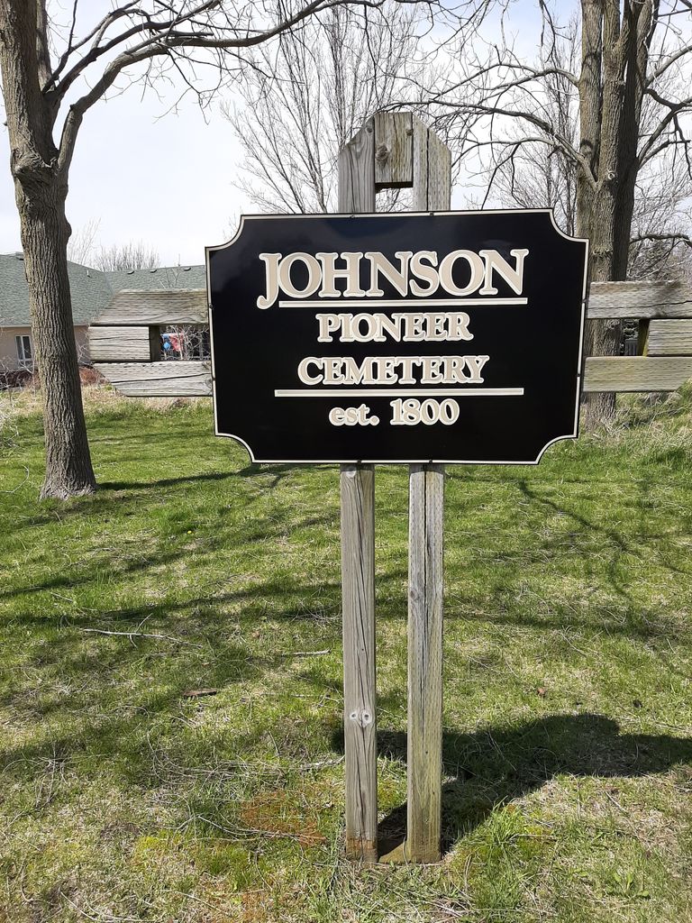
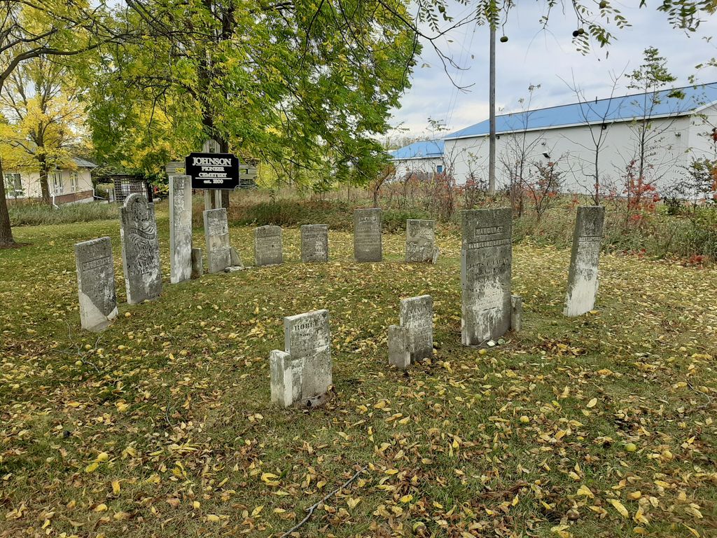
| Description | : | Cemetery is located behind the Highland Shores Children's Aid, MacStevens Drive, on a small hill. It is accessible from Johnson Street by entering the Park and following the path. In 1802 the Crown Patent was issued to Andrew and Henry Johnson (1762-1829) for Lot 3, 1st Concession North West of the Carrying Place in Hallowell. In 1807 Andrew sold his 100 acres of the west half to brother Henry and that same year Henry sold off 22 acres of the "rear end" to Samuel Wright. In 1829 Henry left the land to his son Joseph Jewell Johnson in his Will. ... Read More |
frequently asked questions (FAQ):
-
Where is Johnson Pioneer Cemetery?
Johnson Pioneer Cemetery is located at No GPS information available Add GPSMacStevens Drive. Picton, Prince Edward County Municipality ,Ontario ,Canada.
-
Johnson Pioneer Cemetery cemetery's updated grave count on graveviews.com?
1 memorials
Nearby Cemetories:
1. Albury Church Cemetery
Albury, Prince Edward County Municipality, Canada
Coordinate: 44.1128630, -77.2256250
2. Brooks Burying Ground
Ameliasburg, Prince Edward County Municipality, Canada
Coordinate: 43.9885610, -77.2223800
3. Lawrence Cemetery
Ameliasburg, Prince Edward County Municipality, Canada
Coordinate: 43.9853900, -77.2429600
4. Grove Cemetery
Ameliasburgh, Prince Edward County Municipality, Canada
Coordinate: 43.9668200, -77.2827600
5. Herrington Cemetery
Ameliasburgh, Prince Edward County Municipality, Canada
Coordinate: 44.0110500, -77.3781100
6. Post-Babcock Burying Ground
Ameliasburgh, Prince Edward County Municipality, Canada
7. Salem Cemetery
Ameliasburgh, Prince Edward County Municipality, Canada
Coordinate: 44.0433040, -77.3755400
8. Simond's Burying Ground Cemetery
Ameliasburgh, Prince Edward County Municipality, Canada
Coordinate: 44.0503670, -77.5857940
9. Way Family Cemetery
Ameliasburgh, Prince Edward County Municipality, Canada
Coordinate: 44.0537300, -77.5948500
10. Bethel-Doxsee Cemetery
Bethel, Prince Edward County Municipality, Canada
Coordinate: 43.9387600, -77.4074400
11. Foster Cemetery
Bethesda, Prince Edward County Municipality, Canada
Coordinate: 43.9366100, -77.1520100
12. Roblin Family Cemetery
Bethesda, Prince Edward County Municipality, Canada
13. Big Island Cemetery
Big Island, Prince Edward County Municipality, Canada
Coordinate: 44.1128630, -77.2256250
14. Bloomfield East Friends Cemetery
Bloomfield, Prince Edward County Municipality, Canada
Coordinate: 43.9885610, -77.2223800
15. Hicksite Friends Cemetery
Bloomfield, Prince Edward County Municipality, Canada
Coordinate: 43.9853900, -77.2429600
16. Universalist Friends Burial Ground
Bloomfield, Prince Edward County Municipality, Canada
Coordinate: 43.9668200, -77.2827600
17. Bowerman McFaul's Cemetery
Bowermans, Prince Edward County Municipality, Canada
Coordinate: 44.0110500, -77.3781100
18. Burr-UEL Pioneer Cemetery
Burr, Prince Edward County Municipality, Canada
19. Burrs Cemetery
Burr, Prince Edward County Municipality, Canada
Coordinate: 44.0433040, -77.3755400
20. Carrying Place Cemetery
Carrying Place, Prince Edward County Municipality, Canada
Coordinate: 44.0503670, -77.5857940
21. Carrying Place Cemetery Annex
Carrying Place, Prince Edward County Municipality, Canada
Coordinate: 44.0537300, -77.5948500
22. Chadsey Pioneer Cemetery
Prince Edward County Municipality, Canada
Coordinate: 43.9387600, -77.4074400
23. Cherry Valley United Church Cemetery
Cherry Valley, Prince Edward County Municipality, Canada
Coordinate: 43.9366100, -77.1520100
24. Consecon Cemetery
Consecon, Prince Edward County Municipality, Canada