
| Memorials | : | 0 |
| Location | : | Stonington, Lawrence County, USA |
| Coordinate | : | 38.7101590, -86.3251870 |
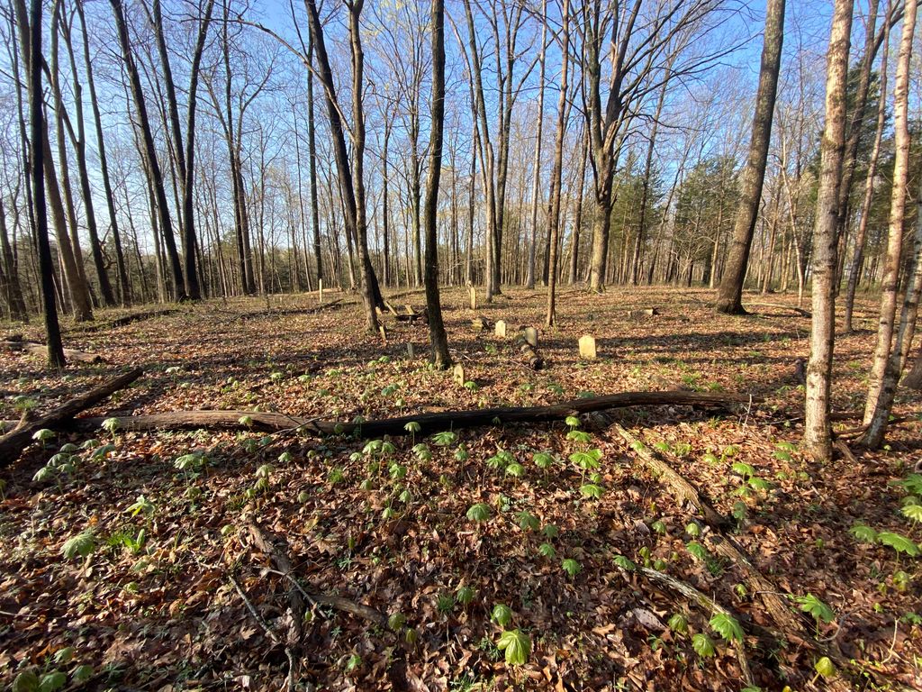
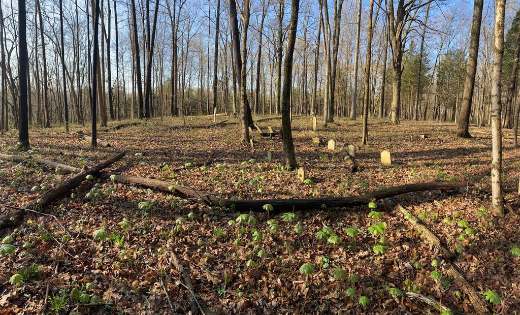
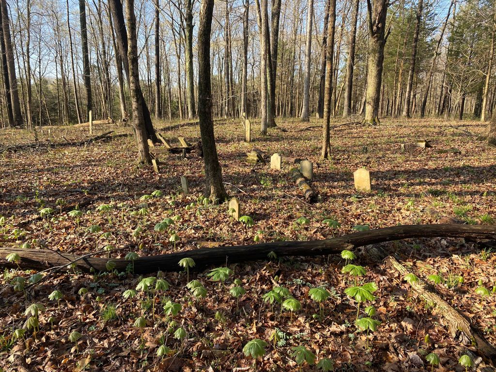
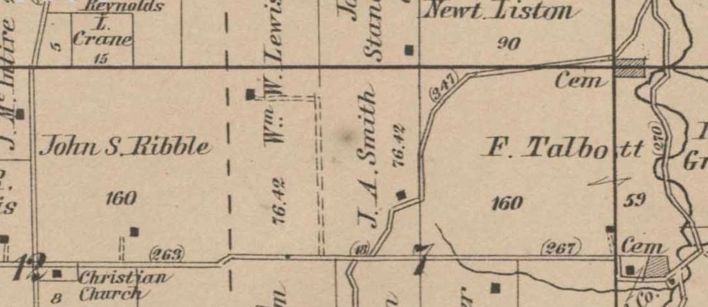
| Description | : | The nearest town to Jolly Cemetery within Lawrence County is Mitchell, which is about 8 miles west-northwest of the Cemetery. The Cemetery is located in Bono Township which has no incorporated towns. A Township landmark helpful in locating Jolly Cemetery and found on current digital maps is the Fishing Creek Chapel. The nearest intersection is Bono Road (County Road 1050 S) and Stonington Road/Holesapple Road (County Road 650). Depart Mitchell on Indiana State Road 60, heading east. Shortly after the road turns southeast, turn east on Sportsman Club Road, and follow it until... Read More |
frequently asked questions (FAQ):
-
Where is Jolly Cemetery?
Jolly Cemetery is located at Bono Road (County Road 1050 S) Stonington, Lawrence County ,Indiana , 47446USA.
-
Jolly Cemetery cemetery's updated grave count on graveviews.com?
0 memorials
-
Where are the coordinates of the Jolly Cemetery?
Latitude: 38.7101590
Longitude: -86.3251870
Nearby Cemetories:
1. Talbott Cemetery
Mitchell, Lawrence County, USA
Coordinate: 38.7172012, -86.3277969
2. John A Smith Cemetery
Lawrence County, USA
Coordinate: 38.6926110, -86.3565460
3. Monyhan Cemetery
Brown Township, Washington County, USA
Coordinate: 38.6921440, -86.2876220
4. Stonington Cemetery
Stonington, Lawrence County, USA
Coordinate: 38.7306000, -86.3611000
5. Cavetown Cemetery
Campbellsburg, Washington County, USA
Coordinate: 38.7092896, -86.2726440
6. Saltillo Cemetery
Saltillo, Washington County, USA
Coordinate: 38.6709023, -86.2896347
7. Sand Point Cemetery
Brown Township, Washington County, USA
Coordinate: 38.7480600, -86.2859800
8. Freedom Cemetery
Northeast Township, Orange County, USA
Coordinate: 38.6610830, -86.3267600
9. Nicholson Cemetery
Fairview, Washington County, USA
Coordinate: 38.7396300, -86.2734800
10. McElyea Nail Cemetery
Leipsic, Orange County, USA
Coordinate: 38.6531530, -86.3271060
11. Wheeler Cemetery
Fairview, Washington County, USA
Coordinate: 38.7273640, -86.2536790
12. Mount Carmel Cemetery
Campbellsburg, Washington County, USA
Coordinate: 38.7168999, -86.2506027
13. Lawrenceport Cemetery
Lawrenceport, Lawrence County, USA
Coordinate: 38.7465897, -86.3863831
14. Pioneer Cemetery
Fairview, Washington County, USA
Coordinate: 38.7422740, -86.2592200
15. Hop Cemetery
Campbellsburg, Washington County, USA
Coordinate: 38.6728287, -86.2634277
16. Freed Cemetery
Orange County, USA
Coordinate: 38.6482470, -86.3385160
17. Tunnelton Cemetery
Tunnelton, Lawrence County, USA
Coordinate: 38.7715340, -86.3426285
18. Bishop Roberts Memorial
Lawrenceport, Lawrence County, USA
Coordinate: 38.7521450, -86.3895090
19. Brewer Cemetery
Campbellsburg, Washington County, USA
Coordinate: 38.6945400, -86.2415370
20. Liberty Cemetery
Orleans, Orange County, USA
Coordinate: 38.6808434, -86.4029617
21. Dodd Cemetery
Lawrence County, USA
Coordinate: 38.7792015, -86.3356018
22. Goldsby Cemetery
Campbellsburg, Washington County, USA
Coordinate: 38.7139000, -86.2328000
23. Hays Cemetery
Claysville, Washington County, USA
Coordinate: 38.6400000, -86.2913000
24. Cravens Farm Cemetery
Brown Township, Washington County, USA
Coordinate: 38.7603960, -86.2486500