
| Memorials | : | 21 |
| Location | : | Orleans, Orange County, USA |
| Coordinate | : | 38.6808434, -86.4029617 |
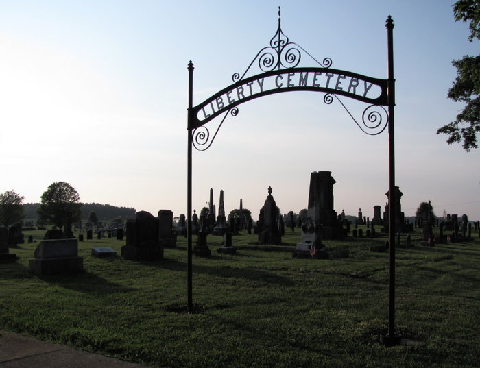
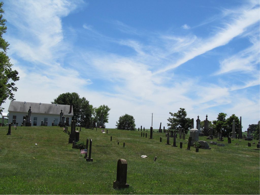
| Description | : | The cemetery is located in Orleans Township (SE quadrant of the SE quadrant of the NE quadrant of Section 21 Township 3N Range 1E) on the northwest corner of the intersection of Liberty Road and County Road 300 E. Indiana Cemetery Locations, Volume 1, published by the Indiana Genealogical Society (02 April 2005), gives the primary cemetery name as Liberty Cemetery. The cemetery is listed in the Cemetery and Burial Grounds Registry of the Indiana Department of Natural Resources (DNR) and in the State Historical Architectural and Archaeological Research Database (SHAARD) with Cemetery Record Number CR-59-101 (Liberty). The... Read More |
frequently asked questions (FAQ):
-
Where is Liberty Cemetery?
Liberty Cemetery is located at Liberty Road and County Road 300 E Orleans, Orange County ,Indiana , 47452USA.
-
Liberty Cemetery cemetery's updated grave count on graveviews.com?
20 memorials
-
Where are the coordinates of the Liberty Cemetery?
Latitude: 38.6808434
Longitude: -86.4029617
Nearby Cemetories:
1. John A Smith Cemetery
Lawrence County, USA
Coordinate: 38.6926110, -86.3565460
2. Campbell Family Cemetery
Orleans, Orange County, USA
Coordinate: 38.6852420, -86.4529610
3. Finley Family Cemetery
Orleans, Orange County, USA
Coordinate: 38.6393700, -86.3954900
4. Magner Cemetery
Orleans, Orange County, USA
Coordinate: 38.6439026, -86.4394450
5. IOOF Cemetery
Orleans, Orange County, USA
Coordinate: 38.6632130, -86.4589580
6. Green Hill Cemetery
Orleans, Orange County, USA
Coordinate: 38.6622009, -86.4589005
7. Fairview Cemetery
Orleans, Orange County, USA
Coordinate: 38.6638985, -86.4610977
8. Brooks Family Cemetery
Orleans, Orange County, USA
Coordinate: 38.6813456, -86.4693414
9. Hamer Cemetery
Spring Mill Village, Lawrence County, USA
Coordinate: 38.7331130, -86.4208870
10. Fisher - Lock Family Cemetery
Orleans, Orange County, USA
Coordinate: 38.6229500, -86.4112160
11. Stonington Cemetery
Stonington, Lawrence County, USA
Coordinate: 38.7306000, -86.3611000
12. Freed Cemetery
Orange County, USA
Coordinate: 38.6482470, -86.3385160
13. Stevens Cemetery
Mitchell, Lawrence County, USA
Coordinate: 38.7295430, -86.4479290
14. Worrell Cemetery
Orange County, USA
Coordinate: 38.6193220, -86.4018830
15. Freedom Cemetery
Mitchell, Lawrence County, USA
Coordinate: 38.7148972, -86.4701004
16. Freedom Cemetery
Northeast Township, Orange County, USA
Coordinate: 38.6610830, -86.3267600
17. McElyea Nail Cemetery
Leipsic, Orange County, USA
Coordinate: 38.6531530, -86.3271060
18. Edwards Cemetery
Orange County, USA
Coordinate: 38.6243640, -86.3583300
19. Lawrenceport Cemetery
Lawrenceport, Lawrence County, USA
Coordinate: 38.7465897, -86.3863831
20. Mount Pleasant Cemetery
Orleans, Orange County, USA
Coordinate: 38.6149254, -86.4200974
21. Jolly Cemetery
Stonington, Lawrence County, USA
Coordinate: 38.7101590, -86.3251870
22. McKnight-Pickett Cemetery
Orleans, Orange County, USA
Coordinate: 38.6260220, -86.4536040
23. Talbott Cemetery
Mitchell, Lawrence County, USA
Coordinate: 38.7172012, -86.3277969
24. Scott Cemetery
Paoli, Orange County, USA
Coordinate: 38.6145270, -86.4385580