
| Memorials | : | 1 |
| Location | : | Green, Summit County, USA |
| Coordinate | : | 40.9126010, -81.4691160 |
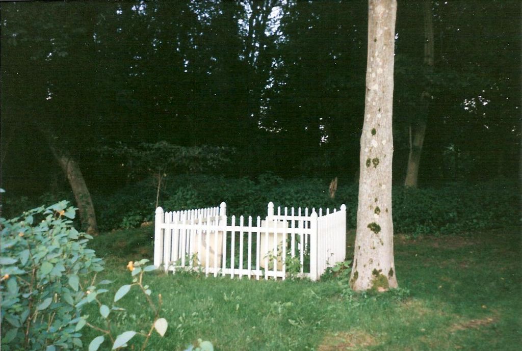
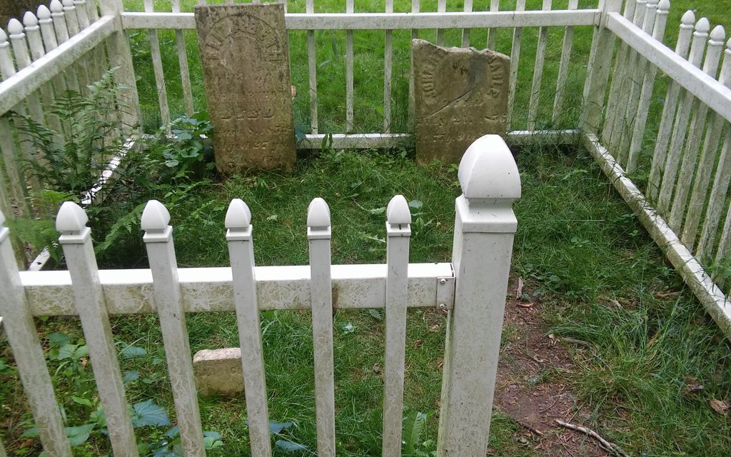
| Description | : | Located inside The Levi Hartong Farm at Southgate Park. Moses Grable was farming this tract prior to the 1839 acquisition of the property by his father, Jonathan. Jonathan Grable farmed the property for nearly two decades until relocating to the village of Greensburg, where he died in 1856. Grable and other members of his family are buried in a small family graveyard on the property. Cyrus Hartong purchased the farm from the Grables in 1859. The cemetery is located in the Green Township, Summit County, Ohio, and is # 11505 (Jonathan Grable Cemetery) in “Ohio Cemeteries 1803-2003”, compiled by... Read More |
frequently asked questions (FAQ):
-
Where is Jonathan Grable Burying Ground?
Jonathan Grable Burying Ground is located at Southgate Park Green, Summit County ,Ohio , 44720USA.
-
Jonathan Grable Burying Ground cemetery's updated grave count on graveviews.com?
1 memorials
-
Where are the coordinates of the Jonathan Grable Burying Ground?
Latitude: 40.9126010
Longitude: -81.4691160
Nearby Cemetories:
1. Greensburg Cemetery
Green, Summit County, USA
Coordinate: 40.9305992, -81.4792023
2. Saint Paul Cemetery
McDonaldsville, Stark County, USA
Coordinate: 40.8914950, -81.4785950
3. Sunset Hills Memory Gardens
North Canton, Stark County, USA
Coordinate: 40.8954460, -81.4375730
4. Klinefelter Cemetery
Green, Summit County, USA
Coordinate: 40.9383011, -81.4953995
5. Pleasant Valley Cemetery
North Canton, Stark County, USA
Coordinate: 40.9061990, -81.4218240
6. North Canton Cemetery
North Canton, Stark County, USA
Coordinate: 40.8969002, -81.4206009
7. Mount Pleasant Cemetery
Canton, Stark County, USA
Coordinate: 40.9078400, -81.4020600
8. Mudbrook Cemetery
Massillon, Stark County, USA
Coordinate: 40.8727989, -81.5141983
9. Faith United Methodist Church Columbarium
North Canton, Stark County, USA
Coordinate: 40.8843520, -81.4076290
10. Greentown Cemetery
Greentown, Stark County, USA
Coordinate: 40.9295000, -81.3970600
11. Church of the Lakes Church Columbarium
Canton, Stark County, USA
Coordinate: 40.8558440, -81.4605370
12. Sunset Hills Burial Park
Canton, Stark County, USA
Coordinate: 40.8537400, -81.4408600
13. Saint Pauls Cemetery
North Canton, Stark County, USA
Coordinate: 40.8736000, -81.4028015
14. East Liberty Cemetery
Green, Summit County, USA
Coordinate: 40.9743004, -81.4962997
15. Saint Stephen Martyr Lutheran Church Columbarium
Canton, Stark County, USA
Coordinate: 40.8425590, -81.4358970
16. Greenlawn Cemetery
Uniontown, Stark County, USA
Coordinate: 40.9782982, -81.4103012
17. Old Lutheran Cemetery
Uniontown, Stark County, USA
Coordinate: 40.9772290, -81.4081710
18. North Lawn Cemetery
Canton, Stark County, USA
Coordinate: 40.8521996, -81.4002991
19. Manchester Cemetery
New Franklin, Summit County, USA
Coordinate: 40.9352989, -81.5708008
20. Woods Cemetery
Uniontown, Stark County, USA
Coordinate: 40.9757996, -81.4008026
21. Rose Hill Memorial Park Cemetery
Massillon, Stark County, USA
Coordinate: 40.8342018, -81.5046997
22. Forest Hill Cemetery
Canton, Stark County, USA
Coordinate: 40.8492966, -81.3895340
23. Saint Jacobs Lutheran Cemetery
Lake Township, Stark County, USA
Coordinate: 40.9153366, -81.3531647
24. Oak Grove Cemetery
Lake Township, Stark County, USA
Coordinate: 40.9530983, -81.3597031