
| Memorials | : | 0 |
| Location | : | Tell Township, Huntingdon County, USA |
| Coordinate | : | 40.2355000, -77.7565000 |
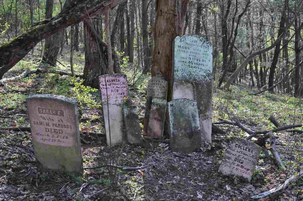
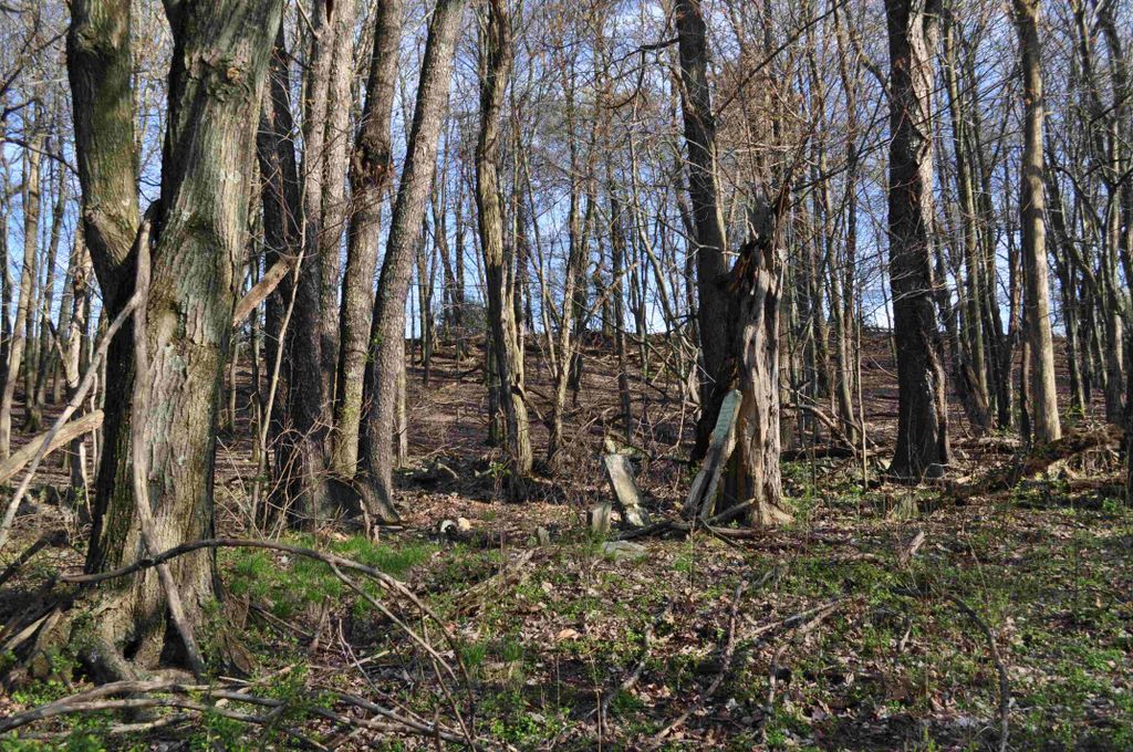
| Description | : | This abandoned cemetery is located in Tell Township on Mount Foot Road, near Nossville. You can not see the cemetery from the road and there is no sign or visible marker for it. It's in the wooded area after crossing a farmer's field. Exact GPS coordinates for the location of this cemetery are: N40-14-07.7 W77-45-23.4 All but one remaining stone show March of 1849 as dates of death. According to my research, the influenza epidemic was world wide in 1848, but shortly thereafter in 1849, a notable Cholera epidemic was in North America. |
frequently asked questions (FAQ):
-
Where is Jones-Chapman-Parson Cemetery?
Jones-Chapman-Parson Cemetery is located at Mount Foot Road Tell Township, Huntingdon County ,Pennsylvania , 17213USA.
-
Jones-Chapman-Parson Cemetery cemetery's updated grave count on graveviews.com?
0 memorials
-
Where are the coordinates of the Jones-Chapman-Parson Cemetery?
Latitude: 40.2355000
Longitude: -77.7565000
Nearby Cemetories:
1. Nossville Cemetery
Nossville, Huntingdon County, USA
Coordinate: 40.2342400, -77.7649000
2. Jeffries Cemetery
Tell Township, Huntingdon County, USA
Coordinate: 40.2582928, -77.7493489
3. Elf Cemetery
Tell Township, Huntingdon County, USA
Coordinate: 40.2687527, -77.7400792
4. United Presbyterian Cemetery
Concord, Franklin County, USA
Coordinate: 40.2435989, -77.7024994
5. Concord Union Cemetery
Concord, Franklin County, USA
Coordinate: 40.2471000, -77.7022000
6. Our Lady Of Refuge Cemetery
Doylesburg, Franklin County, USA
Coordinate: 40.2140530, -77.7060900
7. Shade Valley Union Cemetery
Tell Township, Huntingdon County, USA
Coordinate: 40.2716713, -77.7902832
8. Crow Cemetery
Tell Township, Huntingdon County, USA
Coordinate: 40.2296329, -77.8156254
9. Doylesburg United Methodist Cemetery
Doylesburg, Franklin County, USA
Coordinate: 40.2139910, -77.7009990
10. Richvale Cemetery
Richvale, Huntingdon County, USA
Coordinate: 40.2798000, -77.7836000
11. Salem Cemetery
Tell Township, Huntingdon County, USA
Coordinate: 40.2069400, -77.8099800
12. Mount Zion Cemetery
Blairs Mills, Huntingdon County, USA
Coordinate: 40.2936300, -77.7371800
13. McMullen Cemetery
Tell Township, Huntingdon County, USA
Coordinate: 40.2108189, -77.8301899
14. Upper Tuscarora Presbyterian Cemetery
Waterloo, Juniata County, USA
Coordinate: 40.2903214, -77.7043304
15. Bolinger Family Cemetery
Huntingdon County, USA
Coordinate: 40.2370180, -77.8486070
16. Waterloo Cemetery
Juniata County, USA
Coordinate: 40.2876000, -77.6940000
17. Gilliland Cemetery
Orbisonia, Huntingdon County, USA
Coordinate: 40.2320263, -77.8608294
18. Path Valley Cemetery
Spring Run, Franklin County, USA
Coordinate: 40.1547012, -77.7658005
19. McCaskey Graves
Perry County, USA
Coordinate: 40.2574997, -77.6472015
20. Possumtown Cemetery
Shade Gap, Huntingdon County, USA
Coordinate: 40.1857900, -77.8498900
21. Shope Cemetery
Aughwick, Huntingdon County, USA
Coordinate: 40.3177986, -77.7956009
22. Pine Grove Presbyterian Church Cemetery
Neelyton, Huntingdon County, USA
Coordinate: 40.1605400, -77.8170200
23. Amberson Union Cemetery
Amberson, Franklin County, USA
Coordinate: 40.1709200, -77.6767700
24. Spring Run Cemetery
Spring Run, Franklin County, USA
Coordinate: 40.1436110, -77.7722220