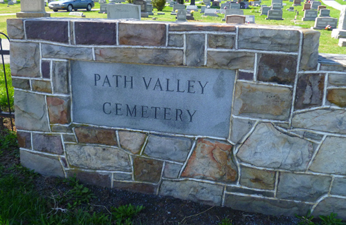
| Memorials | : | 4 |
| Location | : | Spring Run, Franklin County, USA |
| Coordinate | : | 40.1547012, -77.7658005 |
| Description | : | This cemetery is located on Pennsylvania Route 75 about 1 mile north of Spring Run, Pa on the west side of the highway. Please NOTE this cemetery is NOT affiliated with the Upper Path Valley PRESBYTERIAN Church Cemetery which is correctly named Spring Run Cemetery on Find A grave. |
frequently asked questions (FAQ):
-
Where is Path Valley Cemetery?
Path Valley Cemetery is located at 17173 Path Valley Road Spring Run, Franklin County ,Pennsylvania , 17262USA.
-
Path Valley Cemetery cemetery's updated grave count on graveviews.com?
4 memorials
-
Where are the coordinates of the Path Valley Cemetery?
Latitude: 40.1547012
Longitude: -77.7658005
Nearby Cemetories:
1. Spring Run Cemetery
Spring Run, Franklin County, USA
Coordinate: 40.1436110, -77.7722220
2. Wiggins Cemetery
Tell Township, Huntingdon County, USA
Coordinate: 40.1346600, -77.7748563
3. Pine Grove Presbyterian Church Cemetery
Neelyton, Huntingdon County, USA
Coordinate: 40.1605400, -77.8170200
4. Parker Cemetery
Metal Township, Franklin County, USA
Coordinate: 40.1271763, -77.8050054
5. Shetler Family Cemetery
Franklin County, USA
Coordinate: 40.1100000, -77.7833000
6. Fleming Cemetery
Neelyton, Huntingdon County, USA
Coordinate: 40.1333330, -77.8375000
7. Salem Cemetery
Tell Township, Huntingdon County, USA
Coordinate: 40.2069400, -77.8099800
8. Stake Cemetery
Amberson, Franklin County, USA
Coordinate: 40.1610170, -77.6820090
9. Flickinger Farm Family Cemetery
Franklin County, USA
Coordinate: 40.0927480, -77.8015170
10. Amberson Union Cemetery
Amberson, Franklin County, USA
Coordinate: 40.1709200, -77.6767700
11. Possumtown Cemetery
Shade Gap, Huntingdon County, USA
Coordinate: 40.1857900, -77.8498900
12. McMullen Cemetery
Tell Township, Huntingdon County, USA
Coordinate: 40.2108189, -77.8301899
13. Our Lady Of Refuge Cemetery
Doylesburg, Franklin County, USA
Coordinate: 40.2140530, -77.7060900
14. Doylesburg United Methodist Cemetery
Doylesburg, Franklin County, USA
Coordinate: 40.2139910, -77.7009990
15. Pleasant Hill Cemetery
Shade Gap, Huntingdon County, USA
Coordinate: 40.1425844, -77.8661077
16. Blair Cemetery
Shade Gap, Huntingdon County, USA
Coordinate: 40.1698800, -77.8655300
17. Shade Gap Presbyterian Church Cemetery
Shade Gap, Huntingdon County, USA
Coordinate: 40.1826400, -77.8624700
18. Evert Farm Family Cemetery
Metal, Franklin County, USA
Coordinate: 40.0794670, -77.7987490
19. Nossville Cemetery
Nossville, Huntingdon County, USA
Coordinate: 40.2342400, -77.7649000
20. Jones-Chapman-Parson Cemetery
Tell Township, Huntingdon County, USA
Coordinate: 40.2355000, -77.7565000
21. Crow Cemetery
Tell Township, Huntingdon County, USA
Coordinate: 40.2296329, -77.8156254
22. Piper Burial Ground
Amberson, Franklin County, USA
Coordinate: 40.1841000, -77.6540000
23. Roxbury Union Cemetery
Roxbury, Franklin County, USA
Coordinate: 40.1099200, -77.6593900
24. Fair Ridge Cemetery
Shade Gap, Huntingdon County, USA
Coordinate: 40.1356300, -77.8858200

