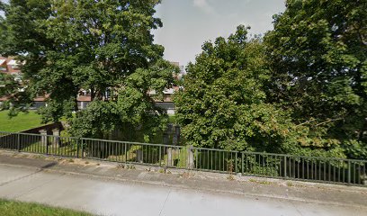
| Memorials | : | 0 |
| Location | : | Gulpen, Gulpen-Wittem Municipality, Netherlands |
| Coordinate | : | 50.8135290, 5.8865910 |
frequently asked questions (FAQ):
-
Where is Joodse Begraafplaats?
Joodse Begraafplaats is located at Rijksweg 5 Gulpen, Gulpen-Wittem Municipality ,Limburg , 6271 ABNetherlands.
-
Joodse Begraafplaats cemetery's updated grave count on graveviews.com?
0 memorials
-
Where are the coordinates of the Joodse Begraafplaats?
Latitude: 50.8135290
Longitude: 5.8865910
Nearby Cemetories:
1. Wijlre Kerkhof
Wijlre, Gulpen-Wittem Municipality, Netherlands
Coordinate: 50.8315400, 5.8945100
2. Mechelen Kerkhof Cemetery
Mechelen, Gulpen-Wittem Municipality, Netherlands
Coordinate: 50.7964000, 5.9256700
3. Mechelen Kerk Begraafplaats apex
Mechelen, Gulpen-Wittem Municipality, Netherlands
Coordinate: 50.7981500, 5.9282700
4. R.K. Begraafplaats
Eys, Gulpen-Wittem Municipality, Netherlands
Coordinate: 50.8260056, 5.9327850
5. Reijmerstok Begraafplaats
Reijmerstok, Gulpen-Wittem Municipality, Netherlands
Coordinate: 50.7994500, 5.8407600
6. Begraafplaats Banholt
Banholt, Eijsden-Margraten Municipality, Netherlands
Coordinate: 50.7911800, 5.8139700
7. Netherlands American Cemetery and Memorial
Margraten, Eijsden-Margraten Municipality, Netherlands
Coordinate: 50.8176918, 5.8046441
8. Oude Joodse Begraafplaats
Valkenburg, Valkenburg aan de Geul Municipality, Netherlands
Coordinate: 50.8613900, 5.8314100
9. Algemene Begraafplaats
Valkenburg, Valkenburg aan de Geul Municipality, Netherlands
Coordinate: 50.8611100, 5.8248500
10. Begraafplaats R.K. Parochie H Remigius
Klimmen, Voerendaal Municipality, Netherlands
Coordinate: 50.8764108, 5.8855418
11. Simpelveld Algemene Begraafplaats
Simpelveld, Simpelveld Municipality, Netherlands
Coordinate: 50.8329100, 5.9827900
12. RK Begraafplaats Kunrade
Kunrade, Voerendaal Municipality, Netherlands
Coordinate: 50.8768009, 5.9344092
13. Voerendaal Algemeen Begraafplaats
Voerendaal, Voerendaal Municipality, Netherlands
Coordinate: 50.8838100, 5.9271200
14. Cadier en Keer Kerkhof
Cadier en Keer, Eijsden-Margraten Municipality, Netherlands
Coordinate: 50.8268600, 5.7695500
15. R.K. Begraafplaats H. Jacobus de Meerderekerk
Bocholtz, Simpelveld Municipality, Netherlands
Coordinate: 50.8181303, 6.0053133
16. Sint-Martens-Voeren Churchyard
Voeren, Arrondissement Tongeren, Belgium
Coordinate: 50.7492100, 5.8127200
17. Remersdaal Cemetery
Voeren, Arrondissement Tongeren, Belgium
Coordinate: 50.7306241, 5.8790311
18. Joodse Begraafplaats
Schimmert, Nuth Municipality, Netherlands
Coordinate: 50.8875400, 5.8149000
19. Joodse Begraafplaats
Vaals Municipality, Netherlands
Coordinate: 50.7675447, 6.0093436
20. Protestantse Begraafplaats
Vaals Municipality, Netherlands
Coordinate: 50.7677076, 6.0102633
21. Hombourg Churchyard
Plombières, Arrondissement de Verviers, Belgium
Coordinate: 50.7233828, 5.9202556
22. Heerlen General Cemetery
Heerlen, Heerlen Municipality, Netherlands
Coordinate: 50.8849800, 5.9816400
23. Joodse Begraafplaats
Heerlen Municipality, Netherlands
Coordinate: 50.8849460, 5.9817340
24. Gemmenich Churchyard
Plombières, Arrondissement de Verviers, Belgium
Coordinate: 50.7464484, 5.9948675

