
| Memorials | : | 3 |
| Location | : | Cloverly, Montgomery County, USA |
| Coordinate | : | 39.1167300, -76.9850400 |
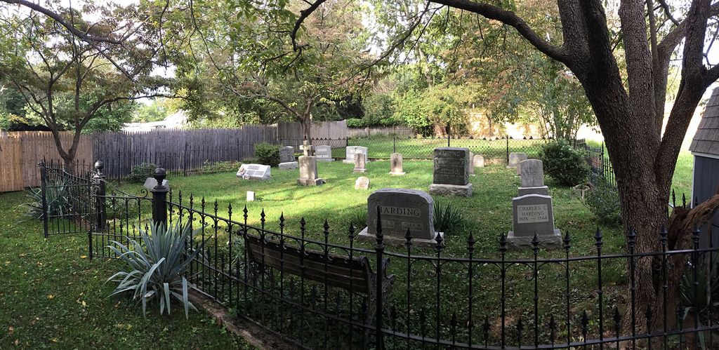
| Description | : | Access to the cemetery is down an alley right-of-way to the left side of the property at 1300 Harding Lane. +++++++++++++++++++++++++++ Joseph Harding (1822-1894) bought 200 acres as a young man, cleared most of it, and built a log house on today’s Harding Lane. He began raising potatoes and eventually became known as the Potato King of Montgomery County. He served as toll keeper at the Ednor toll booth and he founded a small Free Methodist Church in Cloverly that eventually relocated to Spencerville. He established a family cemetery and the first burial was his wife, Elizabeth Moore, and one of their... Read More |
frequently asked questions (FAQ):
-
Where is Joseph Harding Family Cemetery?
Joseph Harding Family Cemetery is located at Behind 1300 Harding Lane Cloverly, Montgomery County ,Maryland ,USA.
-
Joseph Harding Family Cemetery cemetery's updated grave count on graveviews.com?
3 memorials
-
Where are the coordinates of the Joseph Harding Family Cemetery?
Latitude: 39.1167300
Longitude: -76.9850400
Nearby Cemetories:
1. Round Oak Baptist Cemetery
Montgomery County, USA
Coordinate: 39.1147385, -76.9782562
2. Alloway-Miller Cemetery
Spencerville, Montgomery County, USA
Coordinate: 39.1240070, -76.9884170
3. Cloverly Cemetery
Cloverly, Montgomery County, USA
Coordinate: 39.1076100, -76.9911100
4. Cloverly Cemetery
Cloverly, Montgomery County, USA
Coordinate: 39.1082200, -76.9948800
5. Franklin Family Cemetery
Spencerville, Montgomery County, USA
Coordinate: 39.1256030, -76.9620840
6. Good Hope Union Methodist Church Cemetery
Silver Spring, Montgomery County, USA
Coordinate: 39.0958700, -76.9876700
7. Union Cemetery
Burtonsville, Montgomery County, USA
Coordinate: 39.1102982, -76.9499969
8. Ward - Bennett Family Cemetery
Burtonsville, Montgomery County, USA
Coordinate: 39.1135510, -76.9492230
9. Transfiguration Episcopal Church Columbarium
Silver Spring, Montgomery County, USA
Coordinate: 39.0847100, -76.9992600
10. Merson Family Cemetery
Burtonsville, Montgomery County, USA
Coordinate: 39.1078500, -76.9371900
11. Bonifant Family Cemetery
Layhill, Montgomery County, USA
Coordinate: 39.0908012, -77.0218964
12. Ebenezer Church Cemetery
Ashton, Montgomery County, USA
Coordinate: 39.1522500, -77.0052400
13. Burton Family Cemetery
Burtonsville, Montgomery County, USA
Coordinate: 39.1242400, -76.9347600
14. Columbia Primitive Baptist Church Cemetery
Burtonsville, Montgomery County, USA
Coordinate: 39.1172600, -76.9329900
15. Bready Family Cemetery
Norwood, Montgomery County, USA
Coordinate: 39.1123480, -77.0369050
16. Sandy Spring Friends Meeting House Cemetery
Sandy Spring, Montgomery County, USA
Coordinate: 39.1478900, -77.0249700
17. Richardson Family Cemetery
Ashton, Montgomery County, USA
Coordinate: 39.1543500, -77.0147900
18. Colesville Cemetery
Silver Spring, Montgomery County, USA
Coordinate: 39.0750351, -77.0055313
19. Soper Family Cemetery
Burtonsville, Montgomery County, USA
Coordinate: 39.0934710, -76.9317570
20. Saint Marks Episcopal Church Cemetery
Silver Spring, Montgomery County, USA
Coordinate: 39.0644300, -76.9639700
21. Mutual Memorial Cemetery
Sandy Spring, Montgomery County, USA
Coordinate: 39.1573300, -77.0325100
22. Parker Family Cemetery (Defunct)
Layhill, Montgomery County, USA
Coordinate: 39.0886230, -77.0472120
23. Woodside Cemetery
Ashton, Montgomery County, USA
Coordinate: 39.1719700, -77.0081300
24. Mount Zion United Methodist Church Cemetery
Highland, Howard County, USA
Coordinate: 39.1665800, -76.9438000