
| Memorials | : | 0 |
| Location | : | Goodway, Monroe County, USA |
| Coordinate | : | 31.3385790, -87.4537470 |
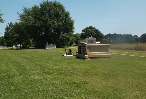
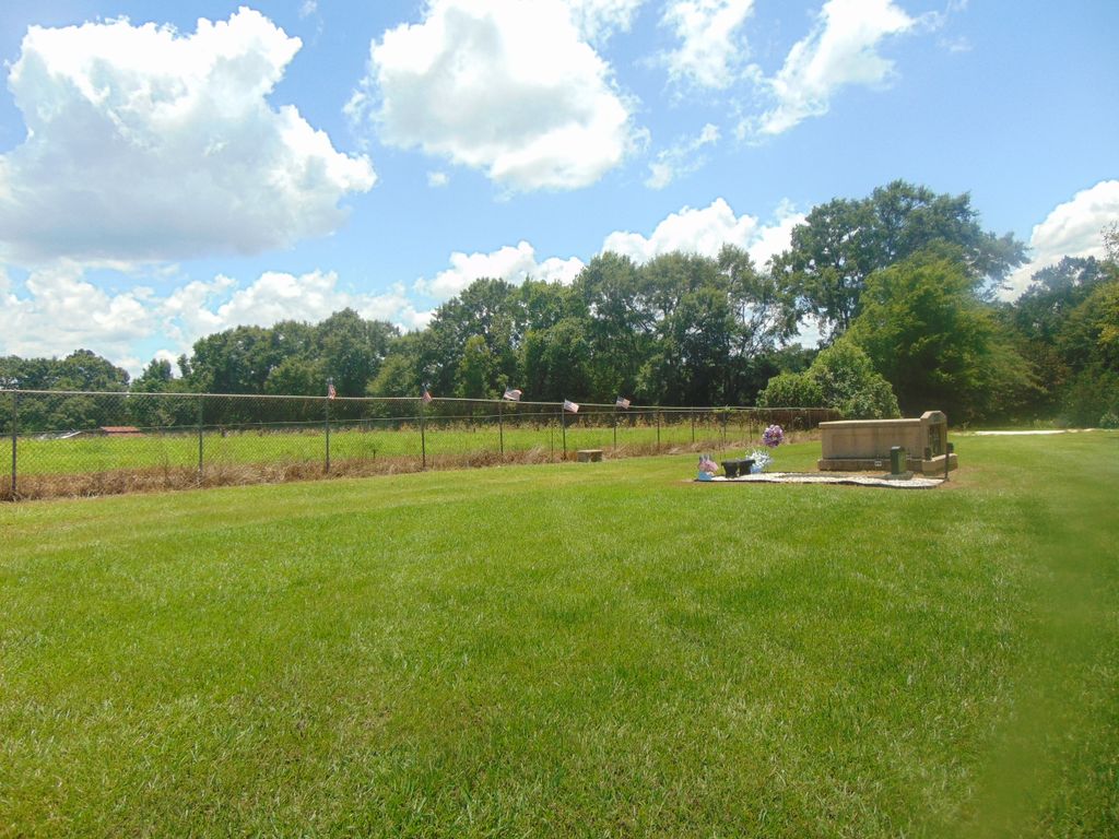
| Description | : | The Junction Cemetery is a small community burial place that has only two mausoleums and one in-ground plot, as of June 2016. Located on a natural landscaped hillside, the property lies behind a tree line that separates the cemetery from Hwy-21. To the east of the cemetery is a fenced pastureland, along which a few fig and pecan trees stand. The gravel path leading to the cemetery has no name. To reach the cemetery from the City of Monroeville, drive south on Hwy-21 passing through Frisco City and Megargle to an area outside the limits of Goodway... Read More |
frequently asked questions (FAQ):
-
Where is Junction Cemetery?
Junction Cemetery is located at Highway 21 at Qualls Road Goodway, Monroe County ,Alabama , 36449USA.
-
Junction Cemetery cemetery's updated grave count on graveviews.com?
0 memorials
-
Where are the coordinates of the Junction Cemetery?
Latitude: 31.3385790
Longitude: -87.4537470
Nearby Cemetories:
1. New Johnson Cemetery
Goodway, Monroe County, USA
Coordinate: 31.3182830, -87.4385410
2. Johnson Cemetery
Megargel, Monroe County, USA
Coordinate: 31.3181000, -87.4383011
3. Sowell Old Field Cemetery
Goodway, Monroe County, USA
Coordinate: 31.3458000, -87.4256000
4. Silo Field Cemetery
Monroe County, USA
Coordinate: 31.3458004, -87.4255981
5. Poplar Springs Cemetery
Uriah, Monroe County, USA
Coordinate: 31.3322060, -87.5104460
6. Old Johnson Cemetery
Megargel, Monroe County, USA
Coordinate: 31.3782100, -87.4171500
7. Uriah AME Community Cemetery
Uriah, Monroe County, USA
Coordinate: 31.3002550, -87.4979370
8. Uriah Cemetery
Monroe County, USA
Coordinate: 31.3083000, -87.5057983
9. Saint Paul Baptist Church Cemetery
Monroe County, USA
Coordinate: 31.3291600, -87.5181090
10. Oak Grove Assembly Of God Cemetery
Monroe County, USA
Coordinate: 31.3590590, -87.3863160
11. Enon Baptist Church Cemetery
Goodway, Monroe County, USA
Coordinate: 31.3008390, -87.3949010
12. Community Chapel Holiness Church Cemetery
Megargel, Monroe County, USA
Coordinate: 31.3987870, -87.4291070
13. Coleman Cemetery
Frisco City, Monroe County, USA
Coordinate: 31.3881530, -87.3828510
14. Hall-King Family Cemetery
Monroe County, USA
Coordinate: 31.3225970, -87.3584540
15. Baas Memorial Cemetery
Frisco City, Monroe County, USA
Coordinate: 31.4160995, -87.4182968
16. Crawford Family Cemetery
Monroe County, USA
Coordinate: 31.3319940, -87.3551500
17. Pleasant Hill Cemetery
Frisco City, Monroe County, USA
Coordinate: 31.4180370, -87.4954900
18. Mount Pisgah Cemetery
Frisco City, Monroe County, USA
Coordinate: 31.4162680, -87.3970850
19. Macedonia Baptist Church Cemetery
Frisco City, Monroe County, USA
Coordinate: 31.4250180, -87.4940550
20. Hendrix Cemetery
Frisco City, Monroe County, USA
Coordinate: 31.4289380, -87.4172370
21. Zion Rest Cemetery
Excel, Monroe County, USA
Coordinate: 31.4069820, -87.3712030
22. Union Cemetery
Frisco City, Monroe County, USA
Coordinate: 31.4299370, -87.4082410
23. Macedonia Church Cemetery
Manistee, Monroe County, USA
Coordinate: 31.4379530, -87.4802680
24. Shiloh Primitive Baptist Church Cemetery
Frisco City, Monroe County, USA
Coordinate: 31.4395027, -87.4118271