| Memorials | : | 0 |
| Location | : | Uriah, Monroe County, USA |
| Coordinate | : | 31.3002550, -87.4979370 |
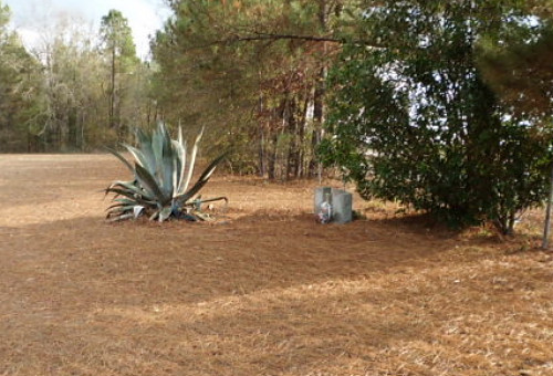
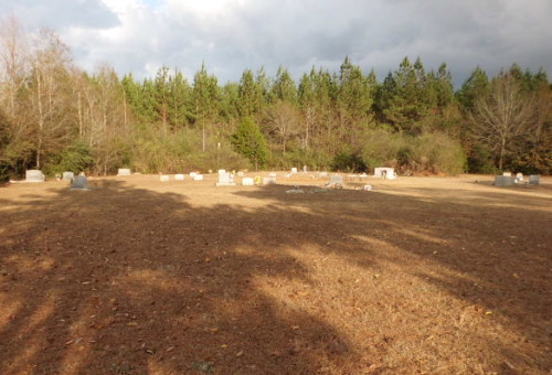
| Description | : | The original name of this cemetery was Mt. Triont. To locate the place follow Hwy-21 south from Monroeville to the town of Uriah. At the large Blacksher home on the right turn left onto Snowden Street and go a distance of about 2,000 feet. The cemetery is on the left in an open meadow. There is a gate but no fence as a tree and brush line separates the cemetery from the roadway. You will find ample parking both on the cemetery grounds and a commercial parking area on the opposite side of the street. The... Read More |
frequently asked questions (FAQ):
-
Where is Uriah AME Community Cemetery?
Uriah AME Community Cemetery is located at Foot of Snowden Street Uriah, Monroe County ,Alabama , 36480USA.
-
Uriah AME Community Cemetery cemetery's updated grave count on graveviews.com?
0 memorials
-
Where are the coordinates of the Uriah AME Community Cemetery?
Latitude: 31.3002550
Longitude: -87.4979370
Nearby Cemetories:
1. Uriah Cemetery
Monroe County, USA
Coordinate: 31.3083000, -87.5057983
2. Saint Paul Baptist Church Cemetery
Monroe County, USA
Coordinate: 31.3291600, -87.5181090
3. Poplar Springs Cemetery
Uriah, Monroe County, USA
Coordinate: 31.3322060, -87.5104460
4. Junction Cemetery
Goodway, Monroe County, USA
Coordinate: 31.3385790, -87.4537470
5. New Johnson Cemetery
Goodway, Monroe County, USA
Coordinate: 31.3182830, -87.4385410
6. Johnson Cemetery
Megargel, Monroe County, USA
Coordinate: 31.3181000, -87.4383011
7. Semirah Springs Cemetery
Jeddo, Monroe County, USA
Coordinate: 31.2627792, -87.5555573
8. Mims Plantation Family Cemetery
Uriah, Monroe County, USA
Coordinate: 31.2877800, -87.5800840
9. Sowell Old Field Cemetery
Goodway, Monroe County, USA
Coordinate: 31.3458000, -87.4256000
10. Silo Field Cemetery
Monroe County, USA
Coordinate: 31.3458004, -87.4255981
11. Huxford Cemetery
Huxford, Escambia County, USA
Coordinate: 31.2175007, -87.4813995
12. Peavy Family Cemetery
Mineola, Monroe County, USA
Coordinate: 31.2941220, -87.5978080
13. Huxford Community of Christ Cemetery
Huxford, Escambia County, USA
Coordinate: 31.2285830, -87.4414300
14. Qualls Cemetery
Monroe County, USA
Coordinate: 31.3258030, -87.5949920
15. Sardis Primitive Baptist Cemetery
Huxford, Escambia County, USA
Coordinate: 31.2245460, -87.4462800
16. Enon Baptist Church Cemetery
Goodway, Monroe County, USA
Coordinate: 31.3008390, -87.3949010
17. Huxford Indian Cemetery
Escambia County, USA
Coordinate: 31.2237339, -87.4461136
18. Old Johnson Cemetery
Megargel, Monroe County, USA
Coordinate: 31.3782100, -87.4171500
19. Dunn Cemetery
Uriah, Monroe County, USA
Coordinate: 31.3846040, -87.5769190
20. Rocky Hill Cemetery
Uriah, Monroe County, USA
Coordinate: 31.3898440, -87.5696690
21. Oak Grove Assembly Of God Cemetery
Monroe County, USA
Coordinate: 31.3590590, -87.3863160
22. Community Chapel Holiness Church Cemetery
Megargel, Monroe County, USA
Coordinate: 31.3987870, -87.4291070
23. Pleasant Hill Cemetery
Frisco City, Monroe County, USA
Coordinate: 31.4180370, -87.4954900
24. Hall-King Family Cemetery
Monroe County, USA
Coordinate: 31.3225970, -87.3584540


