| Memorials | : | 2 |
| Location | : | Coffeyville, Montgomery County, USA |
| Coordinate | : | 37.0682983, -95.5867004 |
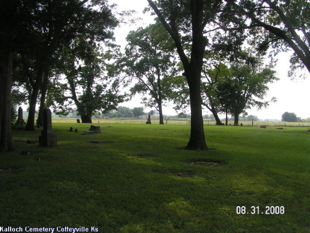
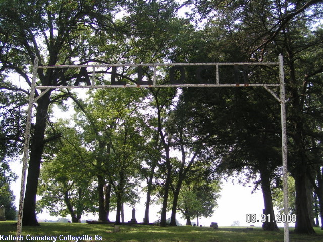
| Description | : | Kalloch Cemetery is one of the early cemeteries of Montgomery County, Kansas. It is located on the west side of highway US 169, 2.2 miles north from the Verdigris River bridge at Coffeyville. From "Montgomery County Kans. Cemetery Records Part 1 & 2," published 1981. |
frequently asked questions (FAQ):
-
Where is Kalloch Cemetery?
Kalloch Cemetery is located at Coffeyville, Montgomery County ,Kansas ,USA.
-
Kalloch Cemetery cemetery's updated grave count on graveviews.com?
2 memorials
-
Where are the coordinates of the Kalloch Cemetery?
Latitude: 37.0682983
Longitude: -95.5867004
Nearby Cemetories:
1. Union Cemetery
Montgomery County, USA
Coordinate: 37.0630989, -95.5408020
2. Chapel of Resurrection Columbarium
Coffeyville, Montgomery County, USA
Coordinate: 37.0373300, -95.6187200
3. Pumpkin Creek Cemetery
Montgomery County, USA
Coordinate: 37.0415400, -95.5411500
4. Westralia Cemetery
Coffeyville, Montgomery County, USA
Coordinate: 37.0232100, -95.5811800
5. Elmwood Cemetery
Coffeyville, Montgomery County, USA
Coordinate: 37.0236015, -95.6188965
6. Calvary Cemetery
Coffeyville, Montgomery County, USA
Coordinate: 37.0567017, -95.6502991
7. Restlawn Memorial Park Cemetery
Coffeyville, Montgomery County, USA
Coordinate: 37.0527992, -95.6493988
8. Fairview Cemetery
Coffeyville, Montgomery County, USA
Coordinate: 37.0546989, -95.6536026
9. Hinton Cemetery
Liberty, Montgomery County, USA
Coordinate: 37.1384900, -95.6101000
10. Saint Josaphat Cemetery
Coffeyville, Montgomery County, USA
Coordinate: 36.9993900, -95.6281000
11. Spring Hill Cemetery
Montgomery County, USA
Coordinate: 37.1235600, -95.6595500
12. All Saints Cemetery
Liberty, Montgomery County, USA
Coordinate: 37.1542015, -95.5757980
13. Liberty Cemetery
Liberty, Montgomery County, USA
Coordinate: 37.1581890, -95.6001580
14. Roberts Cemetery
Labette County, USA
Coordinate: 37.0060997, -95.4863968
15. Melton Cemetery
Nowata County, USA
Coordinate: 36.9639015, -95.6016998
16. Robbins Cemetery
Coffeyville, Montgomery County, USA
Coordinate: 37.0339012, -95.7192001
17. Thompson Homestead Cemetery
Liberty, Montgomery County, USA
Coordinate: 37.1767000, -95.6183100
18. Shelton Mausoleum
Liberty, Montgomery County, USA
Coordinate: 37.1857760, -95.5490630
19. West Brown Cemetery
Dearing, Montgomery County, USA
Coordinate: 37.0549800, -95.7475000
20. Richland Cemetery
Angola, Labette County, USA
Coordinate: 37.1342000, -95.4475000
21. Montgomery County Poor Farm Cemetery
Liberty, Montgomery County, USA
Coordinate: 37.1888590, -95.6493690
22. Jefferson Cemetery
Montgomery County, USA
Coordinate: 37.1039009, -95.7469025
23. Lain Burial Ground
Nowata County, USA
Coordinate: 36.9763985, -95.4443970
24. McKee Cemetery
Labette County, USA
Coordinate: 37.0070900, -95.4203000


