
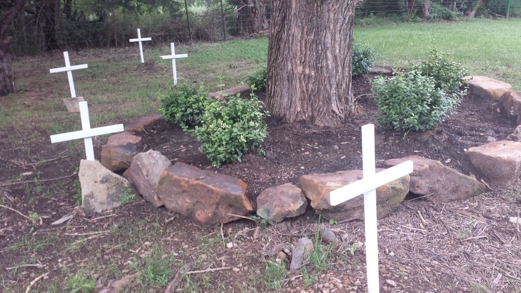
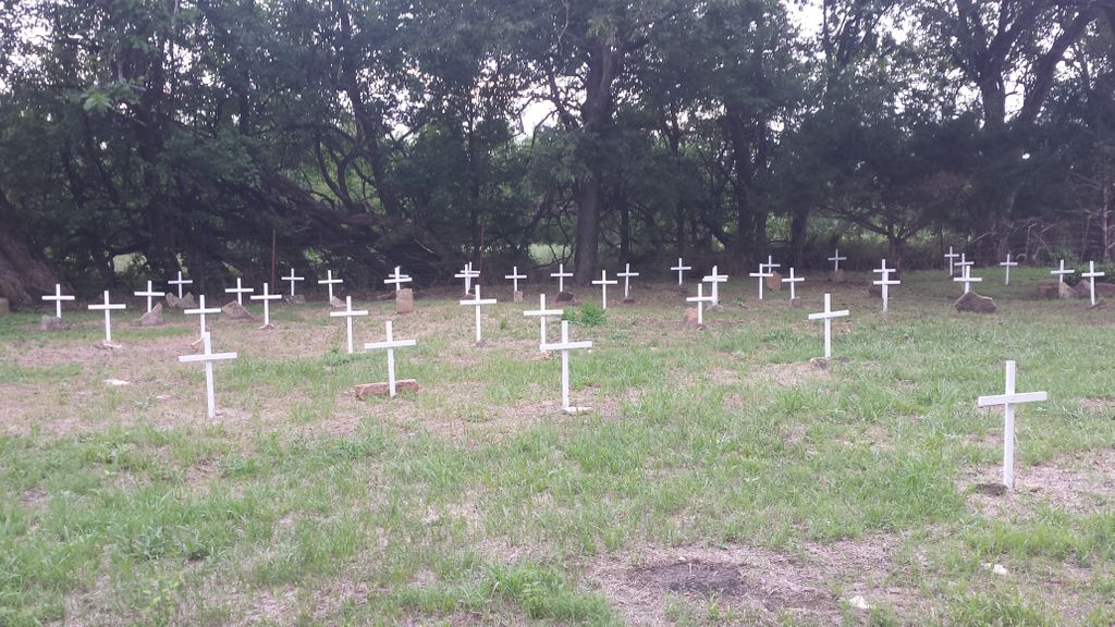
| Memorials | : | 18 |
| Location | : | Liberty, Montgomery County, USA |
| Coordinate | : | 37.1888590, -95.6493690 |
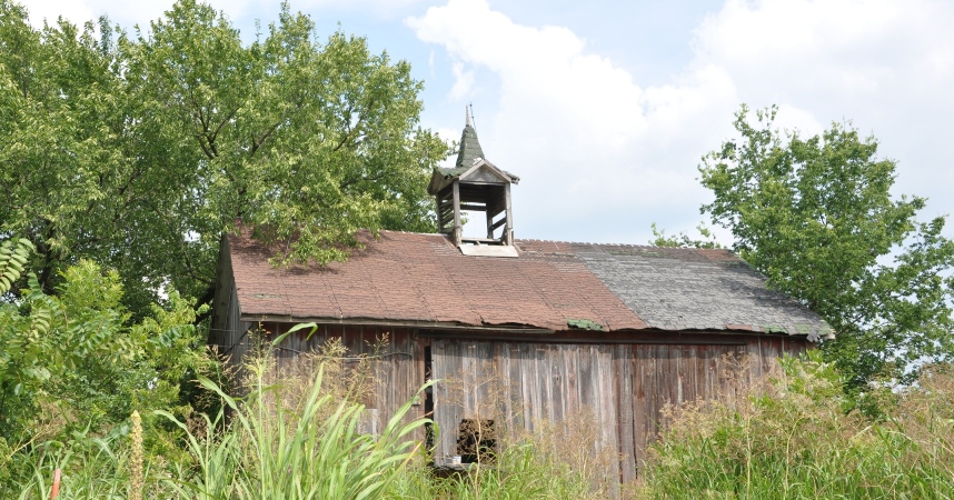
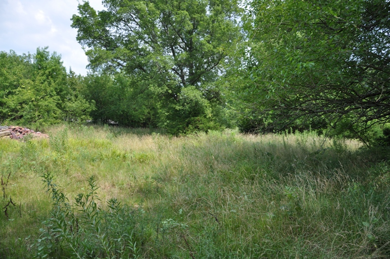
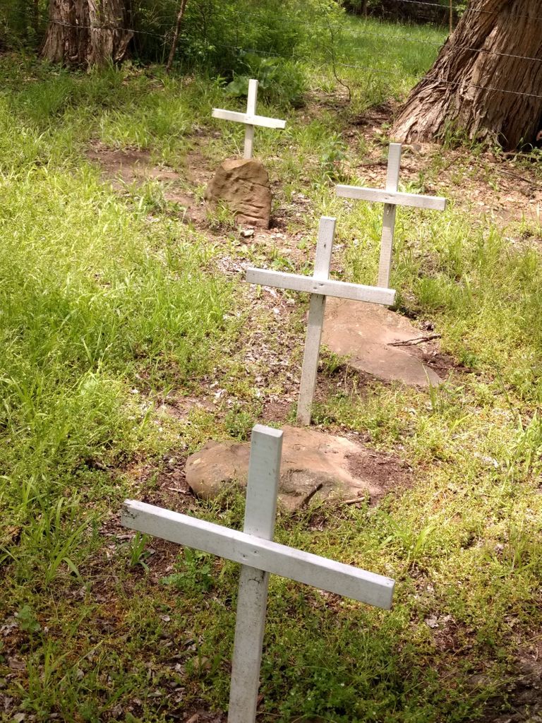
| Description | : | Located on the property that was once the County Poor Farm, along the south fence line/hedge row, which are now the Veath and Schenk properties. Intersection of CR 4550 & 3850. Was then Liberty Township. Is now rural Independence. Cemetery is completely unmarked, unmaintained and only found by this contributor with the help of a long time resident in the area. Compiling an informational book on the Poor Farm now, which will be avilable in the Independence Public Library. Update 11/13/2011: Cemetery found today, now that the brush is low and with a property owner this time. In process of negotiating the clearing,... Read More |
frequently asked questions (FAQ):
-
Where is Montgomery County Poor Farm Cemetery?
Montgomery County Poor Farm Cemetery is located at Liberty, Montgomery County ,Kansas ,USA.
-
Montgomery County Poor Farm Cemetery cemetery's updated grave count on graveviews.com?
18 memorials
-
Where are the coordinates of the Montgomery County Poor Farm Cemetery?
Latitude: 37.1888590
Longitude: -95.6493690
Nearby Cemetories:
1. Thompson Homestead Cemetery
Liberty, Montgomery County, USA
Coordinate: 37.1767000, -95.6183100
2. Pratt Cemetery
Montgomery County, USA
Coordinate: 37.2324982, -95.6557999
3. Liberty Cemetery
Liberty, Montgomery County, USA
Coordinate: 37.1581890, -95.6001580
4. Hinton Cemetery
Liberty, Montgomery County, USA
Coordinate: 37.1384900, -95.6101000
5. Harmony Cemetery
Cherryvale, Montgomery County, USA
Coordinate: 37.2324982, -95.5950012
6. Spring Hill Cemetery
Montgomery County, USA
Coordinate: 37.1235600, -95.6595500
7. All Saints Cemetery
Liberty, Montgomery County, USA
Coordinate: 37.1542015, -95.5757980
8. Saint Andrews Cemetery
Independence, Montgomery County, USA
Coordinate: 37.2566986, -95.6658020
9. Mount Hope Cemetery
Independence, Montgomery County, USA
Coordinate: 37.2413300, -95.7060050
10. Calvary Cemetery
Independence, Montgomery County, USA
Coordinate: 37.2486000, -95.7043991
11. Shelton Mausoleum
Liberty, Montgomery County, USA
Coordinate: 37.1857760, -95.5490630
12. Bethel Cemetery
Independence, Montgomery County, USA
Coordinate: 37.2761002, -95.6457977
13. Centennial Cemetery
Cherryvale, Montgomery County, USA
Coordinate: 37.2296982, -95.5466995
14. Saint Francis Xavier Cemetery
Cherryvale, Montgomery County, USA
Coordinate: 37.2633018, -95.5753021
15. Jefferson Cemetery
Montgomery County, USA
Coordinate: 37.1039009, -95.7469025
16. Le Hunt Cemetery
Montgomery County, USA
Coordinate: 37.2744300, -95.7586200
17. Radical Cemetery
Montgomery County, USA
Coordinate: 37.2882996, -95.7416992
18. Fairview Cemetery
Cherryvale, Montgomery County, USA
Coordinate: 37.2722015, -95.5344009
19. Spindletop Cemetery
Cherryvale, Montgomery County, USA
Coordinate: 37.2958400, -95.5570700
20. Kalloch Cemetery
Coffeyville, Montgomery County, USA
Coordinate: 37.0682983, -95.5867004
21. Choteau Cemetery
Independence, Montgomery County, USA
Coordinate: 37.3194700, -95.6746700
22. Calvary Cemetery
Coffeyville, Montgomery County, USA
Coordinate: 37.0567017, -95.6502991
23. Griffith Cemetery
Labette County, USA
Coordinate: 37.2463989, -95.4981003
24. Fairview Cemetery
Coffeyville, Montgomery County, USA
Coordinate: 37.0546989, -95.6536026