
| Memorials | : | 10 |
| Location | : | Philpot, Daviess County, USA |
| Coordinate | : | 37.7097740, -86.9388123 |
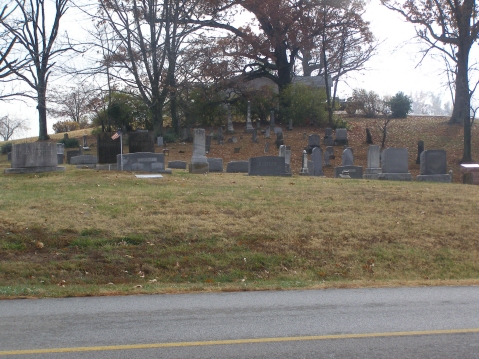
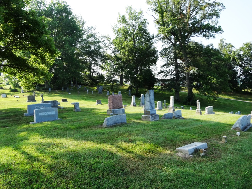
| Description | : | Please note: This is a different cemetery from the Karn's Grove Baptist Church Cemetery, which is across the road. This cemetery was renamed Karn Family Cemetery on here as a solution to designate between the two different cemeteries. This cemetery contains descendants of the Boone Family, including two great-nephews, a great-niece of Daniel Boone (his brother Edwards grandchildren), a niece of Rebecca Bryan Boone and almost all the others are 1st cousins to Daniel. It sits on land that was part of 3,000 acres that was originally purchased by Christopher and Leah (Boone) Karn in 1818. It is across the road from the Karn's... Read More |
frequently asked questions (FAQ):
-
Where is Karn Family Cemetery?
Karn Family Cemetery is located at Karns Grove Road Philpot, Daviess County ,Kentucky ,USA.
-
Karn Family Cemetery cemetery's updated grave count on graveviews.com?
10 memorials
-
Where are the coordinates of the Karn Family Cemetery?
Latitude: 37.7097740
Longitude: -86.9388123
Nearby Cemetories:
1. Karn's Grove Baptist Church Cemetery
Philpot, Daviess County, USA
Coordinate: 37.7102000, -86.9390600
2. Barnhill Cemetery
Philpot, Daviess County, USA
Coordinate: 37.7150650, -86.9604874
3. Adcock-Pursell-Simpson Cemetery
Philpot, Daviess County, USA
Coordinate: 37.7323390, -86.9503300
4. Providence United Methodist Cemetery
Philpot, Daviess County, USA
Coordinate: 37.7320800, -86.9198200
5. Gabbert Family Plot
Philpot, Daviess County, USA
Coordinate: 37.7406080, -86.9639350
6. Bethabara Baptist Church Cemetery
Habit, Daviess County, USA
Coordinate: 37.7033005, -86.9944000
7. Passionist Monastery Cemetery
Whitesville, Daviess County, USA
Coordinate: 37.6674350, -86.9092460
8. Richardson Jones Cemetery
Habit, Daviess County, USA
Coordinate: 37.6865005, -86.9959030
9. Pleasant Grove United Methodist Church Cemetery
Philpot, Daviess County, USA
Coordinate: 37.7457800, -86.9984500
10. Friendship Baptist Church Cemetery
Philpot, Daviess County, USA
Coordinate: 37.6520600, -86.9565100
11. Pleasant Valley Christian Church Cemetery
Knottsville, Daviess County, USA
Coordinate: 37.7682991, -86.9546967
12. Resurrection Cemetery
Owensboro, Daviess County, USA
Coordinate: 37.7359600, -87.0111200
13. Saint William Cemetery
Knottsville, Daviess County, USA
Coordinate: 37.7749050, -86.9086010
14. Cates Cemetery
Whitesville, Daviess County, USA
Coordinate: 37.6819000, -86.8574982
15. Jackson Cemetery
Masonville, Daviess County, USA
Coordinate: 37.6397018, -86.9593964
16. Mobberly Cemetery
Masonville, Daviess County, USA
Coordinate: 37.6778000, -87.0204600
17. Edge Cemetery
Whitesville, Daviess County, USA
Coordinate: 37.6491670, -86.8883330
18. Saint Mary of the Woods Cemetery
Whitesville, Daviess County, USA
Coordinate: 37.6605988, -86.8711014
19. Barnetts Knob Cemetery
Whitesville, Daviess County, USA
Coordinate: 37.6753006, -86.8578033
20. Saint Lawrence Cemetery
Knottsville, Daviess County, USA
Coordinate: 37.7638700, -86.8716000
21. Hite and Payne Family Cemetery
Philpot, Daviess County, USA
Coordinate: 37.7511410, -86.8491940
22. South Hampton Church Cemetery
Owensboro, Daviess County, USA
Coordinate: 37.7813000, -86.9927300
23. Macedonia Baptist Church Cemetery
Philpot, Daviess County, USA
Coordinate: 37.7361800, -87.0401100
24. Masonville United Methodist Church Cemetery
Masonville, Daviess County, USA
Coordinate: 37.6716900, -87.0358700