
| Memorials | : | 1 |
| Location | : | Philpot, Daviess County, USA |
| Coordinate | : | 37.7150650, -86.9604874 |
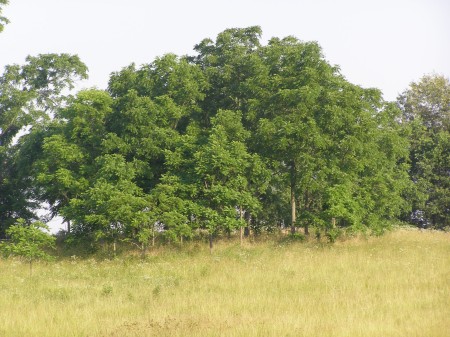
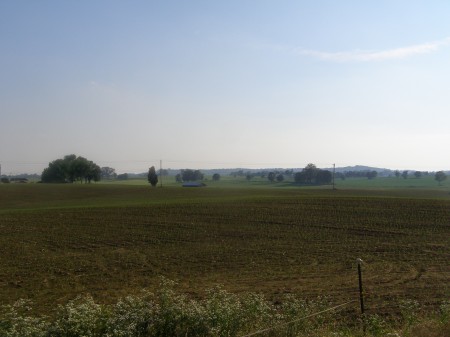
| Description | : | It is located on the Old Leitchfield Road south of Philpot, after crossing Panther Creek and the intersection of State Road, the Cemetery is located on private property behind the first house on the left, on a knoll containing several small Walnut Trees. Located off of what was Hwy 54. Go east through the old part of Philpot, after crossing Panther creek, take the 1st road to left to Mr. Wilson's house. The small cemetery is to right of the barn, on top of the hill. Mr. Wilson stated that there were once more stones before they became covered with debris.... Read More |
frequently asked questions (FAQ):
-
Where is Barnhill Cemetery?
Barnhill Cemetery is located at on the Old Leitchfield Road south of Philpot Philpot, Daviess County ,Kentucky ,USA.
-
Barnhill Cemetery cemetery's updated grave count on graveviews.com?
1 memorials
-
Where are the coordinates of the Barnhill Cemetery?
Latitude: 37.7150650
Longitude: -86.9604874
Nearby Cemetories:
1. Karn's Grove Baptist Church Cemetery
Philpot, Daviess County, USA
Coordinate: 37.7102000, -86.9390600
2. Karn Family Cemetery
Philpot, Daviess County, USA
Coordinate: 37.7097740, -86.9388123
3. Adcock-Pursell-Simpson Cemetery
Philpot, Daviess County, USA
Coordinate: 37.7323390, -86.9503300
4. Gabbert Family Plot
Philpot, Daviess County, USA
Coordinate: 37.7406080, -86.9639350
5. Bethabara Baptist Church Cemetery
Habit, Daviess County, USA
Coordinate: 37.7033005, -86.9944000
6. Providence United Methodist Cemetery
Philpot, Daviess County, USA
Coordinate: 37.7320800, -86.9198200
7. Richardson Jones Cemetery
Habit, Daviess County, USA
Coordinate: 37.6865005, -86.9959030
8. Pleasant Grove United Methodist Church Cemetery
Philpot, Daviess County, USA
Coordinate: 37.7457800, -86.9984500
9. Resurrection Cemetery
Owensboro, Daviess County, USA
Coordinate: 37.7359600, -87.0111200
10. Pleasant Valley Christian Church Cemetery
Knottsville, Daviess County, USA
Coordinate: 37.7682991, -86.9546967
11. Mobberly Cemetery
Masonville, Daviess County, USA
Coordinate: 37.6778000, -87.0204600
12. Passionist Monastery Cemetery
Whitesville, Daviess County, USA
Coordinate: 37.6674350, -86.9092460
13. Friendship Baptist Church Cemetery
Philpot, Daviess County, USA
Coordinate: 37.6520600, -86.9565100
14. Macedonia Baptist Church Cemetery
Philpot, Daviess County, USA
Coordinate: 37.7361800, -87.0401100
15. Wallace - Newbolt Cemetery
Owensboro, Daviess County, USA
Coordinate: 37.7175400, -87.0500000
16. South Hampton Church Cemetery
Owensboro, Daviess County, USA
Coordinate: 37.7813000, -86.9927300
17. Saint William Cemetery
Knottsville, Daviess County, USA
Coordinate: 37.7749050, -86.9086010
18. Masonville United Methodist Church Cemetery
Masonville, Daviess County, USA
Coordinate: 37.6716900, -87.0358700
19. Jackson Cemetery
Masonville, Daviess County, USA
Coordinate: 37.6397018, -86.9593964
20. McCormick Family Cemetery
Masonville, Daviess County, USA
Coordinate: 37.6967600, -87.0598830
21. Winkler Cemetery
Knottsville, Daviess County, USA
Coordinate: 37.7989006, -86.9452972
22. Saint Lawrence Cemetery
Knottsville, Daviess County, USA
Coordinate: 37.7638700, -86.8716000
23. Mount Zion Presbyterian Church Cemetery
Knottsville, Daviess County, USA
Coordinate: 37.8006600, -86.9469600
24. Edge Cemetery
Whitesville, Daviess County, USA
Coordinate: 37.6491670, -86.8883330