
| Memorials | : | 0 |
| Location | : | Loretto, Marion County, USA |
| Coordinate | : | 37.6333370, -85.3916710 |
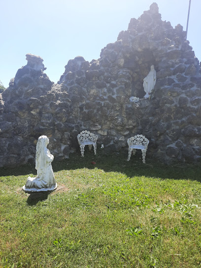
| Description | : | The cemetery is located in Marion County. The cemetery is listed as Taylor County Cemetery # 142 (Kelly Cemetery) on page 11 of Taylor County Cemeteries (Kentucky Cemetery Records Project Vol. 1 Taylor County). The location is described as on the Noe – Middle Pirman Creek Road on the late Truman Stearman farm. The latitude is given as 37° 38’ 00”, and the longitude is given as 85° 23’ 30”. |
frequently asked questions (FAQ):
-
Where is Kelly Cemetery?
Kelly Cemetery is located at Loretto Road (Kentucky 49) Loretto, Marion County ,Kentucky , 40037USA.
-
Kelly Cemetery cemetery's updated grave count on graveviews.com?
0 memorials
-
Where are the coordinates of the Kelly Cemetery?
Latitude: 37.6333370
Longitude: -85.3916710
Nearby Cemetories:
1. Smock Chapel Cemetery
Loretto, Marion County, USA
Coordinate: 37.6537600, -85.4009300
2. Motherhouse Cemetery
Nerinx, Marion County, USA
Coordinate: 37.6593630, -85.3950120
3. Saint Francis of Assisi Catholic Cemetery
Saint Francis, Marion County, USA
Coordinate: 37.6273520, -85.4318330
4. Saint Charles Cemetery
Saint Mary, Marion County, USA
Coordinate: 37.5940020, -85.3442430
5. Holy Cross Cemetery
Holy Cross, Marion County, USA
Coordinate: 37.6729770, -85.4480120
6. McNear Cemetery
Loretto, Marion County, USA
Coordinate: 37.6152770, -85.4638930
7. Saint Francis Xavier Catholic Cemetery
Raywick, Marion County, USA
Coordinate: 37.5574989, -85.4225006
8. Raywick Methodist Cemetery
Raywick, Marion County, USA
Coordinate: 37.5608230, -85.4421490
9. Stewarts Creek Baptist Cemetery
Saint Mary, Marion County, USA
Coordinate: 37.5548210, -85.3573370
10. Saint Vincent De Paul Cemetery
New Hope, Nelson County, USA
Coordinate: 37.6231003, -85.5100021
11. Pottinger Cemetery
Nelson County, USA
Coordinate: 37.6502991, -85.5239029
12. Saint Joseph Cemetery
Marion County, USA
Coordinate: 37.5220230, -85.3886500
13. Abbey of Gethsemani Trappist Cemetery
Gethsemane, Nelson County, USA
Coordinate: 37.6641670, -85.5294440
14. Highview United Methodist Church Cemetery
Raywick, Marion County, USA
Coordinate: 37.5537100, -85.4983150
15. Saint Augustine Church Cemetery
Lebanon, Marion County, USA
Coordinate: 37.5722000, -85.2631000
16. Sutton Cemetery
Marion County, USA
Coordinate: 37.5275002, -85.4689026
17. Hardin's Creek Presbyterian Church Cemetery
Lebanon, Marion County, USA
Coordinate: 37.5706100, -85.2558300
18. Lebanon National Cemetery
Lebanon, Marion County, USA
Coordinate: 37.5535278, -85.2686462
19. Stewarts Creek Baptist Cemetery
Lebanon, Marion County, USA
Coordinate: 37.5697212, -85.2527771
20. Rolling Fork Baptist Cemetery
Gleanings, LaRue County, USA
Coordinate: 37.5606120, -85.5320700
21. Ryder Cemetery
Lebanon, Marion County, USA
Coordinate: 37.5727997, -85.2403030
22. Marshall Cemetery
Nelson County, USA
Coordinate: 37.7196999, -85.5294037
23. Balltown Cemetery
Balltown, Nelson County, USA
Coordinate: 37.7381550, -85.5101810
24. Holy Trinity Cemetery
Nelson County, USA
Coordinate: 37.7742004, -85.3625031