
| Memorials | : | 0 |
| Location | : | Ketchum, Oxford County, USA |
| Coordinate | : | 44.5026880, -70.9135670 |
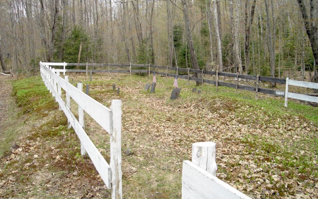
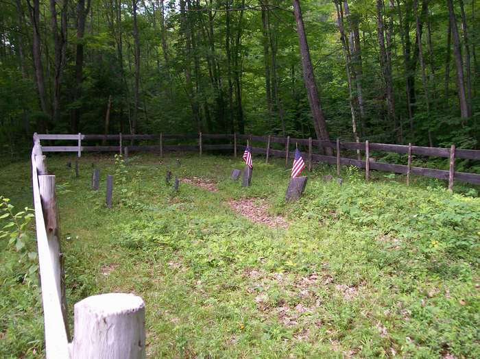
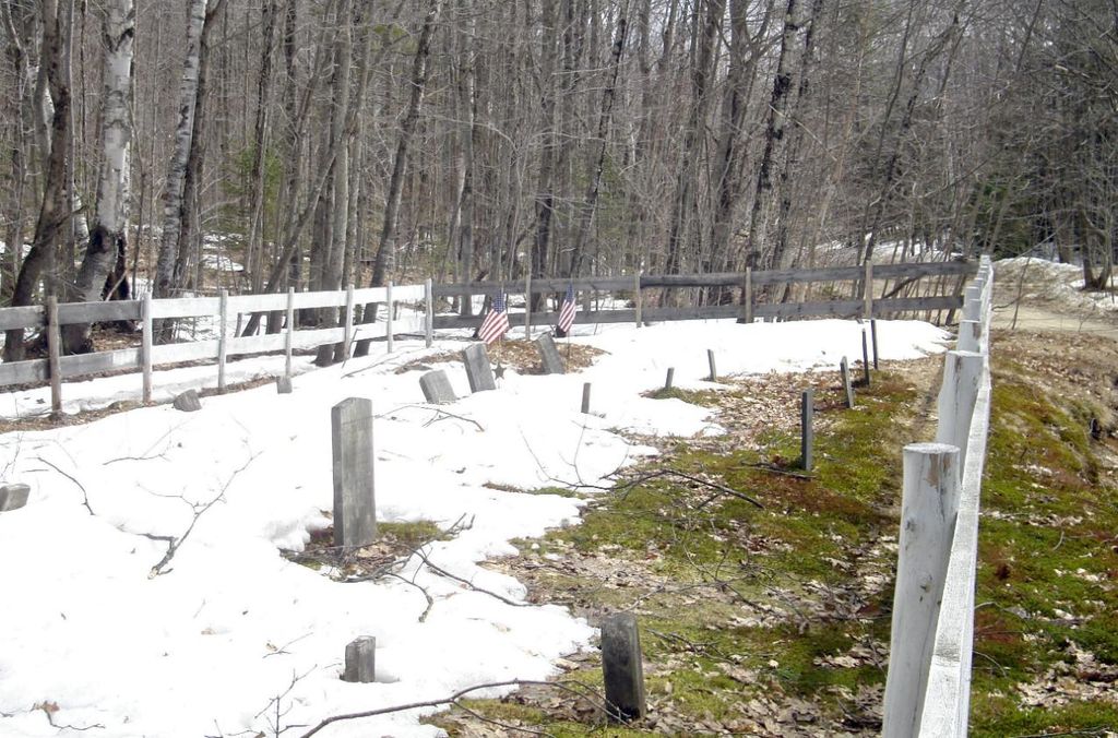
| Description | : | Riley Plantation, also known as Ketchum, no longer has any permanent residents within its borders. This small cemetery is located on the right side of the Sunday River Road, enclosed by a white fence. There are several field stones marking graves. |
frequently asked questions (FAQ):
-
Where is Ketchum Cemetery?
Ketchum Cemetery is located at Ketchum, Oxford County ,Maine ,USA.
-
Ketchum Cemetery cemetery's updated grave count on graveviews.com?
0 memorials
-
Where are the coordinates of the Ketchum Cemetery?
Latitude: 44.5026880
Longitude: -70.9135670
Nearby Cemetories:
1. Sunday River Cemetery
Newry, Oxford County, USA
Coordinate: 44.4888992, -70.8431015
2. Old Powers Cemetery
Newry, Oxford County, USA
Coordinate: 44.5031013, -70.8178024
3. Head of Tide Cemetery
Newry, Oxford County, USA
Coordinate: 44.5682424, -70.8634963
4. Mount Will Cemetery
North Bethel, Oxford County, USA
Coordinate: 44.4636002, -70.8028030
5. Black Family Cemetery
Newry, Oxford County, USA
Coordinate: 44.4889670, -70.7895730
6. Chapman Cemetery
Gilead, Oxford County, USA
Coordinate: 44.4114100, -70.9024900
7. Middle Intervale Cemetery
Bethel, Oxford County, USA
Coordinate: 44.4638600, -70.7866200
8. Pine Grove Cemetery
West Bethel, Oxford County, USA
Coordinate: 44.4055600, -70.8563100
9. Peabody Cemetery
Gilead, Oxford County, USA
Coordinate: 44.3987885, -70.9400635
10. Capen Family Cemetery
Bethel, Oxford County, USA
Coordinate: 44.4382283, -70.7925117
11. Riverside Cemetery
Bethel, Oxford County, USA
Coordinate: 44.4202995, -70.8058014
12. Skillingston Cemetery
Bethel, Oxford County, USA
Coordinate: 44.4085999, -70.8197021
13. Bartlett Cemetery
East Bethel, Oxford County, USA
Coordinate: 44.4817009, -70.7433014
14. Tallyrand G. Lary Cemetery
Gilead, Oxford County, USA
Coordinate: 44.3960800, -71.0117670
15. Hanover Cemetery
Hanover, Oxford County, USA
Coordinate: 44.4850006, -70.7332993
16. Austin Cemetery
Shelburne, Coos County, USA
Coordinate: 44.3999786, -71.0285339
17. Wheeler Cemetery
Shelburne, Coos County, USA
Coordinate: 44.4011500, -71.0370100
18. Flat Cemetery
West Bethel, Oxford County, USA
Coordinate: 44.3731003, -70.8497009
19. Scribner Hill Cemetery Upper Yard
Otisfield, Oxford County, USA
Coordinate: 44.3903181, -70.7978794
20. Chandler Hill Cemetery
Bethel, Oxford County, USA
Coordinate: 44.4392014, -70.7394028
21. Woodland Cemetery
Bethel, Oxford County, USA
Coordinate: 44.3902283, -70.7967911
22. Burbank Cemetery
Shelburne, Coos County, USA
Coordinate: 44.3907300, -71.0321800
23. East Bethel Cemetery
East Bethel, Oxford County, USA
Coordinate: 44.4648500, -70.7210200
24. Grafton Cemetery
Oxford County, USA
Coordinate: 44.6448686, -70.9562422