
| Memorials | : | 0 |
| Location | : | Newry, Oxford County, USA |
| Coordinate | : | 44.4889670, -70.7895730 |
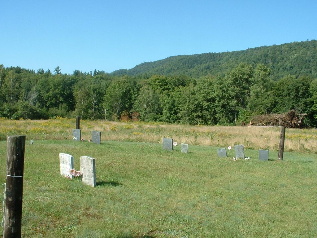
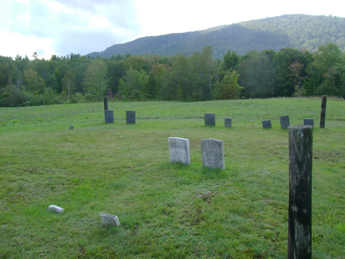
| Description | : | This cemetery is located on Rte 26 (Bear River Rd) not to far from the intersection of Rte 2 & 26 in Newry Maine. At the time the gravestone photos were taken in 2011 there was not sign present at this small cemetery. According to the Newry Town Office the cemetery is known as the "Black Family Cemetery". Other sources refer to it as "Smith Cemetery" This is a small "family" cemetery with only 10 visible gravestones present. Surnames found are "Black" and "Smith". |
frequently asked questions (FAQ):
-
Where is Black Family Cemetery?
Black Family Cemetery is located at Newry, Oxford County ,Maine ,USA.
-
Black Family Cemetery cemetery's updated grave count on graveviews.com?
0 memorials
-
Where are the coordinates of the Black Family Cemetery?
Latitude: 44.4889670
Longitude: -70.7895730
Nearby Cemetories:
1. Old Powers Cemetery
Newry, Oxford County, USA
Coordinate: 44.5031013, -70.8178024
2. Middle Intervale Cemetery
Bethel, Oxford County, USA
Coordinate: 44.4638600, -70.7866200
3. Mount Will Cemetery
North Bethel, Oxford County, USA
Coordinate: 44.4636002, -70.8028030
4. Bartlett Cemetery
East Bethel, Oxford County, USA
Coordinate: 44.4817009, -70.7433014
5. Sunday River Cemetery
Newry, Oxford County, USA
Coordinate: 44.4888992, -70.8431015
6. Hanover Cemetery
Hanover, Oxford County, USA
Coordinate: 44.4850006, -70.7332993
7. Capen Family Cemetery
Bethel, Oxford County, USA
Coordinate: 44.4382283, -70.7925117
8. East Bethel Cemetery
East Bethel, Oxford County, USA
Coordinate: 44.4648500, -70.7210200
9. Chandler Hill Cemetery
Bethel, Oxford County, USA
Coordinate: 44.4392014, -70.7394028
10. Riverside Cemetery
Bethel, Oxford County, USA
Coordinate: 44.4202995, -70.8058014
11. Rumford Corner Cemetery
Rumford Corner, Oxford County, USA
Coordinate: 44.4955200, -70.6762500
12. South Bethel Cemetery
Bethel, Oxford County, USA
Coordinate: 44.4160995, -70.7363968
13. Skillingston Cemetery
Bethel, Oxford County, USA
Coordinate: 44.4085999, -70.8197021
14. Rumford Point Cemetery
Rumford Point, Oxford County, USA
Coordinate: 44.5020760, -70.6725600
15. Upper West Ellis Cemetery
Rumford, Oxford County, USA
Coordinate: 44.5456009, -70.6941986
16. Ketchum Cemetery
Ketchum, Oxford County, USA
Coordinate: 44.5026880, -70.9135670
17. West Ellis Cemetery
Rumford, Oxford County, USA
Coordinate: 44.5372009, -70.6832962
18. Bird Hill Cemetery
Bethel, Oxford County, USA
Coordinate: 44.4234140, -70.6961680
19. Head of Tide Cemetery
Newry, Oxford County, USA
Coordinate: 44.5682424, -70.8634963
20. Pine Grove Cemetery
West Bethel, Oxford County, USA
Coordinate: 44.4055600, -70.8563100
21. East Ellis Cemetery
Rumford, Oxford County, USA
Coordinate: 44.5331001, -70.6669006
22. Scribner Hill Cemetery Upper Yard
Otisfield, Oxford County, USA
Coordinate: 44.3903181, -70.7978794
23. Woodland Cemetery
Bethel, Oxford County, USA
Coordinate: 44.3902283, -70.7967911
24. Mount Abram Cemetery
Greenwood, Oxford County, USA
Coordinate: 44.4025002, -70.7078018