
| Memorials | : | 81 |
| Location | : | Cherry County, USA |
| Coordinate | : | 42.9332020, -100.3366500 |
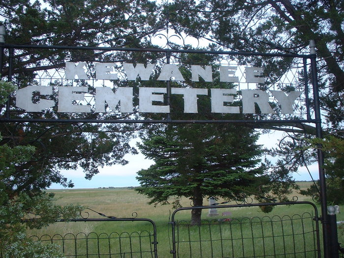
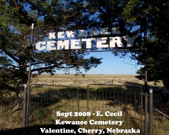
| Description | : | Kewanee Cemetery is located 14 miles northeast of Valentine south of highway 12 (Section 12, Twsp 34, Range 26). The cemetery was originally called Pleasant Prairie Cemetery. The land was deeded by Ervine and Frances Bristol October 1889. The name change occurred in 1916. The first know burial is that of Jessie Johnston October 9, 1886. Joshua A.Hitt is recorded as donating land for a cemetery in the Democratic Blade in December 1885, but his patent was for section 10. |
frequently asked questions (FAQ):
-
Where is Kewanee Cemetery?
Kewanee Cemetery is located at Cherry County ,Nebraska ,USA.
-
Kewanee Cemetery cemetery's updated grave count on graveviews.com?
5 memorials
-
Where are the coordinates of the Kewanee Cemetery?
Latitude: 42.9332020
Longitude: -100.3366500
Nearby Cemetories:
1. Saint Joseph Cemetery
Kewanee, Cherry County, USA
Coordinate: 42.9700000, -100.3373500
2. Sparks Cemetery
Sparks, Cherry County, USA
Coordinate: 42.9399986, -100.2463989
3. Fort Niobrara Post Cemetery
Valentine, Cherry County, USA
Coordinate: 42.8885630, -100.4779260
4. Mount Hope Cemetery
Valentine, Cherry County, USA
Coordinate: 42.8669014, -100.5350037
5. Taylor Cemetery
Thatcher, Cherry County, USA
Coordinate: 42.8131000, -100.4832500
6. Richland Harmony Cemetery
Valentine, Cherry County, USA
Coordinate: 42.9763985, -100.5736008
7. Minnechaduza Cemetery
Valentine, Cherry County, USA
Coordinate: 42.8731003, -100.5674973
8. Norden Cemetery
Norden, Keya Paha County, USA
Coordinate: 42.8685837, -100.0950851
9. Norden West Cemetery
Keya Paha County, USA
Coordinate: 42.8685989, -100.0947037
10. Linden Pioneer Cemetery
Tripp County, USA
Coordinate: 43.0607986, -100.1258011
11. Pleasant Dale Cemetery
Keya Paha County, USA
Coordinate: 42.8494000, -100.0608000
12. Lost Creek Cemetery
Keya Paha County, USA
Coordinate: 42.9486008, -99.9646988
13. Saint Agnes Cemetery
Todd County, USA
Coordinate: 43.0372009, -100.6952972
14. Carroll Cemetery
Olsonville, Todd County, USA
Coordinate: 43.1371300, -100.6085100
15. Crookston Cemetery
Cherry County, USA
Coordinate: 42.9267970, -100.7313580
16. Mount Hope Cemetery
Wood Lake, Cherry County, USA
Coordinate: 42.6372920, -100.2330200
17. Jerusalem Cemetery
Tripp County, USA
Coordinate: 43.2341995, -100.1856003
18. Lakeview Cemetery
Todd County, USA
Coordinate: 43.0746994, -100.7300034
19. Sacred Heart Catholic Cemetery
Lakeview, Todd County, USA
Coordinate: 43.0750000, -100.7302500
20. Ascension Chapel Cemetery
Tripp County, USA
Coordinate: 43.0656400, -99.9211800
21. Union Cemetery
Keya Paha County, USA
Coordinate: 42.8091780, -99.9043730
22. Saint Boniface Catholic Cemetery
Clearfield, Tripp County, USA
Coordinate: 43.2130000, -100.0450000
23. Simeon Cemetery
Cherry County, USA
Coordinate: 42.6704000, -100.6629000
24. Pure Water Cemetery
Todd County, USA
Coordinate: 43.0889015, -100.7844009