| Memorials | : | 0 |
| Location | : | Waakirchen, Landkreis Miesbach, Germany |
| Phone | : | +49 8021 246 |
| Website | : | www.st-martin-waakirchen.de/ |
| Coordinate | : | 47.7726760, 11.6732527 |
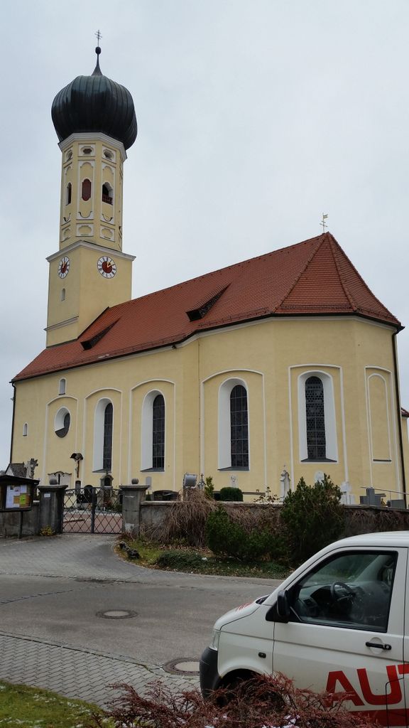
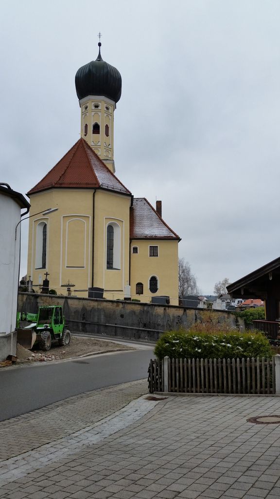
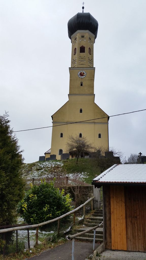
| Description | : | Theold cemetery is around the church St. Martin, which was rebuild in 1739 after a fire destroyed the former church. In Waakirchen a new, second cemetery was opened to cope with the increased number of inhabitants. |
frequently asked questions (FAQ):
-
Where is Kirchfriedhof St. Martin?
Kirchfriedhof St. Martin is located at Schmied-Balthes-Straße 10 Waakirchen, Landkreis Miesbach ,Bavaria (Bayern) , 83666Germany.
-
Kirchfriedhof St. Martin cemetery's updated grave count on graveviews.com?
0 memorials
-
Where are the coordinates of the Kirchfriedhof St. Martin?
Latitude: 47.7726760
Longitude: 11.6732527
Nearby Cemetories:
1. Durnbach War Cemetery
Gmund am Tegernsee, Landkreis Miesbach, Germany
Coordinate: 47.7783790, 11.7335110
2. Kriegsgräberstätte Gmund am Tegernsee
Gmund am Tegernsee, Landkreis Miesbach, Germany
Coordinate: 47.7513710, 11.7290570
3. Alter Friedhof Gmund am Tegernsee
Gmund am Tegernsee, Landkreis Miesbach, Germany
Coordinate: 47.7501770, 11.7398275
4. Neuer Friedhof Gmund am Tegernsee
Gmund am Tegernsee, Landkreis Miesbach, Germany
Coordinate: 47.7510164, 11.7407799
5. Bergfriedhof Gmund am Tegernsee
Gmund am Tegernsee, Landkreis Miesbach, Germany
Coordinate: 47.7502260, 11.7439660
6. Kath. Filialkirche St. Peter und Paul
Kirchbichl, Landkreis Bad Tölz-Wolfratshausen, Germany
Coordinate: 47.7987544, 11.5745742
7. Bergfriedhof Bad Wiessee
Bad Wiessee, Landkreis Miesbach, Germany
Coordinate: 47.7049000, 11.7255420
8. Waldfriedhof Bad Tölz
Bad Tölz, Landkreis Bad Tölz-Wolfratshausen, Germany
Coordinate: 47.7708950, 11.5556220
9. Friedhof Tegernsee
Tegernsee, Landkreis Miesbach, Germany
Coordinate: 47.7091410, 11.7561650
10. Sankt Quirinus Kirche Tegernsee
Tegernsee, Landkreis Miesbach, Germany
Coordinate: 47.7074580, 11.7567920
11. Kath. Pfarrkirche St. Nikolaus
Wackersberg, Landkreis Bad Tölz-Wolfratshausen, Germany
Coordinate: 47.7356180, 11.5465876
12. Sankt Laurentius Friedhof
Rottach-Egern, Landkreis Miesbach, Germany
Coordinate: 47.6953150, 11.7619340
13. Auferstehungskirche Friedhof
Rottach-Egern, Landkreis Miesbach, Germany
Coordinate: 47.6934620, 11.7622380
14. Holzkirchen Neuer Friedhof
Holzkirchen, Landkreis Miesbach, Germany
Coordinate: 47.8724362, 11.7013965
15. Waldfriedhof
Miesbach, Landkreis Miesbach, Germany
Coordinate: 47.7916641, 11.8256664
16. Gemeindeverwaltung Friedhof
Hausham, Landkreis Miesbach, Germany
Coordinate: 47.7575700, 11.8284000
17. Ringbergfriedhof
Kreuth, Landkreis Miesbach, Germany
Coordinate: 47.6754170, 11.7550140
18. Friedhof Weyarn
Weyarn, Landkreis Miesbach, Germany
Coordinate: 47.8590090, 11.7976060
19. Friedhof Schliersee
Schliersee, Landkreis Miesbach, Germany
Coordinate: 47.7369860, 11.8546390
20. Kirchfriedhof St. Sixtus
Schliersee, Landkreis Miesbach, Germany
Coordinate: 47.7333276, 11.8648793
21. Friedhof Otterfing
Otterfing, Landkreis Miesbach, Germany
Coordinate: 47.9113789, 11.6747466
22. Stadtfriedhof Bad Heilbrunn
Bad Heilbrunn, Landkreis Bad Tölz-Wolfratshausen, Germany
Coordinate: 47.7502280, 11.4623770
23. Waldfriedhof Geretsried
Geretsried, Landkreis Bad Tölz-Wolfratshausen, Germany
Coordinate: 47.8622840, 11.4826080
24. Friedhof Ascholding
Dietramszell, Landkreis Bad Tölz-Wolfratshausen, Germany
Coordinate: 47.8879632, 11.5045720

