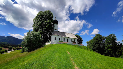
| Memorials | : | 0 |
| Location | : | Bad Heilbrunn, Landkreis Bad Tölz-Wolfratshausen, Germany |
| Coordinate | : | 47.7502280, 11.4623770 |
frequently asked questions (FAQ):
-
Where is Stadtfriedhof Bad Heilbrunn?
Stadtfriedhof Bad Heilbrunn is located at Wörnerweg Bad Heilbrunn, Landkreis Bad Tölz-Wolfratshausen ,Bavaria (Bayern) , 83670Germany.
-
Stadtfriedhof Bad Heilbrunn cemetery's updated grave count on graveviews.com?
0 memorials
-
Where are the coordinates of the Stadtfriedhof Bad Heilbrunn?
Latitude: 47.7502280
Longitude: 11.4623770
Nearby Cemetories:
1. Kath. Pfarrkirche St. Nikolaus
Wackersberg, Landkreis Bad Tölz-Wolfratshausen, Germany
Coordinate: 47.7356180, 11.5465876
2. Friedhof Penzberg
Penzberg, Landkreis Weilheim-Schongau, Germany
Coordinate: 47.7576200, 11.3696900
3. Waldfriedhof Bad Tölz
Bad Tölz, Landkreis Bad Tölz-Wolfratshausen, Germany
Coordinate: 47.7708950, 11.5556220
4. Friedhof Beuerberg
Beuerberg, Landkreis Bad Tölz-Wolfratshausen, Germany
Coordinate: 47.8275684, 11.4142709
5. Kath. Filialkirche St. Peter und Paul
Kirchbichl, Landkreis Bad Tölz-Wolfratshausen, Germany
Coordinate: 47.7987544, 11.5745742
6. Friedhof Antdorf
Antdorf, Landkreis Weilheim-Schongau, Germany
Coordinate: 47.7509894, 11.3069886
7. friedhof kochel
Ort, Landkreis Bad Tölz-Wolfratshausen, Germany
Coordinate: 47.6601000, 11.3653900
8. St. Heinrich am Starnberger See
Eurasburg, Landkreis Bad Tölz-Wolfratshausen, Germany
Coordinate: 47.8249112, 11.3382042
9. Friedhof of Kochel am See
Kochel am See, Landkreis Bad Tölz-Wolfratshausen, Germany
Coordinate: 47.6591860, 11.3654020
10. Waldfriedhof Geretsried
Geretsried, Landkreis Bad Tölz-Wolfratshausen, Germany
Coordinate: 47.8622840, 11.4826080
11. Gemeindefriedhof Seeshaupt
Seeshaupt, Landkreis Weilheim-Schongau, Germany
Coordinate: 47.8261940, 11.2893100
12. Friedhof Ascholding
Dietramszell, Landkreis Bad Tölz-Wolfratshausen, Germany
Coordinate: 47.8879632, 11.5045720
13. Kirchfriedhof St. Martin
Waakirchen, Landkreis Miesbach, Germany
Coordinate: 47.7726760, 11.6732527
14. Friedhof Bernried
Bernried, Landkreis Weilheim-Schongau, Germany
Coordinate: 47.8661700, 11.2948530
15. Neuer Friedhof Münsing
Münsing, Landkreis Bad Tölz-Wolfratshausen, Germany
Coordinate: 47.9016105, 11.3668153
16. Friedhof Nantwein
Wolfratshausen, Landkreis Bad Tölz-Wolfratshausen, Germany
Coordinate: 47.9148931, 11.4345117
17. Kirchhof Mariä Himmelfahrt
Münsing, Landkreis Bad Tölz-Wolfratshausen, Germany
Coordinate: 47.9033796, 11.3669874
18. Friedhof Untersöchering
Untersochering, Landkreis Weilheim-Schongau, Germany
Coordinate: 47.7430952, 11.2065270
19. Hohenried Cemetery
Bernried, Landkreis Weilheim-Schongau, Germany
Coordinate: 47.8770865, 11.2854587
20. Kirchfriedhof St. Martin
Egling, Landkreis Bad Tölz-Wolfratshausen, Germany
Coordinate: 47.9231273, 11.5082707
21. Kriegsgräberstätte Gmund am Tegernsee
Gmund am Tegernsee, Landkreis Miesbach, Germany
Coordinate: 47.7513710, 11.7290570
22. Bergfriedhof Bad Wiessee
Bad Wiessee, Landkreis Miesbach, Germany
Coordinate: 47.7049000, 11.7255420
23. Durnbach War Cemetery
Gmund am Tegernsee, Landkreis Miesbach, Germany
Coordinate: 47.7783790, 11.7335110
24. Dorfkirche Herz Jesu Höhenrain
Berg, Landkreis Starnberg, Germany
Coordinate: 47.9313000, 11.3964730

