
| Memorials | : | 2 |
| Location | : | McNairy County, USA |
| Coordinate | : | 35.0711790, -88.7573040 |
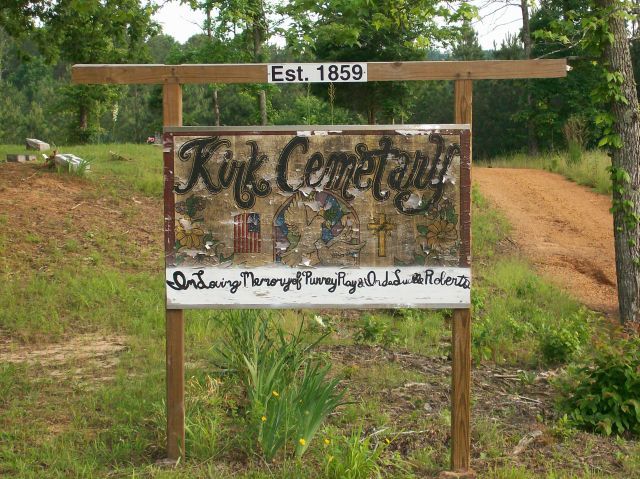
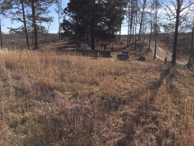
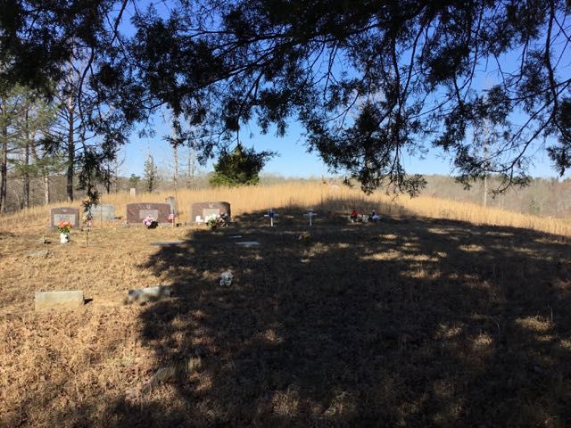
| Description | : | From the intersection of Kirk Cemetery Lane & TN-57, 3.2 mi. east of Pocahontas, travel north on Kirk Cemetery Ln, for 0.5 mi. to the cemetery at the end of the lane. There are probably 100 unidentified graves here, marked with sandstone rocks and funeral home markers, that can no longer be read. According to Robert Lee, Polly Berryman Kirk, age 108, wife of Allen Kirk, is buried here in an unmarked grave. The spot is now surrounded by pines owned by WestVaco, but at one time this was a nice little community with a Church and School. |
frequently asked questions (FAQ):
-
Where is Kirk Cemetery?
Kirk Cemetery is located at Kirk Cemetery Lane McNairy County ,Tennessee ,USA.
-
Kirk Cemetery cemetery's updated grave count on graveviews.com?
2 memorials
-
Where are the coordinates of the Kirk Cemetery?
Latitude: 35.0711790
Longitude: -88.7573040
Nearby Cemetories:
1. Morphis Cemetery
McNairy County, USA
Coordinate: 35.0701720, -88.7510980
2. Ingram Cemetery
McNairy County, USA
Coordinate: 35.0726900, -88.7818800
3. Head Family Cemetery
McNairy County, USA
Coordinate: 35.0741640, -88.7324250
4. McCrary Cemetery
McNairy County, USA
Coordinate: 35.0773000, -88.7829000
5. Union Soldiers Grave
McNairy County, USA
Coordinate: 35.0752240, -88.7241290
6. Coleman Cemetery
Pocahontas, Hardeman County, USA
Coordinate: 35.0626810, -88.7897690
7. Eureka Cemetery
McNairy County, USA
Coordinate: 35.0994240, -88.7724050
8. Eureka Cemetery
Pocahontas, Hardeman County, USA
Coordinate: 35.0994920, -88.7723770
9. Mathis Cemetery
McNairy County, USA
Coordinate: 35.0414009, -88.7769012
10. Gooch Cemetery
McNairy County, USA
Coordinate: 35.1086006, -88.7585983
11. Wooten Cemetery
McNairy County, USA
Coordinate: 35.0291180, -88.7443210
12. Deming Cemetery
Ramer, McNairy County, USA
Coordinate: 35.0524840, -88.7075520
13. Moore Cemetery
Pocahontas, Hardeman County, USA
Coordinate: 35.0409830, -88.8116050
14. Davis Bridge Battlefield Cemetery
Pocahontas, Hardeman County, USA
Coordinate: 35.0279380, -88.7972870
15. Nethery Cemetery
Ramer, McNairy County, USA
Coordinate: 35.0978012, -88.6964035
16. Carr Family Cemetery
Ramer, McNairy County, USA
Coordinate: 35.0963230, -88.6921770
17. White Oak Cemetery
Ramer, McNairy County, USA
Coordinate: 35.0562340, -88.6859940
18. Coleman Cemetery
Ramer, McNairy County, USA
Coordinate: 35.0943370, -88.6874210
19. Bethel Cemetery
Pocahontas, Hardeman County, USA
Coordinate: 35.0317900, -88.8244720
20. Essary Springs Cemetery
Pocahontas, Hardeman County, USA
Coordinate: 35.0122620, -88.8036620
21. Lock Family Cemetery
Selmer, McNairy County, USA
Coordinate: 35.1313100, -88.7128930
22. Antioch Cemetery
Ramer, McNairy County, USA
Coordinate: 35.0693180, -88.6705420
23. Powell Chapel Cemetery
Middleton, Hardeman County, USA
Coordinate: 35.1302820, -88.8113800
24. Chapel Hill Baptist Church Cemetery
McNairy County, USA
Coordinate: 35.1456090, -88.7599310