
| Memorials | : | 16 |
| Location | : | Linden, San Joaquin County, USA |
| Coordinate | : | 38.0799700, -120.9508900 |
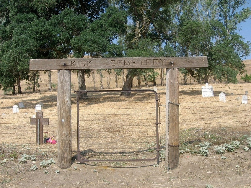
| Description | : | The Kirk Family Cemetery is located about six miles east of Bellota and about a mile south of Hwy 26 on Wimer Road on the Kirk Land Grant. John William Kirk came from Giles County, Virginia in 1847 then returned to Virginia. Then in 1852 he brought his family to California. Four Kirk slaves were given their freedom in Virginia, but they chose to come to California with the family, so they came as free men, with the wagon train. They are buried in the family plot above the family section, and the graves are marked with iron stakes. The... Read More |
frequently asked questions (FAQ):
-
Where is Kirk Family Cemetery?
Kirk Family Cemetery is located at Wimer Road Linden, San Joaquin County ,California ,USA.
-
Kirk Family Cemetery cemetery's updated grave count on graveviews.com?
16 memorials
-
Where are the coordinates of the Kirk Family Cemetery?
Latitude: 38.0799700
Longitude: -120.9508900
Nearby Cemetories:
1. Jenny Lind IOOF Cemetery
Jenny Lind, Calaveras County, USA
Coordinate: 38.0990880, -120.8716360
2. Milton Masonic Cemetery
Milton, Calaveras County, USA
Coordinate: 38.0308189, -120.8498230
3. Linden Cemetery
Linden, San Joaquin County, USA
Coordinate: 38.0226707, -121.0889053
4. Dean Family Cemetery
Copperopolis, Calaveras County, USA
Coordinate: 38.0575050, -120.7747760
5. Campo Seco Catholic Cemetery
Campo Seco, Calaveras County, USA
Coordinate: 38.2223740, -120.8579460
6. Highland View Memorial Gardens
Farmington, San Joaquin County, USA
Coordinate: 37.9242935, -121.0008621
7. Old Brooks Farm Cemetery
Farmington, San Joaquin County, USA
Coordinate: 37.9175800, -120.9440300
8. Glen View Cemetery
Clements, San Joaquin County, USA
Coordinate: 38.2022018, -121.0883026
9. Campo Seco Protestant Cemetery
Campo Seco, Calaveras County, USA
Coordinate: 38.2258880, -120.8569960
10. Old Mackville Cemetery
Clements, San Joaquin County, USA
Coordinate: 38.2143200, -121.0968300
11. Saint Joachim Catholic Cemetery
Lockeford, San Joaquin County, USA
Coordinate: 38.1478400, -121.1752500
12. Harmony Grove Cemetery
Lockeford, San Joaquin County, USA
Coordinate: 38.1478004, -121.1755981
13. Locke Cemetery
Lockeford, San Joaquin County, USA
Coordinate: 38.1758003, -121.1616974
14. Double Springs Cemetery
Valley Springs, Calaveras County, USA
Coordinate: 38.2126930, -120.7712460
15. Buena Vista Rancheria Indian Cemetery
Ione, Amador County, USA
Coordinate: 38.2731600, -120.9107900
16. Saint Joseph Cemetery
Eugene, Stanislaus County, USA
Coordinate: 37.8941994, -120.8696976
17. Beardslee Family Cemetery
Telegraph City, Calaveras County, USA
Coordinate: 37.9423190, -120.7265960
18. Telegraph City Cemetery
Telegraph City, Calaveras County, USA
Coordinate: 37.9290460, -120.7302490
19. Pioneer Cemetery
San Andreas, Calaveras County, USA
Coordinate: 38.2085660, -120.7078710
20. Fairbanks Ranch Cemetery
San Joaquin County, USA
Coordinate: 38.2310250, -121.1725170
21. Collegeville Cemetery
Collegeville, San Joaquin County, USA
Coordinate: 37.9044800, -121.1466141
22. Golden Gate Ranch Family Cemetery
Mokelumne Hill, Calaveras County, USA
Coordinate: 38.2542500, -120.7518800
23. Elliott Cemetery
San Joaquin County, USA
Coordinate: 38.2341995, -121.1761017
24. Lodi Memorial Park and Cemetery
Lodi, San Joaquin County, USA
Coordinate: 38.1319008, -121.2455978