
| Memorials | : | 0 |
| Location | : | Grossheubach, Landkreis Miltenberg, Germany |
| Coordinate | : | 49.7238890, 9.2319440 |
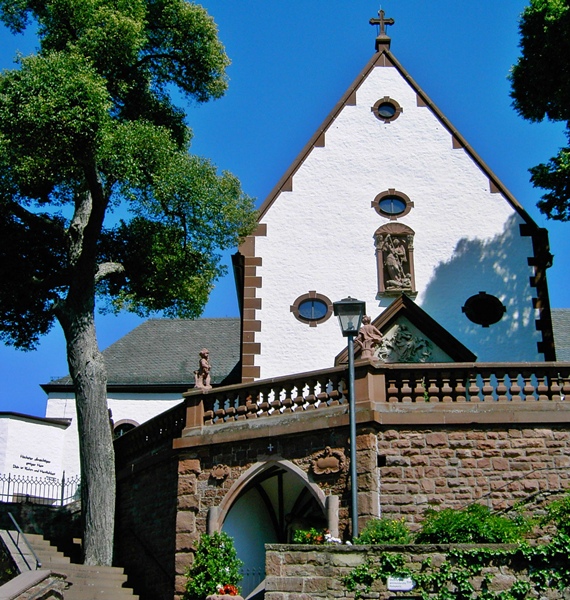
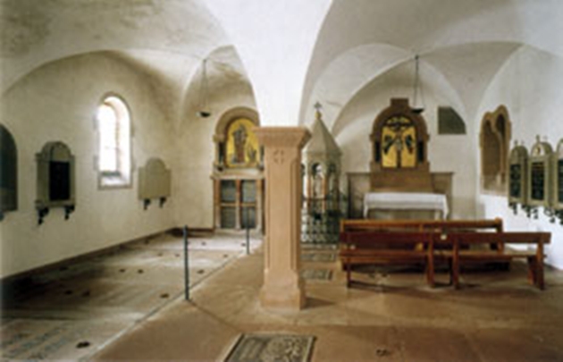
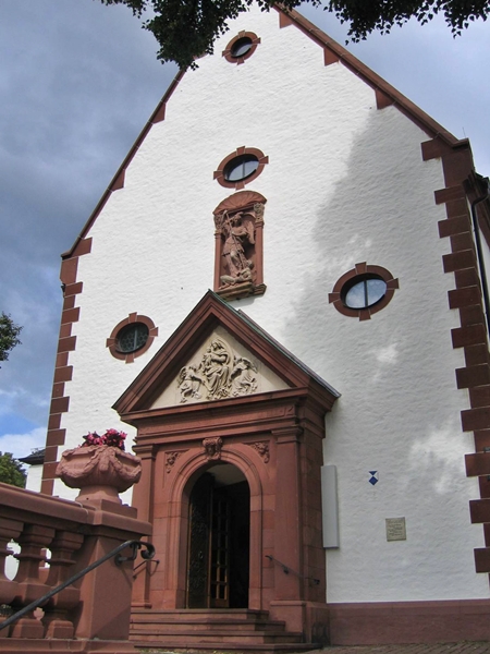
| Description | : | Built in the 17th century on a hill high above the village of Grossheubach it was orignally a Capucine monastery. In 1828 the Friars of the Franciscan Order took over the monastery. Since 1728 nobles of the House of Löwenstein-Wertheim-Rosenberg are buried in the royal crypt underneath the church. Please note that this family's noble pre-fix is "zu", not "von". The monastery is part of the diocese of Würzburg in Bavaria, Germany. |
frequently asked questions (FAQ):
-
Where is Kloster Engelberg in Grossheubach?
Kloster Engelberg in Grossheubach is located at Grossheubach, Landkreis Miltenberg ,Bavaria (Bayern) ,Germany.
-
Kloster Engelberg in Grossheubach cemetery's updated grave count on graveviews.com?
0 memorials
-
Where are the coordinates of the Kloster Engelberg in Grossheubach?
Latitude: 49.7238890
Longitude: 9.2319440
Nearby Cemetories:
1. Old Jewish Cemetery
Miltenberg, Landkreis Miltenberg, Germany
Coordinate: 49.7045200, 9.2672500
2. Friedhof Laudenbach
Laudenbach, Landkreis Miltenberg, Germany
Coordinate: 49.7421300, 9.1783800
3. Friedhof Mönchberg
Mönchberg, Landkreis Miltenberg, Germany
Coordinate: 49.7831300, 9.2387600
4. Friedhof Klingenberg am Main
Klingenberg am Main, Landkreis Miltenberg, Germany
Coordinate: 49.7769190, 9.1847170
5. Friedhof Amorbach-Reichartshausen
Amorbach, Landkreis Miltenberg, Germany
Coordinate: 49.6584208, 9.2804977
6. Jüdischer Friedhof Bad König
Bad König, Odenwaldkreis, Germany
Coordinate: 49.7449500, 9.3471000
7. Friedhof Vielbrunn
Vielbrunn, Odenwaldkreis, Germany
Coordinate: 49.7097000, 9.0977200
8. Friedhof Wörth am Main
Wörth am Main, Landkreis Miltenberg, Germany
Coordinate: 49.7987430, 9.1496900
9. Friedhofskapelle Wörth-am-Main
Wörth am Main, Landkreis Miltenberg, Germany
Coordinate: 49.7988600, 9.1496200
10. Friedhof Seckmauern
Seckmauern, Odenwaldkreis, Germany
Coordinate: 49.7909100, 9.1214000
11. Kloster Himmelthal
Elsenfeld, Landkreis Miltenberg, Germany
Coordinate: 49.8222220, 9.2194440
12. Eschau Village Cemetery
Eschau, Landkreis Miltenberg, Germany
Coordinate: 49.8230600, 9.2515600
13. Friedhof Buch
Kirchzell, Landkreis Miltenberg, Germany
Coordinate: 49.6143390, 9.2001860
14. Friedhof Watterbach
Watterbach, Landkreis Miltenberg, Germany
Coordinate: 49.6271500, 9.1341200
15. Hobbach Cemetery
Hobbach, Landkreis Miltenberg, Germany
Coordinate: 49.8482420, 9.2795480
16. Friedhof Elsenfeld
Elsenfeld, Landkreis Miltenberg, Germany
Coordinate: 49.8460840, 9.1655170
17. Dammbach Privatfriedhof Rexroth
Dammbach, Landkreis Aschaffenburg, Germany
Coordinate: 49.8303670, 9.3553300
18. Sonderriet Friedhof
Sonderriet, Main-Tauber-Kreis, Germany
Coordinate: 49.7189840, 9.4390620
19. Friedhof Breitenbuch
Kirchzell, Landkreis Miltenberg, Germany
Coordinate: 49.6178530, 9.1044980
20. RuheForst Südspessart Stadtprozelten
Stadtprozelten, Landkreis Miltenberg, Germany
Coordinate: 49.7870383, 9.4156397
21. Friedhof Bad König
Bad König, Odenwaldkreis, Germany
Coordinate: 49.7409140, 9.0155950
22. Nassig Friedhof
Nassig, Main-Tauber-Kreis, Germany
Coordinate: 49.7378280, 9.4496690
23. Jüdischer Friedhof
Michelstadt, Odenwaldkreis, Germany
Coordinate: 49.6859609, 9.0190250
24. Friedhof Michelstadt
Michelstadt, Odenwaldkreis, Germany
Coordinate: 49.6724268, 9.0167040