
| Memorials | : | 0 |
| Location | : | Zeltingen-Rachtig, Landkreis Bernkastel-Wittlich, Germany |
| Coordinate | : | 49.9548540, 7.0015740 |
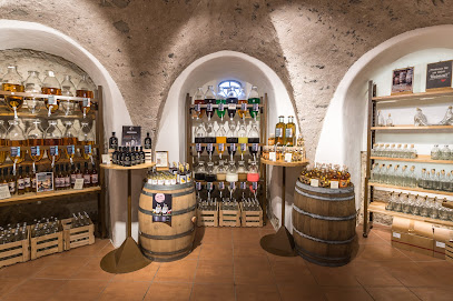
| Description | : | The Abbey is a former monastery opposite the village Zeltingen-Rachtig, on the left bank of the Moselle. The property is located on the area of Bernkastel-Kues five kilometres northwest of the city. It was founded in the 13th century, until its secularization by the French Government in 1802. Then used, its Baroque buildings gradually decayed before they were subjected from 1970 renovation and restoration work. Today, the monastery is a well-known tourist destination on the Middle Moselle, with monastic brewery and Brewery, wine cellar and a museum. |
frequently asked questions (FAQ):
-
Where is Kloster Machern?
Kloster Machern is located at Zeltingen-Rachtig, Landkreis Bernkastel-Wittlich ,Rheinland-Pfalz ,Germany.
-
Kloster Machern cemetery's updated grave count on graveviews.com?
0 memorials
-
Where are the coordinates of the Kloster Machern?
Latitude: 49.9548540
Longitude: 7.0015740
Nearby Cemetories:
1. Wehlen-Mosel Cemetery
Wehlen, Landkreis Bernkastel-Wittlich, Germany
Coordinate: 49.9409111, 7.0407942
2. Friedhof Altrich
Altrich, Landkreis Bernkastel-Wittlich, Germany
Coordinate: 49.9576748, 6.9120208
3. St Michael's Kirche
Landkreis Bernkastel-Wittlich, Germany
Coordinate: 49.9161110, 7.0694440
4. Sankt Nikolaus Hospital
Bernkastel-Kues, Landkreis Bernkastel-Wittlich, Germany
Coordinate: 49.9158500, 7.0715400
5. Jüdischer Friedhof Bernkastel-Kues
Bernkastel-Kues, Landkreis Bernkastel-Wittlich, Germany
Coordinate: 49.9143000, 7.0698400
6. Friedhof Klausen
Klausen, Landkreis Bernkastel-Wittlich, Germany
Coordinate: 49.9040500, 6.8833800
7. Friedhof
Irmenach, Landkreis Bernkastel-Wittlich, Germany
Coordinate: 49.9216982, 7.1886770
8. Friedhof Rivenich
Rivenich, Landkreis Bernkastel-Wittlich, Germany
Coordinate: 49.8790096, 6.8451474
9. St Jakobus Cemetery
Kaimt, Landkreis Cochem-Zell, Germany
Coordinate: 50.0249600, 7.1770120
10. Friedhof Landscheid
Landscheid, Landkreis Bernkastel-Wittlich, Germany
Coordinate: 49.9867014, 6.7736202
11. Friedhof Heidenburg
Heidenburg, Landkreis Bernkastel-Wittlich, Germany
Coordinate: 49.8001607, 6.9184775
12. Friedhof Niederkail
Niederkail, Landkreis Bernkastel-Wittlich, Germany
Coordinate: 49.9743502, 6.7408463
13. Hahn-Hunsrück
Hahn, Rhein-Hunsrück-Kreis, Germany
Coordinate: 49.9638100, 7.2712330
14. Wurrich Friedhof
Wurrich, Rhein-Hunsrück-Kreis, Germany
Coordinate: 49.9790076, 7.3017156
15. Friedhof Sohren
Sohren, Rhein-Hunsrück-Kreis, Germany
Coordinate: 49.9320129, 7.3130949
16. Friedhof Schwarzenborn
Schwarzenborn, Landkreis Bernkastel-Wittlich, Germany
Coordinate: 50.0360514, 6.7104565
17. Friedhof Zemmer
Zemmer, Landkreis Trier-Saarburg, Germany
Coordinate: 49.8902267, 6.6905727
18. Beilstein Jewish Cemetery
Beilstein, Landkreis Cochem-Zell, Germany
Coordinate: 50.1057140, 7.2374635
19. Friedhof Cochem
Cochem, Landkreis Cochem-Zell, Germany
Coordinate: 50.1457712, 7.1640547
20. Friedhof Oberkail
Oberkail, Landkreis Bitburg-Prüm, Germany
Coordinate: 50.0346016, 6.6798981
21. Friedhof Orenhofen
Orenhofen, Landkreis Bitburg-Prüm, Germany
Coordinate: 49.8999649, 6.6548794
22. Hottenbach
Rhein-Hunsrück-Kreis, Germany
Coordinate: 49.8263889, 7.2991667
23. Friedhof in Speicher
Speicher, Landkreis Bitburg-Prüm, Germany
Coordinate: 49.9384766, 6.6430635
24. St. Martin
Schleidweiler, Landkreis Trier-Saarburg, Germany
Coordinate: 49.8806000, 6.6610700