
| Memorials | : | 0 |
| Location | : | Kaimt, Landkreis Cochem-Zell, Germany |
| Coordinate | : | 50.0249600, 7.1770120 |
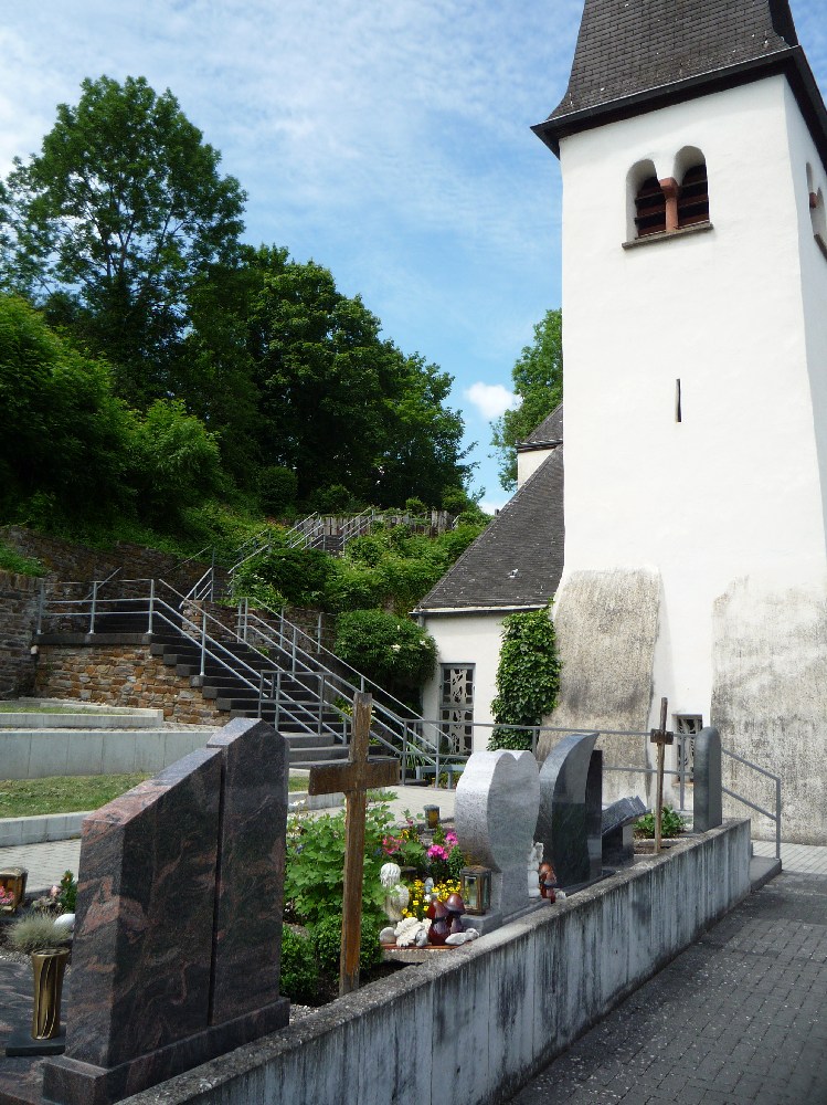
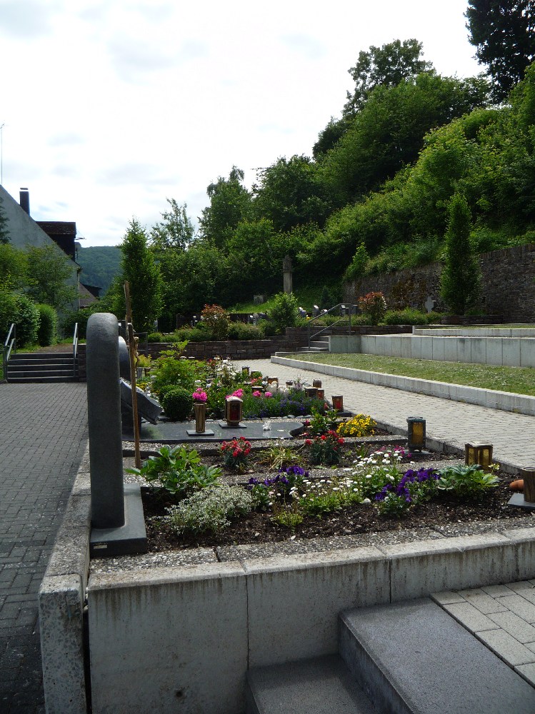
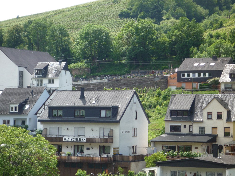
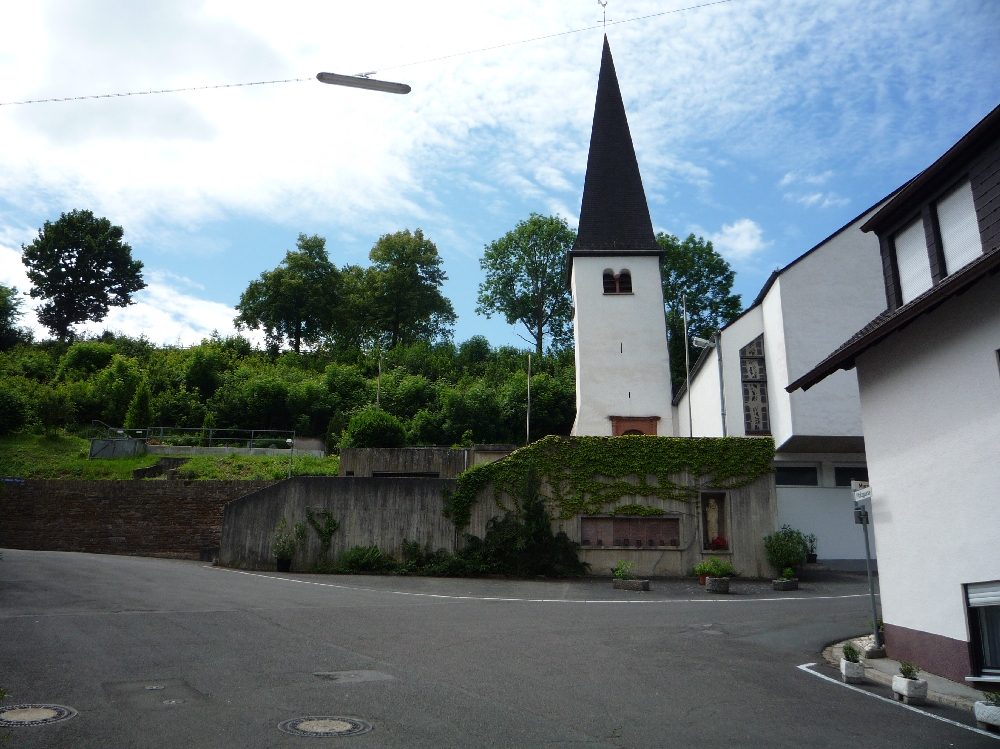
| Description | : | Cemetery is located on the hillside on the outskirts of the village of Zell-Kaimt. It can be seen from the bridge that links Zell an der Mosel and Zell-Kaimt. |
frequently asked questions (FAQ):
-
Where is St Jakobus Cemetery?
St Jakobus Cemetery is located at Kaimt, Landkreis Cochem-Zell ,Rheinland-Pfalz ,Germany.
-
St Jakobus Cemetery cemetery's updated grave count on graveviews.com?
0 memorials
-
Where are the coordinates of the St Jakobus Cemetery?
Latitude: 50.0249600
Longitude: 7.1770120
Nearby Cemetories:
1. Hahn-Hunsrück
Hahn, Rhein-Hunsrück-Kreis, Germany
Coordinate: 49.9638100, 7.2712330
2. Beilstein Jewish Cemetery
Beilstein, Landkreis Cochem-Zell, Germany
Coordinate: 50.1057140, 7.2374635
3. Wurrich Friedhof
Wurrich, Rhein-Hunsrück-Kreis, Germany
Coordinate: 49.9790076, 7.3017156
4. Friedhof
Irmenach, Landkreis Bernkastel-Wittlich, Germany
Coordinate: 49.9216982, 7.1886770
5. Friedhof Cochem
Cochem, Landkreis Cochem-Zell, Germany
Coordinate: 50.1457712, 7.1640547
6. Wehlen-Mosel Cemetery
Wehlen, Landkreis Bernkastel-Wittlich, Germany
Coordinate: 49.9409111, 7.0407942
7. Friedhof Sohren
Sohren, Rhein-Hunsrück-Kreis, Germany
Coordinate: 49.9320129, 7.3130949
8. Sankt Nikolaus Hospital
Bernkastel-Kues, Landkreis Bernkastel-Wittlich, Germany
Coordinate: 49.9158500, 7.0715400
9. St Michael's Kirche
Landkreis Bernkastel-Wittlich, Germany
Coordinate: 49.9161110, 7.0694440
10. Jüdischer Friedhof Bernkastel-Kues
Bernkastel-Kues, Landkreis Bernkastel-Wittlich, Germany
Coordinate: 49.9143000, 7.0698400
11. Kloster Machern
Zeltingen-Rachtig, Landkreis Bernkastel-Wittlich, Germany
Coordinate: 49.9548540, 7.0015740
12. Klotten Cemetery
Klotten, Landkreis Cochem-Zell, Germany
Coordinate: 50.1670250, 7.1975975
13. Friedhof Altrich
Altrich, Landkreis Bernkastel-Wittlich, Germany
Coordinate: 49.9576748, 6.9120208
14. Dorweiler Dommershausen Cemetery
Dorweiler, Rhein-Hunsrück-Kreis, Germany
Coordinate: 50.1394803, 7.4226174
15. Dickenshied Village Cemetery
Dickenschied, Rhein-Hunsrück-Kreis, Germany
Coordinate: 49.9047222, 7.4158796
16. St. Johannes Church Cemetery
Hambuch, Landkreis Cochem-Zell, Germany
Coordinate: 50.2258690, 7.1870719
17. Kloster Ravengiersburg
Ravengiersburg, Rhein-Hunsrück-Kreis, Germany
Coordinate: 49.9356660, 7.4768000
18. Hottenbach
Rhein-Hunsrück-Kreis, Germany
Coordinate: 49.8263889, 7.2991667
19. Friedhof Simmern
Simmern, Rhein-Hunsrück-Kreis, Germany
Coordinate: 49.9805385, 7.5120901
20. Hottenbach Cemetery
Hottenbach, Landkreis Birkenfeld, Germany
Coordinate: 49.8214442, 7.3098419
21. Friedhof Klausen
Klausen, Landkreis Bernkastel-Wittlich, Germany
Coordinate: 49.9040500, 6.8833800
22. Stephanskirche
Simmern, Rhein-Hunsrück-Kreis, Germany
Coordinate: 49.9849200, 7.5230200
23. Friedhof Schlierschied
Schlierschied, Rhein-Hunsrück-Kreis, Germany
Coordinate: 49.8765255, 7.4448120
24. Gehlweiler Cemetery
Gehlweiler, Rhein-Hunsrück-Kreis, Germany
Coordinate: 49.8855600, 7.4616700