
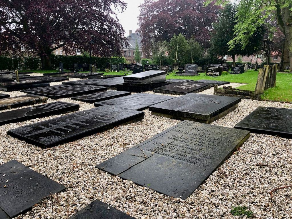
| Memorials | : | 0 |
| Location | : | Willemstad, Moerdijk Municipality, Netherlands |
| Coordinate | : | 51.6921700, 4.4383000 |
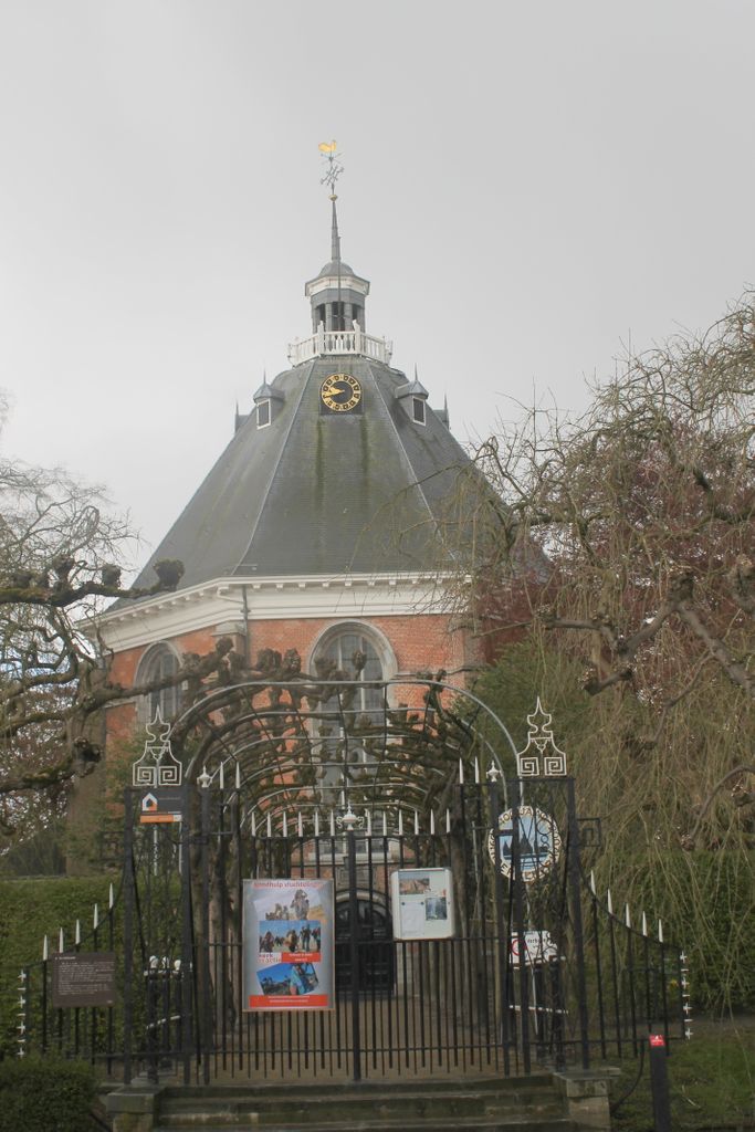
| Description | : | The first inhabitants of the village founded in 1565 Ruigenhil, later Willemstad, initially had to do without a church. But in the construction of the village there was a cemetery built at the end of Front Street. This cemetery has been there since the beginning of the village. The Domed Church was built thirty some years later, after Prince Maurice donated ƒ7000 for a round church for Protestant worship. The church architecture was round to distinguish themselves from the generally cruciform-built Catholic churches. The church was restored in 1770 but in 1793 suffered damage from shelling by... Read More |
frequently asked questions (FAQ):
-
Where is Koepelkerk Kerkhof?
Koepelkerk Kerkhof is located at Willemstad, Moerdijk Municipality ,Noord-Brabant ,Netherlands.
-
Koepelkerk Kerkhof cemetery's updated grave count on graveviews.com?
0 memorials
-
Where are the coordinates of the Koepelkerk Kerkhof?
Latitude: 51.6921700
Longitude: 4.4383000

Nearby Cemetories:
1. Belgian War Cemetery 1940
Willemstad, Moerdijk Municipality, Netherlands
Coordinate: 51.6958300, 4.4413000
2. Numansdorp Protestant Cemetery
Numansdorp, Cromstrijen Municipality, Netherlands
Coordinate: 51.7336800, 4.4298800
3. Fijnaart-en-Heiningen Roman Catholic Cemetery
Fijnaart, Moerdijk Municipality, Netherlands
Coordinate: 51.6368300, 4.4641900
4. Fijnaart-en-Heiningen Protestant Cemetery
Fijnaart, Moerdijk Municipality, Netherlands
Coordinate: 51.6376700, 4.4700100
5. Joodse Begraafplaats
Klundert, Moerdijk Municipality, Netherlands
Coordinate: 51.6645940, 4.5288210
6. Oude Begraafplaats
Zuid-Beijerland, Korendijk Municipality, Netherlands
Coordinate: 51.7490968, 4.3670754
7. Begraafplaats Noordhoek
Noordhoek, Moerdijk Municipality, Netherlands
Coordinate: 51.6419539, 4.5333775
8. Stampersgat Roman Catholic Cemetery
Stampersgat, Halderberge Municipality, Netherlands
Coordinate: 51.6141200, 4.4450400
9. Standdaarbuiten Catholic Cemetery
Standdaarbuiten, Moerdijk Municipality, Netherlands
Coordinate: 51.6140900, 4.5149400
10. Joodse Begraafplaats
Strijen Municipality, Netherlands
Coordinate: 51.7468300, 4.5570500
11. Begraafplaats Nederlands Hervormde Kerk v.m.
Standdaarbuiten, Moerdijk Municipality, Netherlands
Coordinate: 51.6089430, 4.5166929
12. Den Bommel General Cemetery
Den Bommel, Goeree-Overflakkee Municipality, Netherlands
Coordinate: 51.7159400, 4.2812700
13. Begraafplaats Noordtoren
Zevenbergen, Moerdijk Municipality, Netherlands
Coordinate: 51.6455214, 4.5835365
14. Algemene Begraafplaats
Cillaarshoek, Strijen Municipality, Netherlands
Coordinate: 51.7721000, 4.5474300
15. R.K.Begraafplaats Laurentius
Oud Gastel, Halderberge Municipality, Netherlands
Coordinate: 51.5869694, 4.4628189
16. Algemene Begraafplaats
Zevenbergen, Moerdijk Municipality, Netherlands
Coordinate: 51.6465490, 4.5985048
17. Algemene Begraafplaats Oudenbosch
Oudenbosch, Halderberge Municipality, Netherlands
Coordinate: 51.5967744, 4.5244521
18. Protestantse Begraafplaats
Oud Gastel, Halderberge Municipality, Netherlands
Coordinate: 51.5841651, 4.4683994
19. Rooms Katholieke Begraafplaats Zevenbergen
Zevenbergen, Moerdijk Municipality, Netherlands
Coordinate: 51.6454476, 4.5993329
20. Algemene Begraafplaats
Mijnsheerenland, Binnenmaas Municipality, Netherlands
Coordinate: 51.7999720, 4.4823990
21. Protestantse Begraafplaats Moerdijk
Moerdijk, Moerdijk Municipality, Netherlands
Coordinate: 51.6999519, 4.6233284
22. Oudenbosch Rooms-Katholieke Begraafplaats
Oudenbosch, Halderberge Municipality, Netherlands
Coordinate: 51.5891200, 4.5310900
23. Rooms Katholieke Begraafplaats Moerdijk
Moerdijk, Moerdijk Municipality, Netherlands
Coordinate: 51.7012173, 4.6304095
24. Steenbergen-En-Kruisland Churchyard
Kruisland, Steenbergen Municipality, Netherlands
Coordinate: 51.5702921, 4.4061697