
| Memorials | : | 4 |
| Location | : | Fort Atkinson, Jefferson County, USA |
| Coordinate | : | 42.8656000, -88.8394000 |
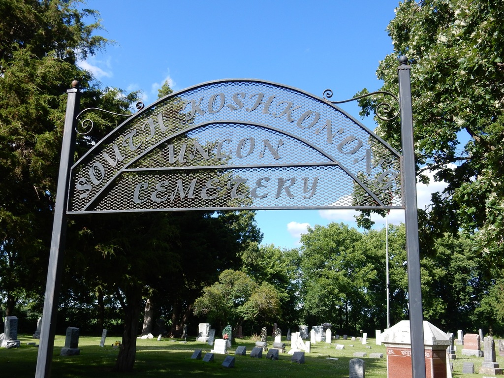
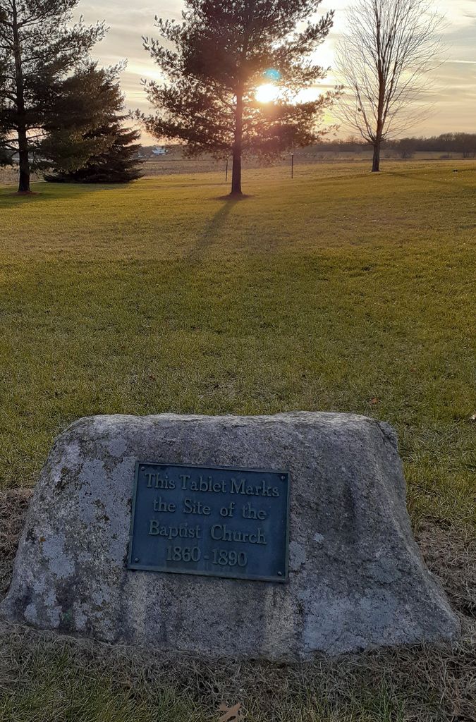
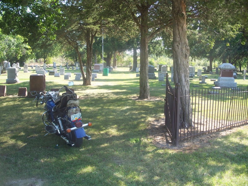
| Description | : | Description: Koshkonong Union Cemeter is also called South Koshkonong Cemetery. It is in use and maintained. Directions to Cemetery: Traveling south from Fort Atkinson, take the county highway "K" to Creamery Rd and then McIntyre Road - the cemetery is on the right. The distance is about 3 miles. Near the cemetery there is a marker for a Baptist church which burned down prior to 1900 and another for the Koshkonong Union Church that lasted into the early 1900s. |
frequently asked questions (FAQ):
-
Where is Koshkonong Cemetery?
Koshkonong Cemetery is located at McIntyre Road Fort Atkinson, Jefferson County ,Wisconsin ,USA.
-
Koshkonong Cemetery cemetery's updated grave count on graveviews.com?
3 memorials
-
Where are the coordinates of the Koshkonong Cemetery?
Latitude: 42.8656000
Longitude: -88.8394000
Nearby Cemetories:
1. Faith Community Church Memorial Garden
Fort Atkinson, Jefferson County, USA
Coordinate: 42.9010570, -88.8311600
2. Lakeview Cemetery
Fort Atkinson, Jefferson County, USA
Coordinate: 42.9103012, -88.8482971
3. Cold Spring Union Cemetery
Cold Spring, Jefferson County, USA
Coordinate: 42.8874320, -88.7774980
4. Saint Joseph Catholic Cemetery
Fort Atkinson, Jefferson County, USA
Coordinate: 42.9313900, -88.8365000
5. Calvary Cemetery
Whitewater, Walworth County, USA
Coordinate: 42.8420600, -88.7430100
6. Evergreen Cemetery
Fort Atkinson, Jefferson County, USA
Coordinate: 42.9407997, -88.8405991
7. Otter Creek Cemetery
Milton, Rock County, USA
Coordinate: 42.8196983, -88.9372025
8. Union Cemetery
Sumner, Jefferson County, USA
Coordinate: 42.9342003, -88.9085999
9. Lima Center Cemetery
Lima Center, Rock County, USA
Coordinate: 42.7803001, -88.8272018
10. Hillside Cemetery
Whitewater, Walworth County, USA
Coordinate: 42.8269005, -88.7288971
11. Oak Grove Cemetery
Whitewater, Walworth County, USA
Coordinate: 42.8349991, -88.7228012
12. Wild Wood Cemetery
Fort Atkinson, Jefferson County, USA
Coordinate: 42.9539490, -88.7903824
13. Taylor Family Cemetery
Fort Atkinson, Jefferson County, USA
Coordinate: 42.9476900, -88.9070320
14. Ward Cemetery
Oakland, Jefferson County, USA
Coordinate: 42.9616680, -88.8955740
15. Munro Cemetery
Hebron, Jefferson County, USA
Coordinate: 42.9319992, -88.7190018
16. Busseyville Cemetery
Busseyville, Jefferson County, USA
Coordinate: 42.9003800, -88.9829100
17. Milton Cemetery
Milton, Rock County, USA
Coordinate: 42.7801000, -88.9379000
18. Arity Family Cemetery
Fort Atkinson, Jefferson County, USA
Coordinate: 42.9787800, -88.8753600
19. Utters Corners Cemetery
Lima Center, Rock County, USA
Coordinate: 42.7556000, -88.7840000
20. Milton Junction Cemetery
Milton, Rock County, USA
Coordinate: 42.7833000, -88.9579000
21. Rock River Cemetery
Jefferson, Jefferson County, USA
Coordinate: 42.9832993, -88.8078003
22. Oakland Seventh-Day Cemetery
Oakland, Jefferson County, USA
Coordinate: 42.9402100, -88.9689400
23. Hebron Cemetery
Hebron, Jefferson County, USA
Coordinate: 42.9183006, -88.6911011
24. Oakland Evergreen Cemetery
Oakland, Jefferson County, USA
Coordinate: 42.9533000, -88.9541300