| Memorials | : | 0 |
| Location | : | Morrisdale, Clearfield County, USA |
| Coordinate | : | 41.0328770, -78.1552160 |
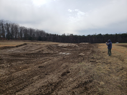
| Description | : | The cemetery is located in Cooper Township about 250 feet west of Rolling Stone Road (State Route 1011) about 0.25 miles north of its intersection with Sylvan Grove Road. Per Clearfield County Pennsylvania GIS Department, the cemetery is identified with Control # 110049517 and PIN: 1100R0700000045. |
frequently asked questions (FAQ):
-
Where is Krasinski Family Cemetery?
Krasinski Family Cemetery is located at Rolling Stone Road (State Route 1011) Morrisdale, Clearfield County ,Pennsylvania , 16858USA.
-
Krasinski Family Cemetery cemetery's updated grave count on graveviews.com?
0 memorials
-
Where are the coordinates of the Krasinski Family Cemetery?
Latitude: 41.0328770
Longitude: -78.1552160
Nearby Cemetories:
1. Sylvan Grove Cemetery
Sylvan Grove, Clearfield County, USA
Coordinate: 41.0202350, -78.1624550
2. Pleasant Hill United Methodist Church Cemetery
Pleasant Hill, Clearfield County, USA
Coordinate: 41.0062000, -78.1300000
3. Saint Severin Cemetery
Drifting, Clearfield County, USA
Coordinate: 41.0313988, -78.1097031
4. Grassflat Lanse Lutheran Cemetery
Grassflat, Clearfield County, USA
Coordinate: 41.0034000, -78.1195000
5. Kylertown Presbyterian Cemetery
Kylertown, Clearfield County, USA
Coordinate: 40.9914000, -78.1667000
6. Saint Peter and Paul Catholic Church Cemetery
Grassflat, Clearfield County, USA
Coordinate: 40.9948000, -78.1265400
7. Messiah Baptist Cemetery
Lanse, Clearfield County, USA
Coordinate: 40.9867000, -78.1442000
8. Palestine Cemetery
Morrisdale, Clearfield County, USA
Coordinate: 41.0234000, -78.2211000
9. Fairview United Methodist Cemetery
Morrisdale, Clearfield County, USA
Coordinate: 41.0348000, -78.2325000
10. Lanse Free Evangelical Cemetery
Lanse, Clearfield County, USA
Coordinate: 40.9736870, -78.1332280
11. Hunter Cemetery
Allport, Clearfield County, USA
Coordinate: 40.9771996, -78.1932983
12. Allport Cemetery
Allport, Clearfield County, USA
Coordinate: 40.9751000, -78.1986000
13. Emmanuel United Methodist Church Cemetery
Morrisdale, Clearfield County, USA
Coordinate: 40.9658280, -78.1567280
14. Immanuel Cemetery
Clearfield County, USA
Coordinate: 40.9658012, -78.1568985
15. Saint John's Evangelical Lutheran Cemetery
Lanse, Clearfield County, USA
Coordinate: 40.9640490, -78.1660190
16. Saint Johns Evangelical Lutheran Cemetery
Munson, Clearfield County, USA
Coordinate: 40.9640480, -78.1660100
17. Keewaydin Cemetery
Keewaydin, Clearfield County, USA
Coordinate: 41.1054000, -78.1531000
18. Old Allport Cemetery
Allport, Clearfield County, USA
Coordinate: 40.9672012, -78.2003021
19. Saint Mary of the Assumption Cemetery
Frenchville, Clearfield County, USA
Coordinate: 41.1040000, -78.2157000
20. Congress Hill Cemetery
Lecontes Mills, Clearfield County, USA
Coordinate: 41.0769005, -78.2643967
21. Pine Glen Cemetery
Pine Glen, Centre County, USA
Coordinate: 41.0932840, -78.0565630
22. Centre Hill United Methodist Cemetery
Morrisdale, Clearfield County, USA
Coordinate: 40.9713430, -78.2544680
23. Centre Cemetery
Hyde, Clearfield County, USA
Coordinate: 40.9710999, -78.2544022
24. Summit Hill Cemetery
Morrisdale, Clearfield County, USA
Coordinate: 40.9645000, -78.2506000

