| Memorials | : | 0 |
| Location | : | Nord-Fron, Nord-Fron kommune, Norway |
| Coordinate | : | 61.5744000, 9.5873500 |
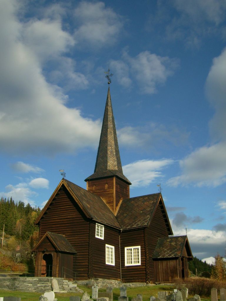
| Description | : | The Kvikne Churchyard surrounds the Kvikne Kyrkje (Church), located on Fv (highway) 255, about 12.6 kilometers west of the City of Vinstra. The present Kvikne Church, a cruciform log church with central steeple, was built in 1764 by Kvikne native Per Korpberget on the grounds of the Sylte farm on the site of the previous church. A flood in July 1789 ("Storofsen": the great flood) severely damaged the church, when a landslide broke in the upper wall of the church, filling the church with earth and mud. In 1789-90, the church was moved to higher ground, on the Tune... Read More |
frequently asked questions (FAQ):
-
Where is Kvikne Churchyard?
Kvikne Churchyard is located at Nord-Fron, Nord-Fron kommune ,Oppland fylke ,Norway.
-
Kvikne Churchyard cemetery's updated grave count on graveviews.com?
0 memorials
-
Where are the coordinates of the Kvikne Churchyard?
Latitude: 61.5744000
Longitude: 9.5873500
Nearby Cemetories:
1. Sødorp
Vinstra, Nord-Fron kommune, Norway
Coordinate: 61.5990900, 9.7360900
2. Sødorp Old Cemetery
Nord-Fron, Nord-Fron kommune, Norway
Coordinate: 61.5885130, 9.7813620
3. Kvam Churchyard
Kvam, Nord-Fron kommune, Norway
Coordinate: 61.6654660, 9.6941910
4. Sør Fron Cemetery
Hundorp, Sør-Fron kommune, Norway
Coordinate: 61.5586920, 9.9418070
5. Heidal Churchyard
Otta, Sel kommune, Norway
Coordinate: 61.7473900, 9.3302700
6. Venabygd Churchyard
Venabygd, Ringebu kommune, Norway
Coordinate: 61.5928840, 10.0524460
7. Sel Kirke
Otta, Sel kommune, Norway
Coordinate: 61.8017900, 9.5524490
8. Svatsum Cemetery
Vestre Gausdal, Gausdal kommune, Norway
Coordinate: 61.3193320, 9.8563950
9. Nord-Sel Churchyard
Sel kommune, Norway
Coordinate: 61.8496240, 9.4214310
10. Ringebu Cemetery
Ringebu, Ringebu kommune, Norway
Coordinate: 61.5090710, 10.1732530
11. Faavang Kirke
Ringebu, Ringebu kommune, Norway
Coordinate: 61.4272450, 10.2197510
12. Vågå churchyard
Vagamo, Vågå kommune, Norway
Coordinate: 61.8752450, 9.0981000
13. Østre Gausdal Cemetery
Gausdal kommune, Norway
Coordinate: 61.2573900, 10.1552000
14. Tretten Kirke
Tretten, Øyer kommune, Norway
Coordinate: 61.3170800, 10.3053470
15. Sollia kirke
Sollia, Stor-Elvdal kommune, Norway
Coordinate: 61.7804470, 10.4001850
16. Dovre Churchyard
Dovre, Dovre kommune, Norway
Coordinate: 61.9884950, 9.2480190
17. Vestre Gausdal Cemetery
Vestre Gausdal, Gausdal kommune, Norway
Coordinate: 61.2005670, 10.1470830
18. Follebu kirkegård
Follebu, Gausdal kommune, Norway
Coordinate: 61.2259500, 10.2677600
19. Øyer kirkegård
Øyer kommune, Norway
Coordinate: 61.2661051, 10.4209226
20. Bruvin gravlund
Øyer kommune, Norway
Coordinate: 61.2587591, 10.4401440
21. Rogne Cemetery
Rogne, Øystre Slidre kommune, Norway
Coordinate: 61.0874550, 9.1243580
22. Dombås Churchyard
Dombås, Dovre kommune, Norway
Coordinate: 62.0750066, 9.1245741
23. Nord Etnedal Kirke
Etnedal kommune, Norway
Coordinate: 61.0253740, 9.5010940
24. Fåberg kirkegård
Fåberg, Lillehammer kommune, Norway
Coordinate: 61.1607090, 10.3714490

