
| Memorials | : | 0 |
| Location | : | Rio Hondo, Cameron County, USA |
| Coordinate | : | 26.2292600, -97.3475500 |
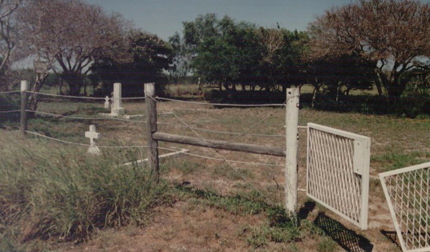
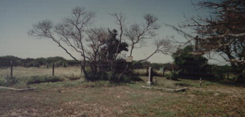
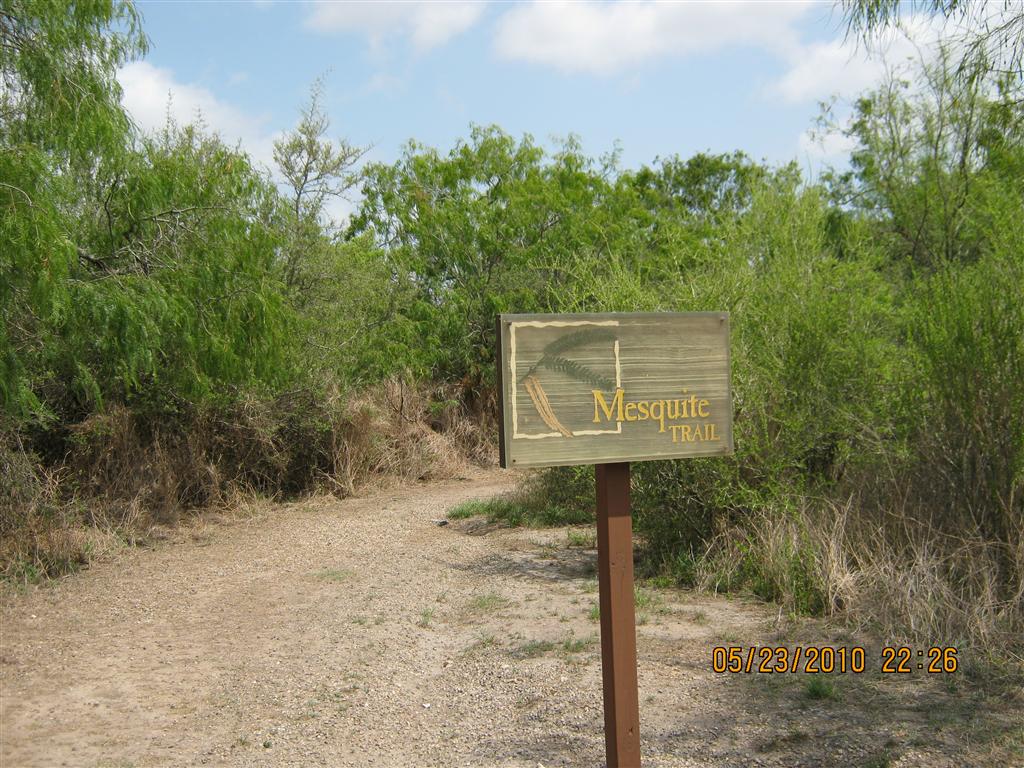
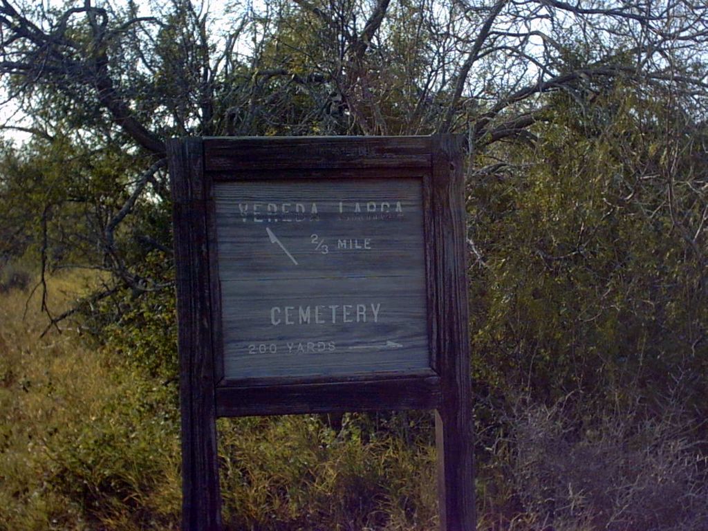
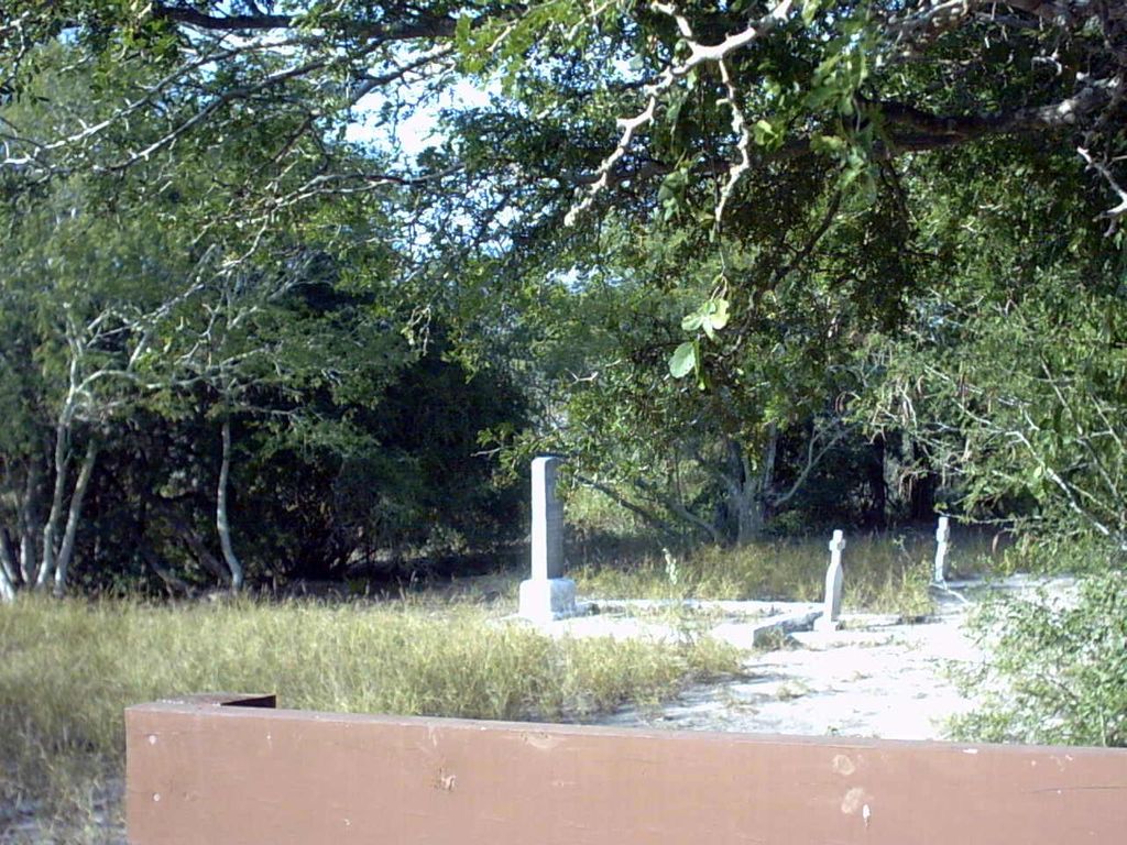
| Description | : | 26.22926 -097.34755 The GPS coordinates will take you to the corner of the visitor center parking lot where you take the Mesquite Trail. This trail is 1.5 miles round trip and the cemetery is off north of the midpoint of the trail. There were several burials of people who lived and worked at the Granjeno Ranch, now part of the National Wildlife Refuge. Only 3 have markers at this time. It is a nice nature walk. |
frequently asked questions (FAQ):
-
Where is Laguna Atascosa Cemetery?
Laguna Atascosa Cemetery is located at Rio Hondo, Cameron County ,Texas ,USA.
-
Laguna Atascosa Cemetery cemetery's updated grave count on graveviews.com?
0 memorials
-
Where are the coordinates of the Laguna Atascosa Cemetery?
Latitude: 26.2292600
Longitude: -97.3475500
Nearby Cemetories:
1. La Leona Cemetery
Cameron County, USA
Coordinate: 26.2613930, -97.4642210
2. La Tina Cemetery
Cameron County, USA
Coordinate: 26.2139750, -97.4751230
3. Sandoval Family Cemetery
Cameron County, USA
Coordinate: 26.2133970, -97.4791570
4. Soldiers Cemetery
Bayview, Cameron County, USA
Coordinate: 26.1252995, -97.4475021
5. Las Yescas Cemetery
Las Yescas, Cameron County, USA
Coordinate: 26.2223000, -97.5058100
6. San Vicente Cemetery # 1
Las Yescas, Cameron County, USA
Coordinate: 26.2251000, -97.5204700
7. Anaquitas Cemetery
Monte Grande, Cameron County, USA
Coordinate: 26.2737500, -97.5180400
8. San Vicente Cemetery #2
Las Yescas, Cameron County, USA
Coordinate: 26.2239700, -97.5256700
9. Fresnos Resaca Cemetery
Cameron County, USA
Coordinate: 26.1449730, -97.5069400
10. Garcia Gravesite
Los Fresnos, Cameron County, USA
Coordinate: 26.0711050, -97.4647160
11. San Jose Ranch Cemetery
San Benito, Cameron County, USA
Coordinate: 26.1350600, -97.5340300
12. Santa Isabel Cemetery
Port Isabel, Cameron County, USA
Coordinate: 26.0720910, -97.2190650
13. Port Isabel City Cemetery
Port Isabel, Cameron County, USA
Coordinate: 26.0772910, -97.2111510
14. Rio Hondo Community Cemetery
Rio Hondo, Cameron County, USA
Coordinate: 26.2374300, -97.5710300
15. Los Cuates Cemetery
Los Fresnos, Cameron County, USA
Coordinate: 26.0774600, -97.4974700
16. Robinson Family Gravesites
Rio Hondo, Cameron County, USA
Coordinate: 26.2382800, -97.5756100
17. Rio Hondo City Cemetery
Rio Hondo, Cameron County, USA
Coordinate: 26.2267300, -97.5853600
18. Mont Meta Memorial Park
San Benito, Cameron County, USA
Coordinate: 26.1825008, -97.5883026
19. San Benito Memorial Park Cemetery
Cameron County, USA
Coordinate: 26.1511810, -97.6139120
20. San Benito City Cemetery
San Benito, Cameron County, USA
Coordinate: 26.1508500, -97.6159700
21. San Pedro Cemetery
Rancho Viejo, Cameron County, USA
Coordinate: 26.0472740, -97.5513950
22. Juan Garza Jr Memorial
San Benito, Cameron County, USA
Coordinate: 26.0948700, -97.6125200
23. El Jardin Cemetery
Brownsville, Cameron County, USA
Coordinate: 25.9687000, -97.4516900
24. Rose Lawn Memorial Gardens
Brownsville, Cameron County, USA
Coordinate: 25.9684800, -97.4515000