| Memorials | : | 0 |
| Location | : | Port Isabel, Cameron County, USA |
| Coordinate | : | 26.0720910, -97.2190650 |
frequently asked questions (FAQ):
-
Where is Santa Isabel Cemetery?
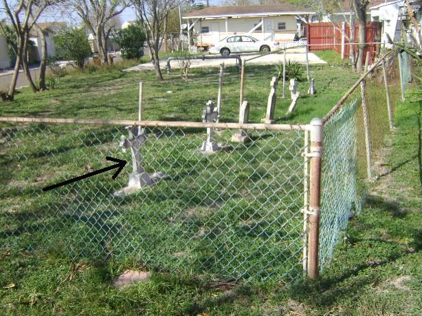
Santa Isabel Cemetery is located at Island Blvd. Port Isabel, Cameron County ,Texas ,USA.
-
Santa Isabel Cemetery cemetery's updated grave count on graveviews.com?
0 memorials
-
Where are the coordinates of the Santa Isabel Cemetery?
Latitude: 26.0720910
Longitude: -97.2190650
Nearby Cemetories:
1. Port Isabel City Cemetery
Port Isabel, Cameron County, USA
Coordinate: 26.0772910, -97.2111510
2. Circle 'L' Cemetery
Brownsville, Cameron County, USA
Coordinate: 25.9516180, -97.3235360
3. Laguna Atascosa Cemetery
Rio Hondo, Cameron County, USA
Coordinate: 26.2292600, -97.3475500
4. Los Sauces Ranch Cemetery
Brownsville, Cameron County, USA
Coordinate: 25.9204800, -97.3625700
5. Panteón de La Carrera
La Carrera, Matamoros Municipality, Mexico
Coordinate: 25.8981300, -97.3531740
6. Soldiers Cemetery
Bayview, Cameron County, USA
Coordinate: 26.1252995, -97.4475021
7. Guillen Community Cemetery
Brownsville, Cameron County, USA
Coordinate: 25.9205000, -97.3883000
8. Garcia Gravesite
Los Fresnos, Cameron County, USA
Coordinate: 26.0711050, -97.4647160
9. Rose Lawn Memorial Gardens
Brownsville, Cameron County, USA
Coordinate: 25.9684800, -97.4515000
10. El Jardin Cemetery
Brownsville, Cameron County, USA
Coordinate: 25.9687000, -97.4516900
11. Los Cuates Cemetery
Los Fresnos, Cameron County, USA
Coordinate: 26.0774600, -97.4974700
12. San Rafael Ray Cemetery
Brownsville, Cameron County, USA
Coordinate: 25.8572900, -97.3909400
13. Brulay Cemetery
Brownsville, Cameron County, USA
Coordinate: 25.8659550, -97.4078190
14. Fresnos Resaca Cemetery
Cameron County, USA
Coordinate: 26.1449730, -97.5069400
15. San Rafael Cemetery
Brownsville, Cameron County, USA
Coordinate: 25.8497510, -97.3879670
16. La Tina Cemetery
Cameron County, USA
Coordinate: 26.2139750, -97.4751230
17. Sandoval Family Cemetery
Cameron County, USA
Coordinate: 26.2133970, -97.4791570
18. La Palma Cemetery
Brownsville, Cameron County, USA
Coordinate: 25.9795800, -97.5134000
19. Santa Rosalia Cemetery
Brownsville, Cameron County, USA
Coordinate: 25.8875008, -97.4606018
20. Buena Vista Burial Park
Brownsville, Cameron County, USA
Coordinate: 25.9160995, -97.4886017
21. Panteón del Ejido Longoreño
El Longoreno, Matamoros Municipality, Mexico
Coordinate: 25.8343570, -97.4027880
22. San Jose Ranch Cemetery
San Benito, Cameron County, USA
Coordinate: 26.1350600, -97.5340300
23. La Leona Cemetery
Cameron County, USA
Coordinate: 26.2613930, -97.4642210
24. Parque Funeral San Joaquín
El Longoreno, Matamoros Municipality, Mexico
Coordinate: 25.8317440, -97.4040870


