
| Memorials | : | 48 |
| Location | : | Echo Bay, Algoma District, Canada |
| Coordinate | : | 46.3982120, -84.0440370 |
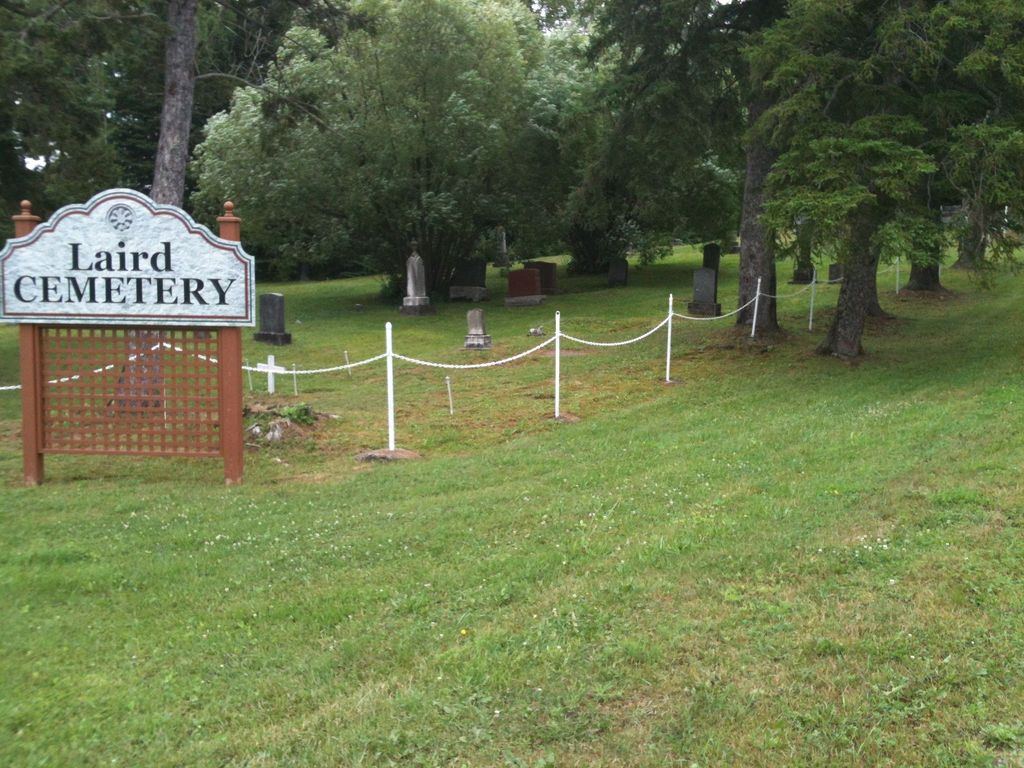
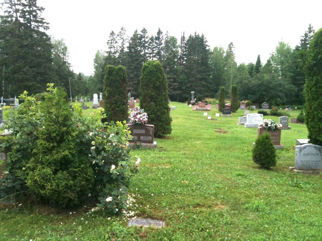
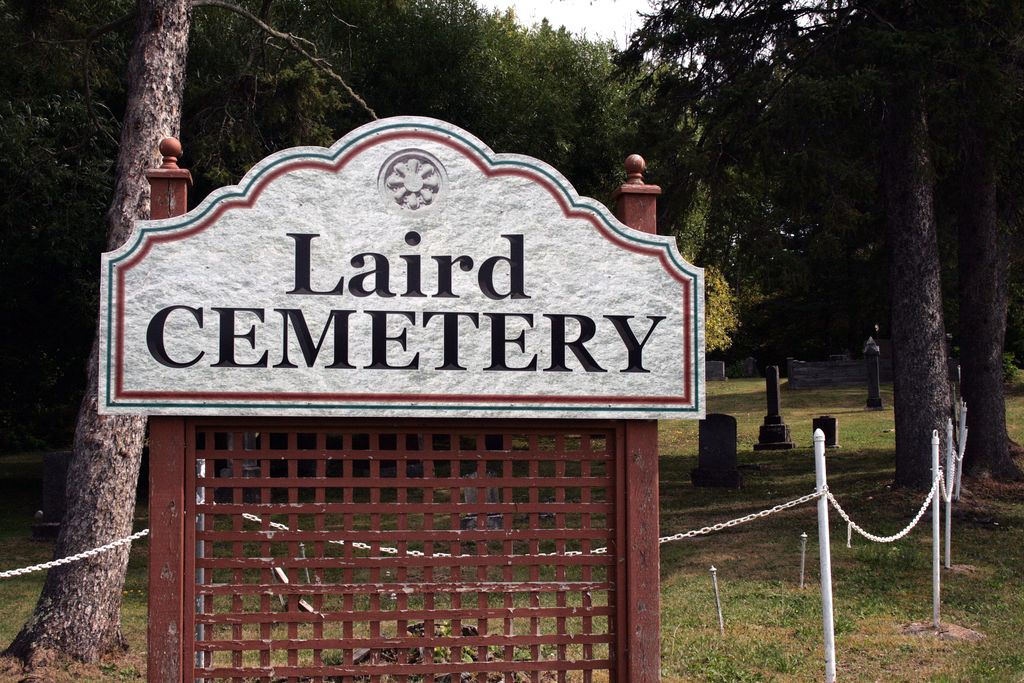
| Description | : | There are 3 sections in the Cemetery: The original Section is at the bottom of the treed area, The new section is at the top of the hill, The third section is below (west) of the original section. There is a sign posted showing the layout and names of plots in both sections Directions: Travelling East from Sault Ste Marie on Highway 17, turn left on Pumpkin Point Road which is about 10 kms past the Hwy 638 turnoff. The cemetery is about 1.9 kms on the left. |
frequently asked questions (FAQ):
-
Where is Laird Cemetery?
Laird Cemetery is located at Corner of Government Road & Pumpkin Point Road Echo Bay, Algoma District ,Ontario ,Canada.
-
Laird Cemetery cemetery's updated grave count on graveviews.com?
48 memorials
-
Where are the coordinates of the Laird Cemetery?
Latitude: 46.3982120
Longitude: -84.0440370
Nearby Cemetories:
1. Stickney Cemetery
Algoma District, Canada
Coordinate: 46.3519640, -84.0450220
2. Sylvan Valley Cemetery
Sylvan Valley, Algoma District, Canada
Coordinate: 46.4608840, -83.9839970
3. Osborn Family Cemetery
Duck Island, Chippewa County, USA
Coordinate: 46.3596300, -84.1376000
4. Port Findlay Cemetery
Port Findlay, Algoma District, Canada
Coordinate: 46.3227600, -84.0134300
5. Desbarats Cemetery
Desbarats, Algoma District, Canada
Coordinate: 46.3540760, -83.9434960
6. Maple Leaf Cemetery
Echo Bay, Algoma District, Canada
Coordinate: 46.4858665, -84.0700455
7. Saint Lukes Community Church Cemetery
Sault Sainte Marie, Chippewa County, USA
Coordinate: 46.3223340, -84.1236020
8. Finnish Cemetery
Sault Sainte Marie, Chippewa County, USA
Coordinate: 46.3905900, -84.1897200
9. Gem Island Cemetery
Sugar Island Township, Chippewa County, USA
Coordinate: 46.4333333, -84.1916667
10. Will Walk Native American Cemetery
Baie de Wasai, Chippewa County, USA
Coordinate: 46.3938890, -84.2069440
11. Mount Pleasant Cemetery
Gordon Lake, Algoma District, Canada
Coordinate: 46.4087150, -83.8672590
12. St Joseph Township Cemetery
Richards Landing, Algoma District, Canada
Coordinate: 46.2699900, -84.0221800
13. Aberdeen Cemetery
Algoma District, Canada
Coordinate: 46.4661000, -83.8801000
14. Sugar Island Cemetery
Sault Sainte Marie, Chippewa County, USA
Coordinate: 46.4613890, -84.2333330
15. Payment Cemetery
Sugar Island Township, Chippewa County, USA
Coordinate: 46.5242004, -84.1505966
16. Reilly Cemetery
Bruce Township, Chippewa County, USA
Coordinate: 46.3329880, -84.2475200
17. Neebish Island Presbyterian Church Cemetery
Barbeau, Chippewa County, USA
Coordinate: 46.2560190, -84.1354310
18. Johnston Family Cemetery
Munuscong, Chippewa County, USA
Coordinate: 46.2494444, -84.1125000
19. Garden River Indian Reservation Anglican Cemetery
Garden River, Algoma District, Canada
Coordinate: 46.5500600, -84.0999300
20. Laitinen Family Cemetery
Munuscong, Chippewa County, USA
Coordinate: 46.2611111, -84.1666667
21. Neebish Island Catholic Cemetery
Barbeau, Chippewa County, USA
Coordinate: 46.2580550, -84.1755550
22. Haynes Family Plot
Bruce Township, Chippewa County, USA
Coordinate: 46.2634400, -84.1940700
23. Brasser Road Cemetery
Brassar, Chippewa County, USA
Coordinate: 46.5055556, -84.2361111
24. Grace United Cemetery
Hilton Beach, Algoma District, Canada
Coordinate: 46.2524630, -83.9040880