
| Memorials | : | 0 |
| Location | : | Duck Island, Chippewa County, USA |
| Coordinate | : | 46.3596300, -84.1376000 |
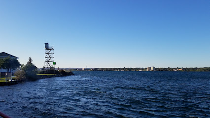
| Description | : | The old Osborn "Little Duck" vacation home is now the Osborn Preserve. It is located on the southeastern shore of Sugar Island (including Duck Island - a small off shoot of Sugar Island) which is squeezed between mainland Michigan at Sault Ste. Marie and Ontario. The preserve encompasses some 3,000 acres, and is managed by the University of Michigan which utilizes it for biological research. The graves of former Michigan Governor Chase Salmon Osborn and his second wife Stellanova are located here. The U.S. Geological Survey (USGS) Geographic Names Information System (GNIS) feature ID for the cemetery is 2356454... Read More |
frequently asked questions (FAQ):
-
Where is Osborn Family Cemetery?
Osborn Family Cemetery is located at Duck Island, Chippewa County ,Michigan , 49783USA.
-
Osborn Family Cemetery cemetery's updated grave count on graveviews.com?
0 memorials
-
Where are the coordinates of the Osborn Family Cemetery?
Latitude: 46.3596300
Longitude: -84.1376000
Nearby Cemetories:
1. Saint Lukes Community Church Cemetery
Sault Sainte Marie, Chippewa County, USA
Coordinate: 46.3223340, -84.1236020
2. Finnish Cemetery
Sault Sainte Marie, Chippewa County, USA
Coordinate: 46.3905900, -84.1897200
3. Will Walk Native American Cemetery
Baie de Wasai, Chippewa County, USA
Coordinate: 46.3938890, -84.2069440
4. Stickney Cemetery
Algoma District, Canada
Coordinate: 46.3519640, -84.0450220
5. Laird Cemetery
Echo Bay, Algoma District, Canada
Coordinate: 46.3982120, -84.0440370
6. Reilly Cemetery
Bruce Township, Chippewa County, USA
Coordinate: 46.3329880, -84.2475200
7. Gem Island Cemetery
Sugar Island Township, Chippewa County, USA
Coordinate: 46.4333333, -84.1916667
8. Port Findlay Cemetery
Port Findlay, Algoma District, Canada
Coordinate: 46.3227600, -84.0134300
9. Laitinen Family Cemetery
Munuscong, Chippewa County, USA
Coordinate: 46.2611111, -84.1666667
10. Neebish Island Presbyterian Church Cemetery
Barbeau, Chippewa County, USA
Coordinate: 46.2560190, -84.1354310
11. Haynes Family Plot
Bruce Township, Chippewa County, USA
Coordinate: 46.2634400, -84.1940700
12. Neebish Island Catholic Cemetery
Barbeau, Chippewa County, USA
Coordinate: 46.2580550, -84.1755550
13. Johnston Family Cemetery
Munuscong, Chippewa County, USA
Coordinate: 46.2494444, -84.1125000
14. Holy Family Catholic Cemetery
Barbeau, Chippewa County, USA
Coordinate: 46.2891670, -84.2697220
15. Rosedale Mount Zion Cemetery
Rosedale, Chippewa County, USA
Coordinate: 46.3903008, -84.2996979
16. St Joseph Township Cemetery
Richards Landing, Algoma District, Canada
Coordinate: 46.2699900, -84.0221800
17. Sugar Island Cemetery
Sault Sainte Marie, Chippewa County, USA
Coordinate: 46.4613890, -84.2333330
18. Desbarats Cemetery
Desbarats, Algoma District, Canada
Coordinate: 46.3540760, -83.9434960
19. Maple Leaf Cemetery
Echo Bay, Algoma District, Canada
Coordinate: 46.4858665, -84.0700455
20. Riverside Cemetery
Sault Sainte Marie, Chippewa County, USA
Coordinate: 46.4571810, -84.2856820
21. Sylvan Valley Cemetery
Sylvan Valley, Algoma District, Canada
Coordinate: 46.4608840, -83.9839970
22. Brasser Road Cemetery
Brassar, Chippewa County, USA
Coordinate: 46.5055556, -84.2361111
23. Donaldson Presbyterian Cemetery
Sault Sainte Marie, Chippewa County, USA
Coordinate: 46.3163880, -84.3655550
24. Payment Cemetery
Sugar Island Township, Chippewa County, USA
Coordinate: 46.5242004, -84.1505966