
| Memorials | : | 0 |
| Location | : | Lanercost, City of Carlisle, England |
| Coordinate | : | 54.9659840, -2.6954990 |
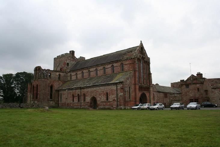
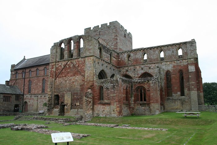
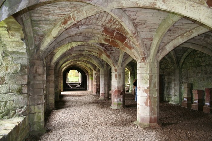
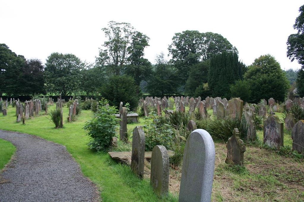
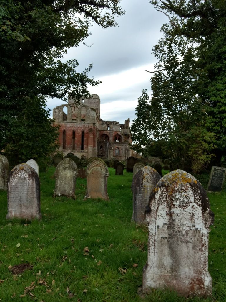
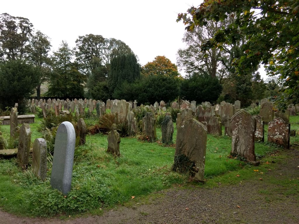
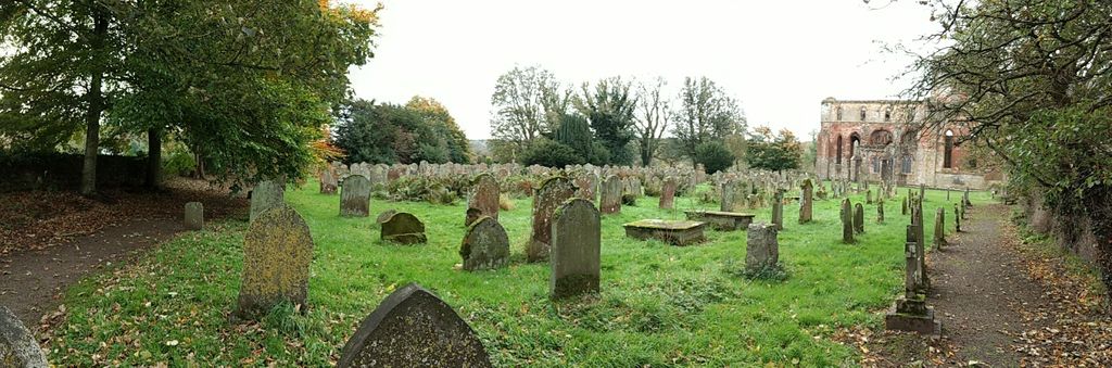
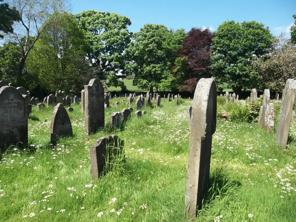
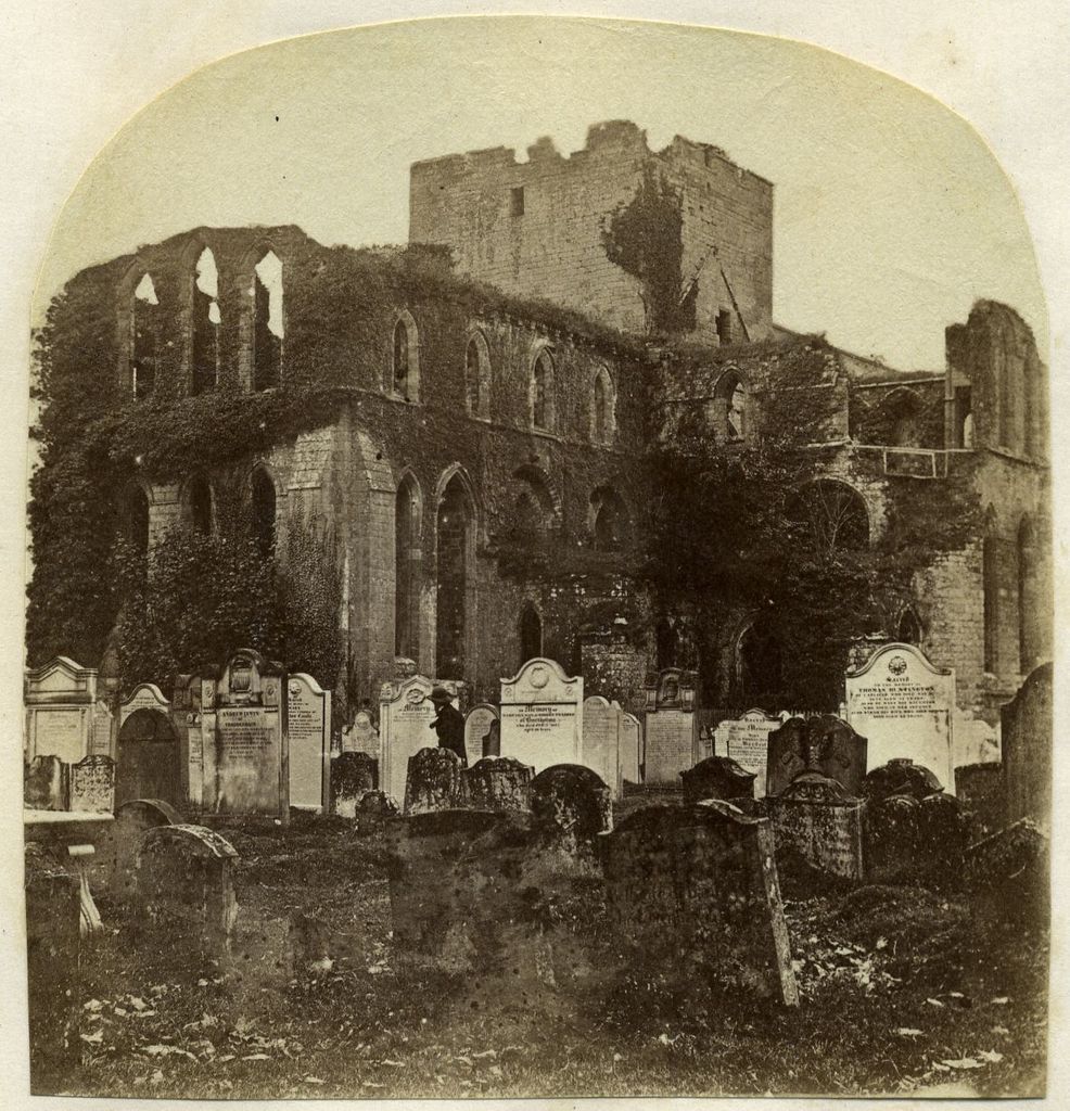
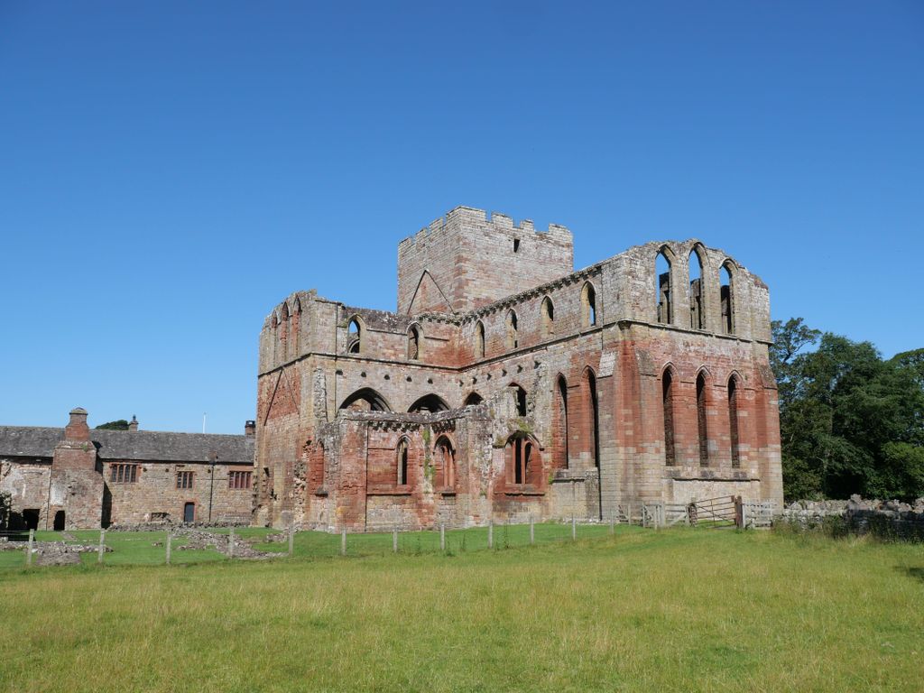
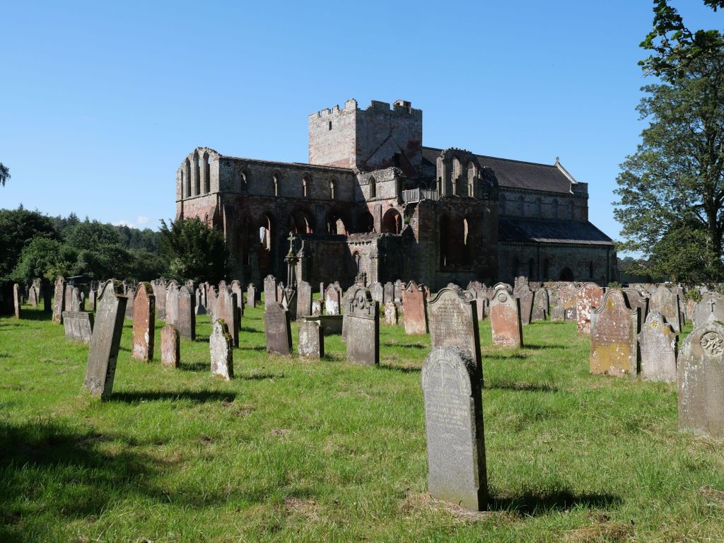
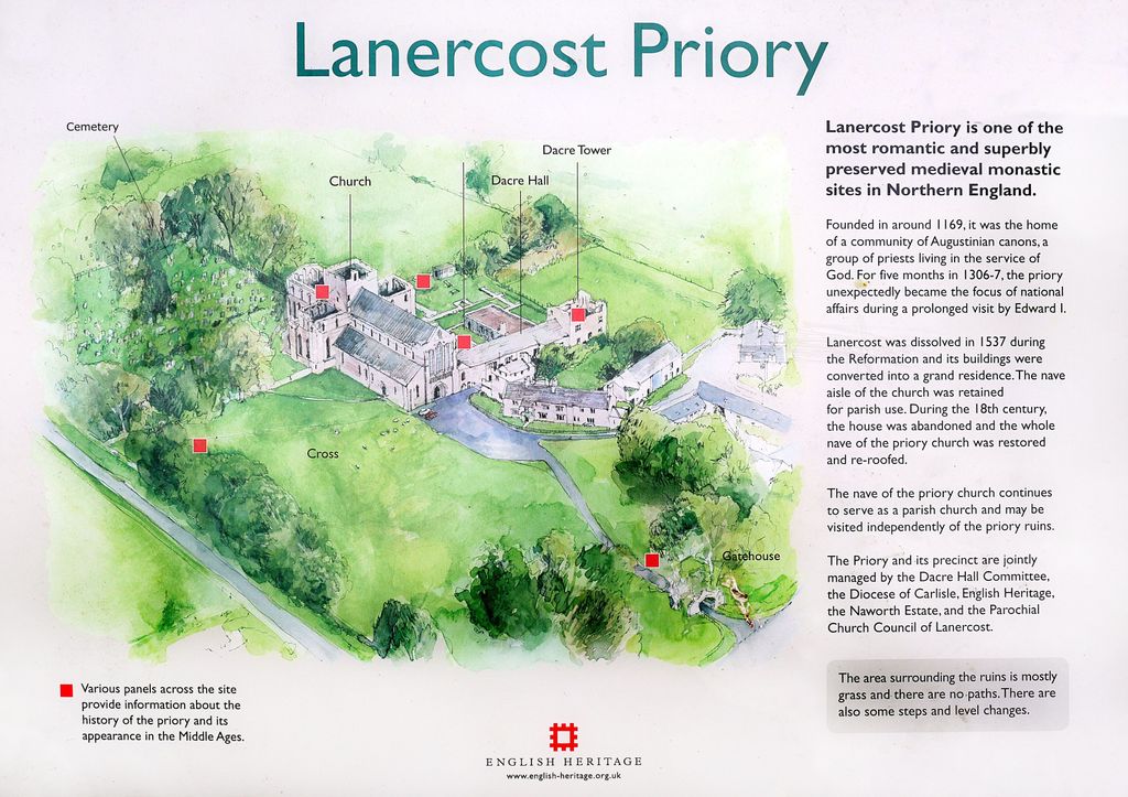
| Description | : | Founded by Robert de Vaux around 1169, Lanercost Priory was home to a community of Augustinian canons. It was dedicated to Mary Magdalene, unusual in this region. It was built using stone from the nearby Hadrian's Wall. Lanercost was dissolved in 1537 during the Reformation of Henry VIII and converted into a grand residence under the ownership of Thomas Dacre. The nave aisle was retained for parish use. During the 18th century, the house was abandoned while the whole nave of the priory church was re-roofed and restored. The graveyard situated to the northern and eastern aspects of the priory... Read More |
frequently asked questions (FAQ):
-
Where is Lanercost Priory?
Lanercost Priory is located at Lanercost, City of Carlisle ,Cumbria ,England.
-
Lanercost Priory cemetery's updated grave count on graveviews.com?
0 memorials
-
Where are the coordinates of the Lanercost Priory?
Latitude: 54.9659840
Longitude: -2.6954990

Nearby Cemetories:
1. St Mary's Churchyard
Walton, City of Carlisle, England
Coordinate: 54.9725960, -2.7483910
2. St. Martin's Churchyard
Brampton, City of Carlisle, England
Coordinate: 54.9416500, -2.7378200
3. St Thomas a Becket
Farlam, City of Carlisle, England
Coordinate: 54.9319760, -2.6751970
4. St Cuthbert's Churchyard
Nether Denton, City of Carlisle, England
Coordinate: 54.9743370, -2.6340210
5. Brampton Cemetery
Brampton, City of Carlisle, England
Coordinate: 54.9457080, -2.7631810
6. St. Martin's Old Churchyard
Brampton, City of Carlisle, England
Coordinate: 54.9461250, -2.7664640
7. St. Kentigern Churchyard
Irthington, City of Carlisle, England
Coordinate: 54.9467410, -2.7842350
8. St. Mary Magdalene Churchyard
Hayton, City of Carlisle, England
Coordinate: 54.9115160, -2.7692210
9. St Peter Churchyard
Castle Carrock, City of Carlisle, England
Coordinate: 54.8913590, -2.7133890
10. St Mary's Churchyard
Hethersgill, City of Carlisle, England
Coordinate: 54.9957890, -2.8168960
11. St Mary Magdalene Churchyard
Gilsland, Northumberland Unitary Authority, England
Coordinate: 54.9989150, -2.5743860
12. St. Mary's Churchyard
Stapleton, City of Carlisle, England
Coordinate: 55.0333800, -2.7786500
13. St Cuthbert's Churchyard
Greenhead, Northumberland Unitary Authority, England
Coordinate: 54.9813930, -2.5324120
14. Our Lady And St Wilfred Churchyard
Wetheral, City of Carlisle, England
Coordinate: 54.9032570, -2.8197300
15. Bewcastle Cemetery
Bewcastle, City of Carlisle, England
Coordinate: 55.0630549, -2.6909662
16. All Saints Churchyard
Scaleby, City of Carlisle, England
Coordinate: 54.9596360, -2.8651530
17. St. Cuthbert's Churchyard
Bewcastle, City of Carlisle, England
Coordinate: 55.0635980, -2.6821690
18. St Paul's Churchyard Holme Eden
Wetheral, City of Carlisle, England
Coordinate: 54.8989540, -2.8232760
19. St. John the Evangelist Churchyard
Crosby-on-Eden, City of Carlisle, England
Coordinate: 54.9278679, -2.8628831
20. St Mary the Virgin Churchyard
Cumwhitton, City of Carlisle, England
Coordinate: 54.8626120, -2.7709920
21. St Cuthbert's Churchyard
Kirklinton Middle, City of Carlisle, England
Coordinate: 54.9945420, -2.8884150
22. St Mary & St Patrick Churchyard
Lambley, Northumberland Unitary Authority, England
Coordinate: 54.9209060, -2.5122140
23. Holy Trinity and St Constantine Churchyard
Wetheral, City of Carlisle, England
Coordinate: 54.8814860, -2.8305510
24. Wetheral Parish Cemetery
Wetheral, City of Carlisle, England
Coordinate: 54.8812650, -2.8309020