
| Memorials | : | 2 |
| Location | : | Marion Township, Hocking County, USA |
| Coordinate | : | 39.6391983, -82.4291992 |
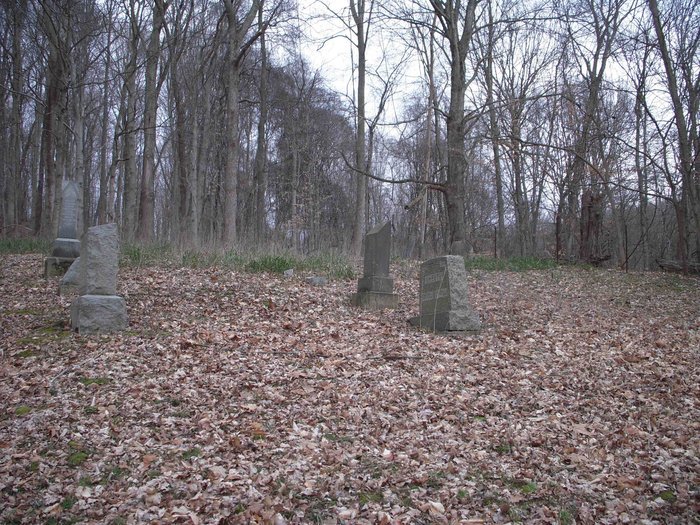
| Description | : | The cemetery is located on the north side of Ansel Road (Township Road 100) about 0.2 miles east of its intersection with Ohio State Route 664. The cemetery is located in Marion Township, Hocking County, Ohio, and is # 5433 (Laurel Chapel Cemetery) in “Ohio Cemeteries 1803-2003”, compiled by the Ohio Genealogical Society. The U.S. Geological Survey (USGS) Geographic Names Information System (GNIS) feature ID for the cemetery is 1042436 (Laurel Chapel Cemetery). |
frequently asked questions (FAQ):
-
Where is Laurel Chapel Cemetery?
Laurel Chapel Cemetery is located at Ansel Road (Township Road 100) Marion Township, Hocking County ,Ohio , 43107USA.
-
Laurel Chapel Cemetery cemetery's updated grave count on graveviews.com?
2 memorials
-
Where are the coordinates of the Laurel Chapel Cemetery?
Latitude: 39.6391983
Longitude: -82.4291992
Nearby Cemetories:
1. Flagdale Cemetery
Marion Township, Hocking County, USA
Coordinate: 39.6542015, -82.4336014
2. Welty Cemetery
Bremen, Fairfield County, USA
Coordinate: 39.6627998, -82.4214020
3. Saint Jacobus Evangelical Lutheran Cemetery
Hideaway Hills, Hocking County, USA
Coordinate: 39.6434700, -82.4607900
4. Shepley Cemetery
Marion Township, Hocking County, USA
Coordinate: 39.6246380, -82.4029260
5. Ruff Cemetery
Logan, Hocking County, USA
Coordinate: 39.6176500, -82.4467900
6. Saint Emanuel Lutheran Cemetery
Marion Township, Hocking County, USA
Coordinate: 39.6433900, -82.4628000
7. Marion School Cemetery
Rockbridge, Hocking County, USA
Coordinate: 39.6148000, -82.4419000
8. Sacred Heart Cemetery
Bremen, Fairfield County, USA
Coordinate: 39.6647600, -82.4189300
9. Baron-Graham Family Cemetery
Hideaway Hills, Hocking County, USA
Coordinate: 39.6385070, -82.4657110
10. South Harvey Chapel Cemetery
Logan, Hocking County, USA
Coordinate: 39.6413000, -82.3881000
11. Zwingley Cemetery
Fairfield County, USA
Coordinate: 39.6735992, -82.4475021
12. Mount Zion Brethren Cemetery
Marion Township, Hocking County, USA
Coordinate: 39.6109400, -82.3971100
13. Bright Family Cemetery
Bremen, Fairfield County, USA
Coordinate: 39.6695404, -82.3990936
14. Mount Tabor Christian Fellowship Church Cemetery
Marion Township, Hocking County, USA
Coordinate: 39.6009660, -82.4274840
15. Focht Cemetery
Rush Creek Township, Fairfield County, USA
Coordinate: 39.6704990, -82.4590440
16. Hilyard Cemetery
Bremen, Fairfield County, USA
Coordinate: 39.6791992, -82.4231033
17. Harmony Cemetery
Maxville, Perry County, USA
Coordinate: 39.6330986, -82.3760986
18. Dunkard Cemetery
Hocking County, USA
Coordinate: 39.6046982, -82.3914032
19. Sugar Hill Cemetery
Fairfield County, USA
Coordinate: 39.6707993, -82.3824997
20. Pleasant Hill Mennonite Cemetery
Rush Creek Township, Fairfield County, USA
Coordinate: 39.6817398, -82.4000694
21. Pleasant Hill United Methodist Church Cemetery
Marion Township, Hocking County, USA
Coordinate: 39.5888600, -82.4302100
22. Turkey Run Mennonite Church Cemetery
Perry County, USA
Coordinate: 39.6540604, -82.3661957
23. Bethel Cemetery
Bremen, Fairfield County, USA
Coordinate: 39.6768990, -82.3816986
24. Saint Paul's Lutheran Cemetery
Monday Creek Township, Perry County, USA
Coordinate: 39.6323350, -82.3602590