
| Memorials | : | 108 |
| Location | : | Windsor, Henry County, USA |
| Coordinate | : | 38.5224991, -93.5203018 |
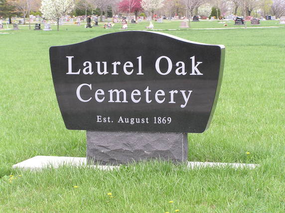
| Description | : | In 1838, John Taylor, son of Major William Taylor of the Continental Army, came to Missouri and settled on what is now section 17 Windsor Township. His brother, Richard Ferguson Taylor along with his sister Caroline V.J. and husband Dr. William T. Thornton and family, came to the same area around 1839. In 1842 Richard Ferguson Taylor married Ann Fitzhugh and in 1853 he purchased the land where the new town of Bellmont would soon be located. He opened the first store there in 1853. Richard was the first postmaster, served as city justice and held the office of mayor... Read More |
frequently asked questions (FAQ):
-
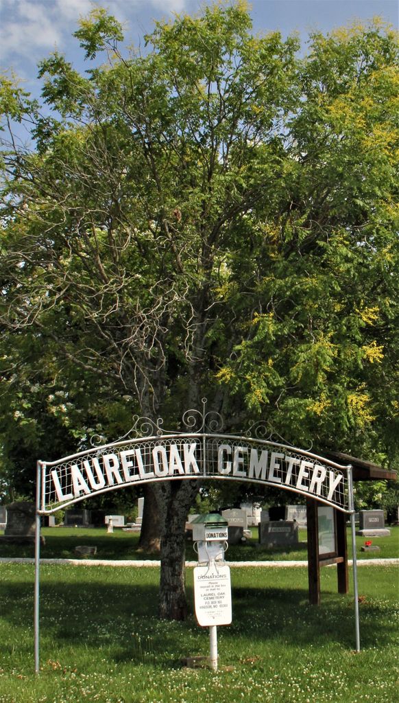
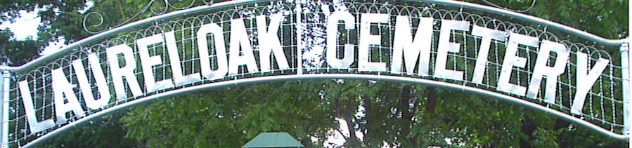
Where is Laurel Oak Cemetery?
Laurel Oak Cemetery is located at Windsor, Henry County ,Missouri ,USA.
-
Laurel Oak Cemetery cemetery's updated grave count on graveviews.com?
97 memorials
-
Where are the coordinates of the Laurel Oak Cemetery?
Latitude: 38.5224991
Longitude: -93.5203018

Nearby Cemetories:
1. Bell Cemetery
Pettis County, USA
Coordinate: 38.5130997, -93.5038986
2. Woodard Cemetery
Johnson County, USA
Coordinate: 38.5581017, -93.5302963
3. Chipman Cemetery
Henry County, USA
Coordinate: 38.5247002, -93.6010971
4. McMillian Cemetery
Santiago, Benton County, USA
Coordinate: 38.4504800, -93.5072780
5. Askins Cemetery
Calhoun, Henry County, USA
Coordinate: 38.5074997, -93.6177979
6. Goodwin Cemetery
Johnson County, USA
Coordinate: 38.6063995, -93.5310974
7. Harmony Baptist Church Cemetery
Benton County, USA
Coordinate: 38.4460600, -93.4643000
8. Cooper Cemetery
Johnson County, USA
Coordinate: 38.6006012, -93.5725021
9. Robinson Cemetery
Leesville, Henry County, USA
Coordinate: 38.4566130, -93.5982370
10. Salem Cemetery
Henry County, USA
Coordinate: 38.5257988, -93.6371994
11. McIntire Chapel Cemetery
Windsor Junction, Benton County, USA
Coordinate: 38.4303017, -93.4760971
12. High Point Baptist Church Cemetery
Leeton, Johnson County, USA
Coordinate: 38.6028450, -93.6017700
13. Goff Cemetery
Deer Creek Township, Henry County, USA
Coordinate: 38.4537230, -93.6237720
14. Prairie Chapel Methodist Cemetery
Pettis County, USA
Coordinate: 38.5228004, -93.3818970
15. Mount Olivet Cemetery
Roseland, Henry County, USA
Coordinate: 38.4122400, -93.5474300
16. Sardis North Cemetery
Windsor, Henry County, USA
Coordinate: 38.5387670, -93.6650130
17. Sardis Cemetery
Henry County, USA
Coordinate: 38.5374985, -93.6652985
18. Clover Dale-Yancy Cemetery
Benton County, USA
Coordinate: 38.4392014, -93.4191971
19. Avery Cemetery
Henry County, USA
Coordinate: 38.5205994, -93.6678009
20. Lewis Cemetery
Tebo Township, Henry County, USA
Coordinate: 38.5210991, -93.6757965
21. Flat Creek Methodist Cemetery
Pettis County, USA
Coordinate: 38.5236015, -93.3638992
22. George Grave Yard
Calhoun, Henry County, USA
Coordinate: 38.4070160, -93.5829940
23. Green Ridge Cemetery
Green Ridge, Pettis County, USA
Coordinate: 38.6207100, -93.4151500
24. Fewell Farm Graveyard
Benton County, USA
Coordinate: 38.3922100, -93.5109000