
| Memorials | : | 0 |
| Location | : | Atoka, Atoka County, USA |
| Coordinate | : | 34.3452790, -96.3545610 |
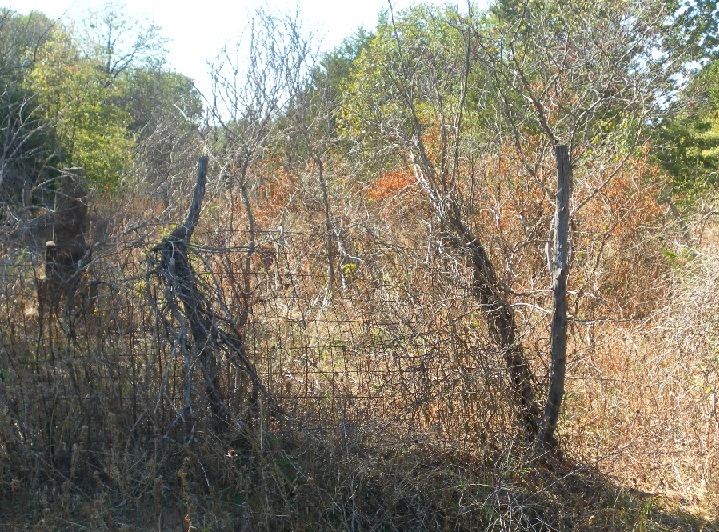
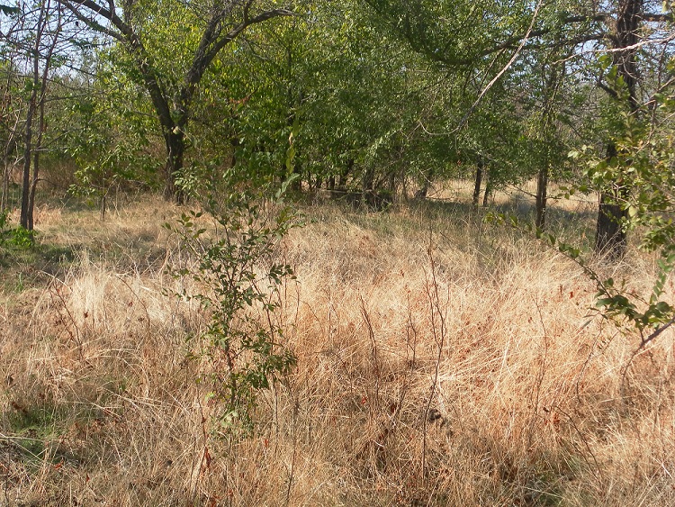
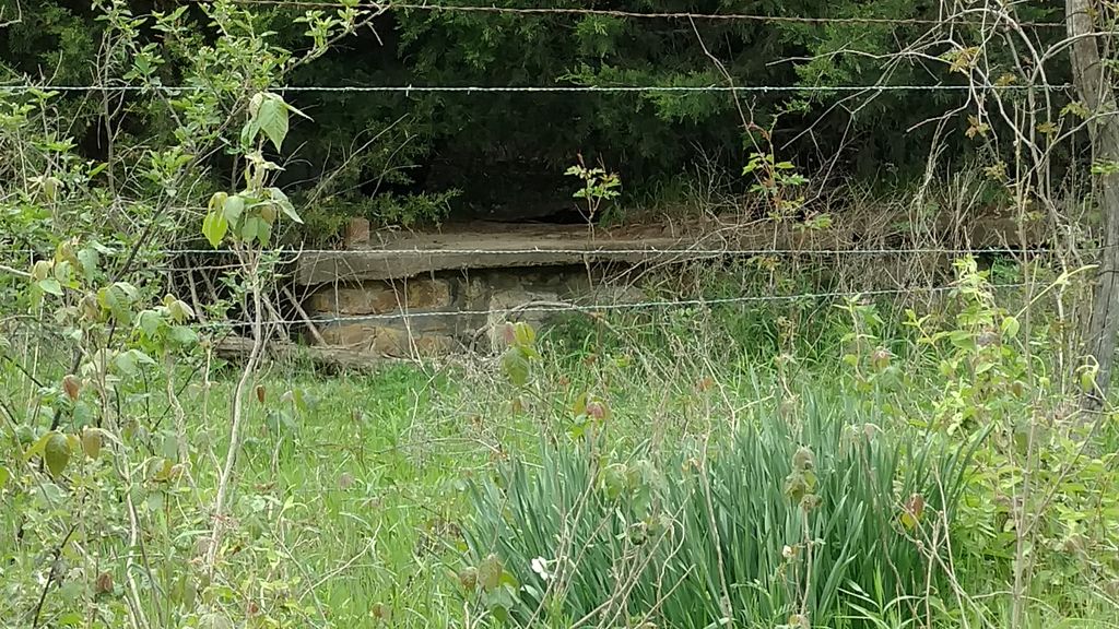
| Description | : | This is an abandon cemetery also know as Wilson Cemetery located in the woods; overgrown with thick underbrush, tall weeds and trees on private land. The individuals buried in the cemetery are my ancestors from the Choctaw and Chickasaw Freedmen of the Lehigh, Nation Indian Territory, Atoka, Oklahoma, in Wilson Community. The land where the cemetery is was once owned by great great grandmother, Lizzie and Dewey Lawrence, my great grand uncle who also lived on the land and now buried in the family cemetery. The house is no long there just an old well, under ground cellar and a... Read More |
frequently asked questions (FAQ):
-
Where is Lawrence-Banks Family Cemetery?
Lawrence-Banks Family Cemetery is located at Corner of Artesian Road andWilson Lane Atoka, Atoka County ,Oklahoma , 74525USA.
-
Lawrence-Banks Family Cemetery cemetery's updated grave count on graveviews.com?
0 memorials
-
Where are the coordinates of the Lawrence-Banks Family Cemetery?
Latitude: 34.3452790
Longitude: -96.3545610

Nearby Cemetories:
1. Boggy Depot Cemetery
Atoka, Atoka County, USA
Coordinate: 34.3222008, -96.3127975
2. Rose Hill Cemetery
Wapanucka, Johnston County, USA
Coordinate: 34.3883018, -96.4244003
3. Standing Rock Cemetery
Atoka County, USA
Coordinate: 34.3863983, -96.2810974
4. Whitehall Cemetery
Atoka County, USA
Coordinate: 34.4166985, -96.3230972
5. Enterprise Cemetery
Wapanucka, Johnston County, USA
Coordinate: 34.3153150, -96.4531900
6. Wards Chapel Cemetery
Atoka, Atoka County, USA
Coordinate: 34.3675003, -96.2497025
7. Valley View Cemetery
Atoka County, USA
Coordinate: 34.4068985, -96.2632980
8. Ego-Coleman Cemetery
Coleman, Johnston County, USA
Coordinate: 34.2543983, -96.4186020
9. Clarita Amish Cemetery
Coal County, USA
Coordinate: 34.4343416, -96.4394419
10. Worcester Cemetery
Coal County, USA
Coordinate: 34.4221000, -96.4589590
11. Wells Valley Cemetery
Bromide, Johnston County, USA
Coordinate: 34.3869019, -96.4891968
12. James Family Cemetery
Olney, Coal County, USA
Coordinate: 34.4617100, -96.3872100
13. Plainview Cemetery
Atoka County, USA
Coordinate: 34.3717003, -96.2118988
14. Perkins Cemetery
Caney, Atoka County, USA
Coordinate: 34.2475014, -96.2581024
15. Moore Cemetery
Clarita, Coal County, USA
Coordinate: 34.4625015, -96.4261017
16. Hollow Spring Cemetery
Fillmore, Johnston County, USA
Coordinate: 34.2691600, -96.4877700
17. Sandy Creek Cemetery
Fillmore, Johnston County, USA
Coordinate: 34.2802450, -96.4966990
18. Sealy Cemetery
Coal County, USA
Coordinate: 34.4775009, -96.3202972
19. Davis Cemetery
Coal County, USA
Coordinate: 34.4860992, -96.3321991
20. Filmore Cemetery
Johnston County, USA
Coordinate: 34.3081017, -96.5306015
21. Old Lehigh Cemetery
Lehigh, Coal County, USA
Coordinate: 34.4435997, -96.2164001
22. Bold Springs Cemetery
Milburn, Johnston County, USA
Coordinate: 34.3168983, -96.5366974
23. Tushka Cemetery
Tushka, Atoka County, USA
Coordinate: 34.3238983, -96.1707993
24. Greenwood Cemetery
Fillmore, Johnston County, USA
Coordinate: 34.2860985, -96.5261002