
| Memorials | : | 0 |
| Location | : | Flickerville, Fulton County, USA |
| Coordinate | : | 39.8617000, -78.2254000 |
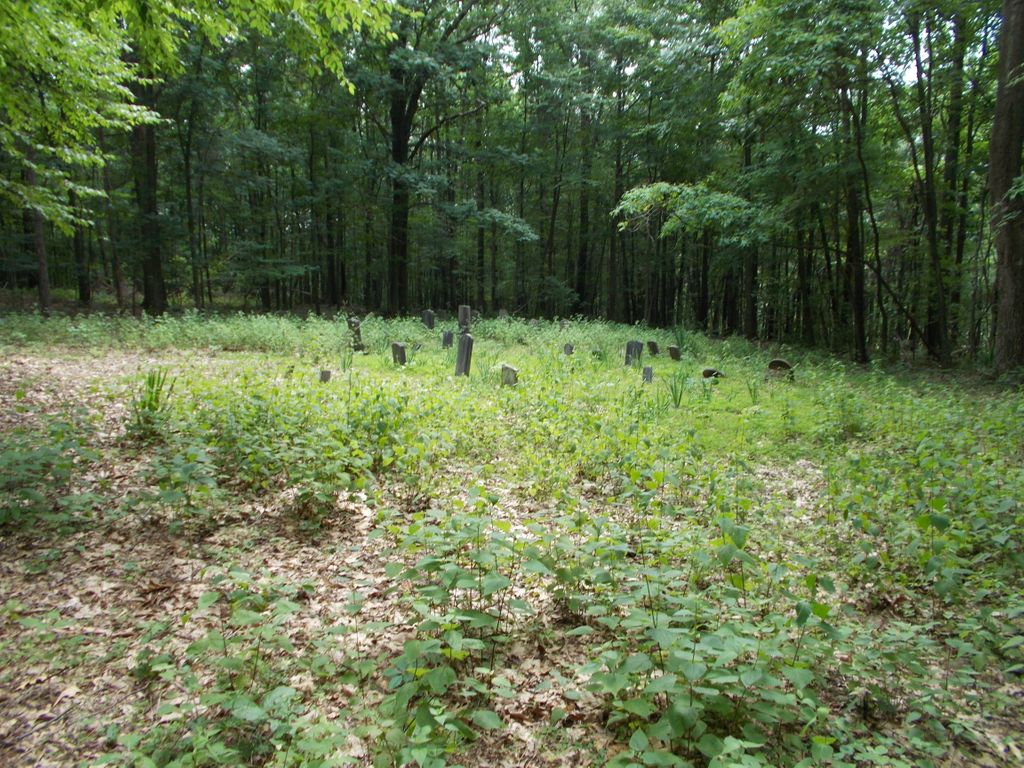
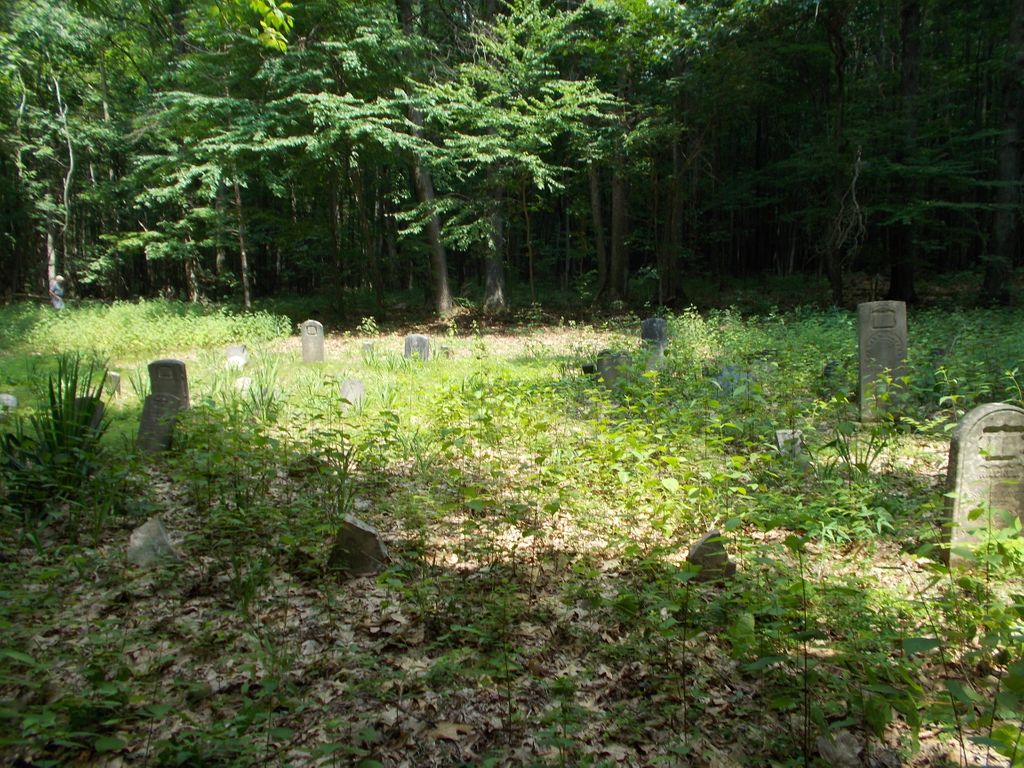
| Description | : | Layton Cemetery is located in Whips Cove, Brush Creek Twp. north of rt 643. This is the former Howard Layton farm. The land was originally owned by Asher Layton who died in 1823 intestate. His oldest son Christopher Layton filed for an inquest on behalf of Asher's surviving children as they could not agree on how to divide the 150 acres of land left behind. When the Orphans Court ruled that the land could not be divided fairly the land was sold at auction and purchased by George May, Ashers son in law who then sold the land to... Read More |
frequently asked questions (FAQ):
-
Where is Layton Cemetery?
Layton Cemetery is located at Flickerville, Fulton County ,Pennsylvania ,USA.
-
Layton Cemetery cemetery's updated grave count on graveviews.com?
0 memorials
-
Where are the coordinates of the Layton Cemetery?
Latitude: 39.8617000
Longitude: -78.2254000
Nearby Cemetories:
1. Whips Cove Cemetery
Warfordsburg, Fulton County, USA
Coordinate: 39.8552000, -78.2382000
2. Jerusalem Christian Cemetery
Amaranth, Fulton County, USA
Coordinate: 39.8507000, -78.2501000
3. Pleasant Grove Cemetery
Warfordsburg, Fulton County, USA
Coordinate: 39.8636000, -78.1839000
4. Cedar Grove Cemetery
Dott, Fulton County, USA
Coordinate: 39.8148000, -78.1936000
5. Hill Chapel Cemetery
Dott, Fulton County, USA
Coordinate: 39.8210983, -78.1789017
6. Needmore Bible Church Cemetery
Needmore, Fulton County, USA
Coordinate: 39.8387100, -78.1593670
7. McKendree Methodist Episcopal Church Cemetery
Crystal Spring, Fulton County, USA
Coordinate: 39.9201000, -78.2492000
8. Stevens Methodist Chapel Church Cemetery
Mattie, Bedford County, USA
Coordinate: 39.8982000, -78.2921900
9. Deneen Family Cemetery
Union Township, Fulton County, USA
Coordinate: 39.7996900, -78.2466900
10. Morton Cemetery
Needmore, Fulton County, USA
Coordinate: 39.8503550, -78.1388650
11. Sideling Hill Primitive Baptist Cemetery
Fulton County, USA
Coordinate: 39.9064440, -78.1565450
12. Oakley Methodist Cemetery
Needmore, Fulton County, USA
Coordinate: 39.8185000, -78.1463000
13. Amaranth Church of the Brethren Cemetery
Warfordsburg, Fulton County, USA
Coordinate: 39.7986000, -78.2775000
14. Fletcher Cemetery
Clearville, Bedford County, USA
Coordinate: 39.8557016, -78.3283085
15. Mount Pleasant Cemetery
Mattie, Bedford County, USA
Coordinate: 39.9247437, -78.2919769
16. Bethel Community Church Cemetery
Warfordsburg, Fulton County, USA
Coordinate: 39.7854000, -78.1820000
17. Pleasant Ridge Brethren Cemetery
Needmore, Fulton County, USA
Coordinate: 39.8848000, -78.1200000
18. Bowman Family Cemetery
Mattie, Bedford County, USA
Coordinate: 39.9321422, -78.2887292
19. Union Christian Cemetery
Crystal Spring, Fulton County, USA
Coordinate: 39.9476891, -78.2319260
20. Rohm Cemetery
Crystal Spring, Fulton County, USA
Coordinate: 39.9483000, -78.2337000
21. Ensley Cemetery
Crystal Spring, Fulton County, USA
Coordinate: 39.9483000, -78.2340000
22. Ebenezer United Methodist Cemetery
Harrisonville, Fulton County, USA
Coordinate: 39.9259720, -78.1401367
23. Shreve Chapel Cemetery
Monroe Township, Bedford County, USA
Coordinate: 39.8506000, -78.3447500
24. Mays Chapel Christian Church Cemetery
Warfordsburg, Fulton County, USA
Coordinate: 39.7690000, -78.2298000