
| Memorials | : | 0 |
| Location | : | Crystal Spring, Fulton County, USA |
| Coordinate | : | 39.9483000, -78.2337000 |
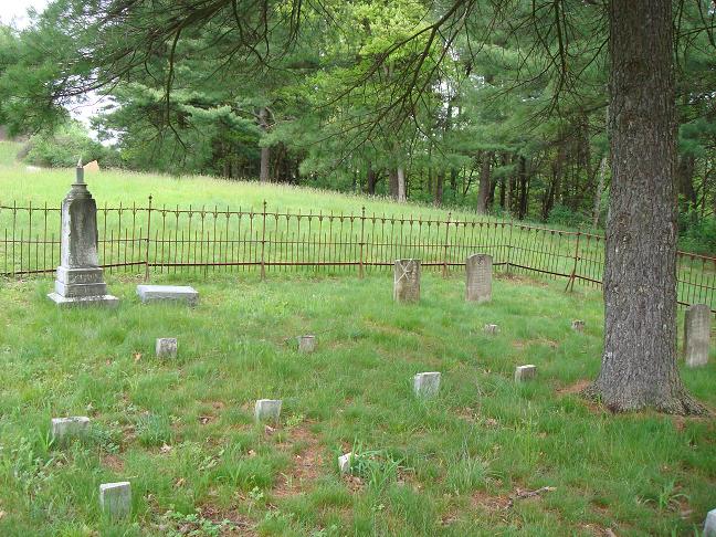
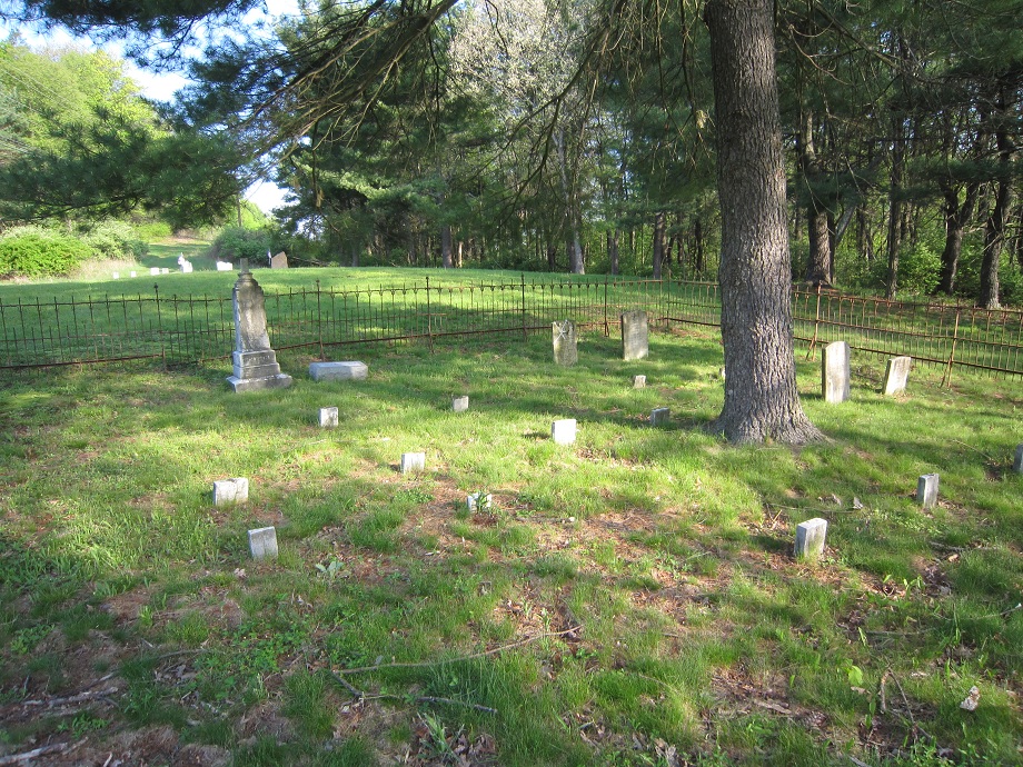
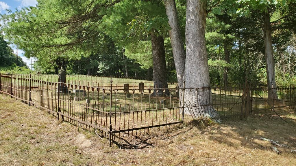
| Description | : | Located on Old 126 beside the country store/ post office at the Rt. 70 exit. You can see the lower section of the cemetery at this point. The upper portion of the cemetery is across the dirt road and up to the top of the hill, following the power lines. |
frequently asked questions (FAQ):
-
Where is Rohm Cemetery?
Rohm Cemetery is located at Crystal Spring, Fulton County ,Pennsylvania ,USA.
-
Rohm Cemetery cemetery's updated grave count on graveviews.com?
0 memorials
-
Where are the coordinates of the Rohm Cemetery?
Latitude: 39.9483000
Longitude: -78.2337000
Nearby Cemetories:
1. Ensley Cemetery
Crystal Spring, Fulton County, USA
Coordinate: 39.9483000, -78.2340000
2. Union Christian Cemetery
Crystal Spring, Fulton County, USA
Coordinate: 39.9476891, -78.2319260
3. McKendree Methodist Episcopal Church Cemetery
Crystal Spring, Fulton County, USA
Coordinate: 39.9201000, -78.2492000
4. Akersville Cemetery
Akersville, Fulton County, USA
Coordinate: 39.9776000, -78.1983800
5. Bowman Family Cemetery
Mattie, Bedford County, USA
Coordinate: 39.9321422, -78.2887292
6. Union Memorial Cemetery
Mench, Bedford County, USA
Coordinate: 39.9569000, -78.2973000
7. Rays Hill Cemetery Old
Breezewood, Bedford County, USA
Coordinate: 39.9977900, -78.2385800
8. Cedar Grove Cemetery
Breezewood, Bedford County, USA
Coordinate: 39.9789000, -78.2850000
9. Mount Pleasant Cemetery
Mattie, Bedford County, USA
Coordinate: 39.9247437, -78.2919769
10. Christ Church Cemetery
Breezewood, Bedford County, USA
Coordinate: 39.9983000, -78.2451400
11. Mount Zion Lutheran Church Cemetery
Breezewood, Bedford County, USA
Coordinate: 39.9999000, -78.2303000
12. Blackhart Farm Cemetery
Everett, Bedford County, USA
Coordinate: 39.9818750, -78.2877266
13. Mellott Family Cemetery
Needmore, Fulton County, USA
Coordinate: 39.9538190, -78.1476230
14. Stevens Methodist Chapel Church Cemetery
Mattie, Bedford County, USA
Coordinate: 39.8982000, -78.2921900
15. Sideling Hill Primitive Baptist Cemetery
Fulton County, USA
Coordinate: 39.9064440, -78.1565450
16. Mount Union Christian Church Cemetery
Mench, Bedford County, USA
Coordinate: 39.9739000, -78.3230000
17. Vaughn Williams Farm Cemetery
Mench, Bedford County, USA
Coordinate: 39.9820130, -78.3183590
18. Ebenezer United Methodist Cemetery
Harrisonville, Fulton County, USA
Coordinate: 39.9259720, -78.1401367
19. Old Shaw Farm Cemetery
Mattie, Bedford County, USA
Coordinate: 39.9209280, -78.3272840
20. Sideling Hill Christian Church Cemetery
Sipes Mill, Fulton County, USA
Coordinate: 39.9499600, -78.1290500
21. Mountain Chapel Church Cemetery
Breezewood, Bedford County, USA
Coordinate: 40.0293000, -78.2149000
22. Rays Cove Christian Church Cemetery
Breezewood, Bedford County, USA
Coordinate: 40.0247650, -78.2764969
23. Dibert Farm Cemetery
Bedford County, USA
Coordinate: 39.9802000, -78.3347000
24. Rockhill Cemetery
Monroe Township, Bedford County, USA
Coordinate: 39.9186000, -78.3391000