
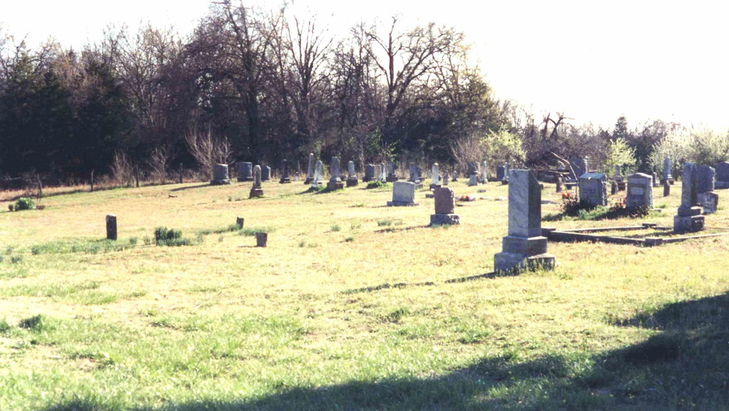
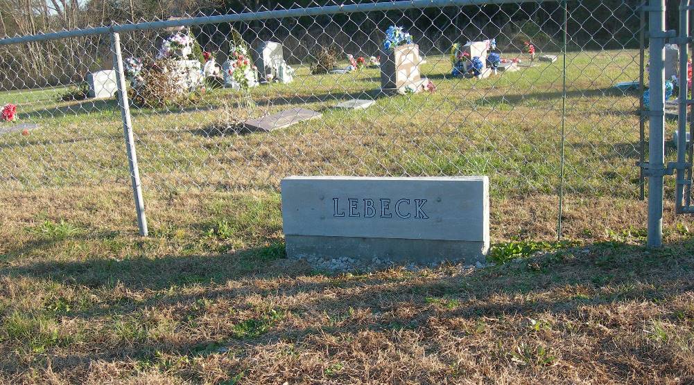
| Memorials | : | 9 |
| Location | : | Cedar County, USA |
| Coordinate | : | 37.8890600, -93.9149200 |
| Description | : | Located Northeast of El Dorado Springs. From Eldorado Springs, take State Highway 54 East to Route "DD", turn left and continue on "DD" through 5 curves. On the 6th curve turn left onto a gravel road for about 200 yards. Cemetery is on the left and can be seen as soon as you enter the gravel road. It is 2 miles from the turn-off onto Route "DD" to the turn-off onto the gravel road on which the Cemetery is located. |
frequently asked questions (FAQ):
-
Where is Lebeck Cemetery?
Lebeck Cemetery is located at Cedar County ,Missouri ,USA.
-
Lebeck Cemetery cemetery's updated grave count on graveviews.com?
9 memorials
-
Where are the coordinates of the Lebeck Cemetery?
Latitude: 37.8890600
Longitude: -93.9149200

Nearby Cemetories:
1. Preston Cemetery
Cedar County, USA
Coordinate: 37.8849983, -93.9060974
2. Coal Hill Cemetery
El Dorado Springs, Cedar County, USA
Coordinate: 37.8778801, -93.9361801
3. Cedar Springs Amish Mennonite Cemetery
Cedar Springs, Cedar County, USA
Coordinate: 37.8670700, -93.8943700
4. Eslinger Cemetery
Cedar Springs, Cedar County, USA
Coordinate: 37.8630981, -93.8897018
5. Fraley Cemetery
St. Clair County, USA
Coordinate: 37.8974991, -93.8728027
6. Herriman Chapel Cemetery
Cedar County, USA
Coordinate: 37.8544617, -93.8845062
7. Mound Cemetery
El Dorado Springs, Cedar County, USA
Coordinate: 37.8816299, -93.8614743
8. Love Cemetery
Cedar Springs, Cedar County, USA
Coordinate: 37.8819008, -93.8613968
9. Kennerly Cemetery
St. Clair County, USA
Coordinate: 37.9399986, -93.9152985
10. Tennessee Chapel Cemetery
Cedar County, USA
Coordinate: 37.8394012, -93.8961029
11. Union Point Cemetery
Tiffin, St. Clair County, USA
Coordinate: 37.9425011, -93.9310989
12. Vandenburg Cemetery
El Dorado Springs, Cedar County, USA
Coordinate: 37.8689003, -93.9875031
13. Hazel Dell Cemetery
El Dorado Springs, Cedar County, USA
Coordinate: 37.8243294, -93.9466095
14. French Cemetery
El Dorado Springs, Cedar County, USA
Coordinate: 37.8544006, -93.9933014
15. Burns Cemetery
Cedar County, USA
Coordinate: 37.8364630, -93.8516950
16. Pleasant Springs Cemetery
Oyer, St. Clair County, USA
Coordinate: 37.9599991, -93.8707962
17. Martin Cemetery
El Dorado Springs, Cedar County, USA
Coordinate: 37.8936005, -94.0250015
18. Clintonville Cemetery
El Dorado Springs, Cedar County, USA
Coordinate: 37.8492012, -94.0130997
19. Hackleman Cemetery
Cedar County, USA
Coordinate: 37.8121986, -93.8602982
20. El Dorado Springs Cemetery
El Dorado Springs, Cedar County, USA
Coordinate: 37.8842010, -94.0286026
21. Pleasant Ridge Cemetery
Cedar County, USA
Coordinate: 37.8147011, -93.9822006
22. Culbartson Cemetery
St. Clair County, USA
Coordinate: 37.9310989, -93.8080978
23. Seat Cemetery
St. Clair County, USA
Coordinate: 37.8830986, -93.7885971
24. Ruark Cemetery
St. Clair County, USA
Coordinate: 37.9825211, -93.9615173