
| Memorials | : | 5 |
| Location | : | Calera, Bryan County, USA |
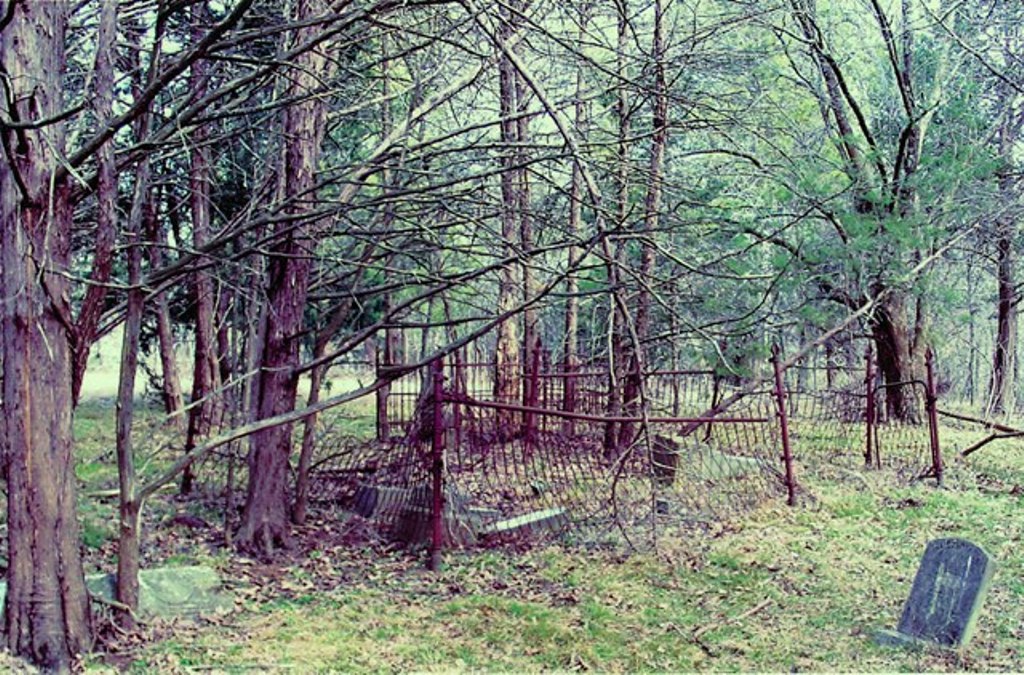
| Description | : | Lemon Hill Cemetery is located south of Calera in the old Lemon Hill Community in Section 11, Township 8 South, Range 8 East. After going south through Calera on U.S. 69-75 Highway, turn left at the first road (about 1/2 miles south of Calera). Go 2 1/2 miles south. At the first crossroad, turn left (east) for 1 mile. The cemetery is located about 1/4 southeast in a pasture. At one time the cemetery was called Mead Chapel Cemetery. Lucille Brimage and Wanda Shelton recorded this cemetery on October 7, 1985. Many children are buried here. There are two wrought iron fences... Read More |
frequently asked questions (FAQ):
-
Where is Lemon Hill Cemetery?
Lemon Hill Cemetery is located at Calera, Bryan County, USA.
-
Lemon Hill Cemetery cemetery's updated grave count on graveviews.com?
4 memorials

Nearby Cemetories:
1. Bloomfield Colored Cemetery
Achille, Bryan County, USA
2. Rosewood Cemetery
Achille, Bryan County, USA
Coordinate: 33.9481010, -96.4302979
3. Bennington Cemetery
Bennington, Bryan County, USA
4. Brackett Cemetery
Bennington, Bryan County, USA
Coordinate: 34.1056600, -96.5455700
5. Chishoktak Cemetery
Bennington, Bryan County, USA
Coordinate: 34.1030998, -96.5516968
6. Dyer Cemetery
Bennington, Bryan County, USA
Coordinate: 34.1051800, -96.5456800
7. Folsom Cemetery
Bennington, Bryan County, USA
Coordinate: 33.9522018, -96.5449982
8. Jones Family Cemetery
Bennington, Bryan County, USA
Coordinate: 34.1380997, -96.0578003
9. Labors Cemetery
Bennington, Bryan County, USA
Coordinate: 33.8958015, -96.2438965
10. McGee Springs Cemetery
Bennington, Bryan County, USA
11. Old Bennington Presbyterian Church Cemetery
Bennington, Bryan County, USA
Coordinate: 34.0716300, -96.0455700
12. White Sands Cemetery
Bennington, Bryan County, USA
Coordinate: 33.7881012, -96.2699966
13. Goldsby Cemetery
Calera, Bryan County, USA
14. Rose Hill Cemetery
Calera, Bryan County, USA
Coordinate: 33.9481010, -96.4302979
15. Chickasaw Indian Burial Grounds
Fort Washita, Bryan County, USA
16. Colbert Family Cemetery
Fort Washita, Bryan County, USA
Coordinate: 34.1056600, -96.5455700
17. Confederate Cemetery
Fort Washita, Bryan County, USA
Coordinate: 34.1030998, -96.5516968
18. Fort Washita Post Cemetery
Fort Washita, Bryan County, USA
Coordinate: 34.1051800, -96.5456800
19. Love Cemetery
Bryan County, USA
Coordinate: 33.9522018, -96.5449982
20. Matoy Cemetery
Matoy, Bryan County, USA
Coordinate: 34.1380997, -96.0578003
21. Wolf Creek Cemetery
Roberta, Bryan County, USA
Coordinate: 33.8958015, -96.2438965
22. Walley Cemetery
Bryan County, USA
23. Wilson Cemetery
Bryan County, USA
Coordinate: 34.0716300, -96.0455700
24. Yarnaby Cemetery
Yarnaby, Bryan County, USA
Coordinate: 33.7881012, -96.2699966