
| Memorials | : | 0 |
| Location | : | Barlow, Copiah County, USA |
| Coordinate | : | 31.8777540, -90.6769510 |
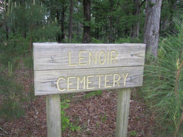
| Description | : | Lenoir Cemetery is located near Barlow on Warren Hood Road, )1/10 mile from the intersection with Old Port Gibson Rd (Ms 548) thirty-one gravestones have been identified, in addition there are a number of depressions indicating additional graves. Red & Audrey V Hudson of Vidor, Texas maintained the cemetery for a number of years but because of advancing age an health reasons, they are no longer able to visit the cemetery. The Cemetery is located in a stand of Hardwoods, with a number of small pine seedings growing there also. Directions:(1) from Jackson, MS TAKE I-55 SOUTH TO EXIT 61 HAZLEHURST/FAYETTE,... Read More |
frequently asked questions (FAQ):
-
Where is Lenoir Cemetery?
Lenoir Cemetery is located at Barlow, Copiah County ,Mississippi ,USA.
-
Lenoir Cemetery cemetery's updated grave count on graveviews.com?
0 memorials
-
Where are the coordinates of the Lenoir Cemetery?
Latitude: 31.8777540
Longitude: -90.6769510
Nearby Cemetories:
1. Nelson Cemetery
Copiah County, USA
Coordinate: 31.8908005, -90.6913986
2. Greenlee Cemetery
Copiah County, USA
Coordinate: 31.9197006, -90.6913986
3. Hawkins Cemetery
Barlow, Copiah County, USA
Coordinate: 31.8316994, -90.6560974
4. McCrory Cemetery
Barlow, Copiah County, USA
Coordinate: 31.8263054, -90.6702957
5. Hulburt Cemetery
Claiborne County, USA
Coordinate: 31.9242001, -90.7182999
6. Rehobeth-Barlow Cemetery
Barlow, Copiah County, USA
Coordinate: 31.8230991, -90.6532974
7. Hall's Hill Cemetery
Hazlehurst, Copiah County, USA
Coordinate: 31.8749313, -90.6064901
8. Hulburt Cemetery
Claiborne County, USA
Coordinate: 31.9267006, -90.7202988
9. Trimm Cemetery
Copiah County, USA
Coordinate: 31.9358006, -90.7069016
10. Pisgah Cemetery
Hermanville, Claiborne County, USA
Coordinate: 31.9169006, -90.7406006
11. Beech Grove Cemetery
Claiborne County, USA
Coordinate: 31.9132996, -90.7485962
12. Sarepta Cemetery
Hermanville, Claiborne County, USA
Coordinate: 31.8724995, -90.7660980
13. Grant Cemetery
Copiah County, USA
Coordinate: 31.9557991, -90.6703033
14. Route 548
Hermanville, Claiborne County, USA
Coordinate: 31.9316230, -90.7447530
15. Saint Phillips Cemetery
Hermanville, Claiborne County, USA
Coordinate: 31.9317800, -90.7448000
16. Little Zion Cemetery
Willing, Copiah County, USA
Coordinate: 31.9546900, -90.6547200
17. Segrest Cemetery
Claiborne County, USA
Coordinate: 31.8255997, -90.7500000
18. Newman Cemetery
Burnell, Claiborne County, USA
Coordinate: 31.8255400, -90.7537000
19. Mount Hope Cemetery
Smyrna, Copiah County, USA
Coordinate: 31.8794003, -90.5761032
20. Mount Pleasant Cemetery
Pattison, Claiborne County, USA
Coordinate: 31.8478860, -90.7717770
21. Shelton Cemetery
Hazlehurst, Copiah County, USA
Coordinate: 31.7928009, -90.7052994
22. Mount Olive Baptist Church Cemetery
Barlow, Copiah County, USA
Coordinate: 31.8292270, -90.5892440
23. Hartley Cemetery
Copiah County, USA
Coordinate: 31.7985992, -90.7283020
24. Sanders Cemetery
Claiborne County, USA
Coordinate: 31.8567009, -90.7810974